Property Record
811 W Constance Rd, Suffolk, VA 23434
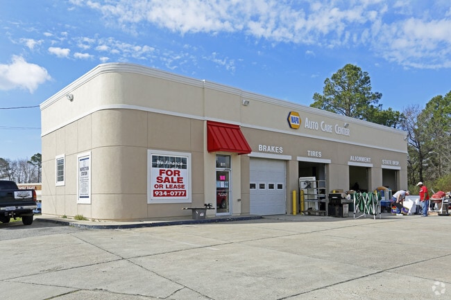
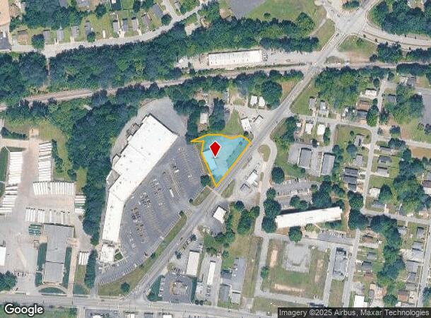
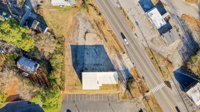
This Property Is For Sale
NEARBY LISTINGS FOR SALE OR LEASE
-
-
View all Suffolk listings for sale on LoopNet.com
Property Detail
811 W Constance Rd
351252000
L A W CONSTANCE RD
Commercialnec
Suffolk City
X
Virginia
5101560230E
0.65 AC
2025
South Suffolk
2024
Hampton Roads
065301
Virginia Beach-Norfolk-Newport News, VA-NC
2,024 SF
DEMOGRAPHICS near 811 W Constance Rd
1 Mile
3 Mile
5 Mile
2024 Total Population
7,573
33,574
50,436
2029 Population
8,539
37,515
56,369
Pop Growth 2024-2029
+ 12.76%
+ 11.74%
+ 11.76%
Average Age
39
39
39
2024 Total Households
3,108
12,902
19,048
HH Growth 2024-2029
+ 13.06%
+ 12.13%
+ 12.14%
Median Household Inc
$56,027
$58,388
$67,966
Avg Household Size
2.40
2.50
2.50
2024 Avg HH Vehicles
2.00
2.00
2.00
Median Home Value
$256,225
$238,696
$258,183
Median Year Built
1954
1976
1987
Nearby Places
- Restaurants
- Banks
- Shops
- Fitness
- Groceries
PUBLIC TRANSPORTATION
AIRPORT
Norfolk International
DRIVE
WALK
Distance
Norfolk International
42 min
26.8 mi
Newport News/Williamsburg International
DRIVE
WALK
Distance
Newport News/Williamsburg International
54 min
35.2 mi
Freight Ports
Virginia Port Authority - Portsmouth
DRIVE
WALK
Distance
Virginia Port Authority - Portsmouth
31 min
19.7 mi
Nearby Properties
Address
Land Use
TOTAL SIZE
Lot Size
Zoning
Address
Land Use
TOTAL SIZE
Lot Size
Zoning
71.72 AC
HEAVY INDU
Address
Land Use
TOTAL SIZE
Lot Size
Zoning
72.52 AC
LIGHT INDU
Address
Land Use
TOTAL SIZE
Lot Size
Zoning
30,746.62 AC
CONSERVATI
Address
Land Use
TOTAL SIZE
Lot Size
Zoning
5,617 SF
16.96 AC
MIXED USE
Address
Land Use
TOTAL SIZE
Lot Size
Zoning
388,200 SF
27.99 AC
LIGHT INDU
Address
Land Use
TOTAL SIZE
Lot Size
Zoning
10,255 SF
35.42 AC
HEAVY INDU
Address
Land Use
TOTAL SIZE
Lot Size
Zoning
13.21 AC
OFFICE-INS
Address
Land Use
TOTAL SIZE
Lot Size
Zoning
19.66 AC
RES LOW-ME
Address
Land Use
TOTAL SIZE
Lot Size
Zoning
4,928 SF
20.79 AC
GENERAL CO
Address
Land Use
TOTAL SIZE
Lot Size
Zoning
2,443.35 AC
CONSERVATI
Address
Land Use
TOTAL SIZE
Lot Size
Zoning
91,512 SF
0.35 AC
CENTRAL BU
Address
Land Use
TOTAL SIZE
Lot Size
Zoning
86.84 AC
GENERAL CO
Address
Land Use
TOTAL SIZE
Lot Size
Zoning
12,457 SF
27.01 AC
GENERAL CO
Address
Land Use
TOTAL SIZE
Lot Size
Zoning
91,050 SF
17.06 AC
HEAVY INDU
Address
Land Use
TOTAL SIZE
Lot Size
Zoning
115,088 SF
0.17 AC
CENTRAL BU
Address
Land Use
TOTAL SIZE
Lot Size
Zoning
5.70 AC
RESIDENTIA
Address
Land Use
TOTAL SIZE
Lot Size
Zoning
73,277 SF
1.94 AC
CENTRAL BU
Address
Land Use
TOTAL SIZE
Lot Size
Zoning
5,000 SF
5.92 AC
GENERAL CO
Address
Land Use
TOTAL SIZE
Lot Size
Zoning
4,458 SF
40.56 AC
GENERAL CO
Address
Land Use
TOTAL SIZE
Lot Size
Zoning
9,800 SF
8.22 AC
HEAVY INDU
Address
Land Use
TOTAL SIZE
Lot Size
Zoning
10.26 AC
RESIDENTIA
Address
Land Use
TOTAL SIZE
Lot Size
Zoning
4.70 AC
RESIDENTIA
Address
Land Use
TOTAL SIZE
Lot Size
Zoning
149,212 SF
39.20 AC
RES LOW-ME
The World's #1 Commercial Real Estate Marketplace
Connect with us
© 2025 CoStar Group
The information above has been obtained from sources believed reliable. While we do not doubt its accuracy we have not verified it and make no guarantee, warranty or representation about it. It is your responsibility to independently confirm its accuracy and completeness. Any projections, opinions, assumptions, or estimates used are for example only and do not represent the current or future performance of the property. The value of this transaction to you depends on tax and other factors which should be evaluated by your tax, financial, and legal advisors. You and your advisors should conduct a careful, independent investigation of the property to determine to your satisfaction the suitability of the property for your needs.