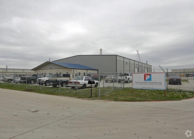
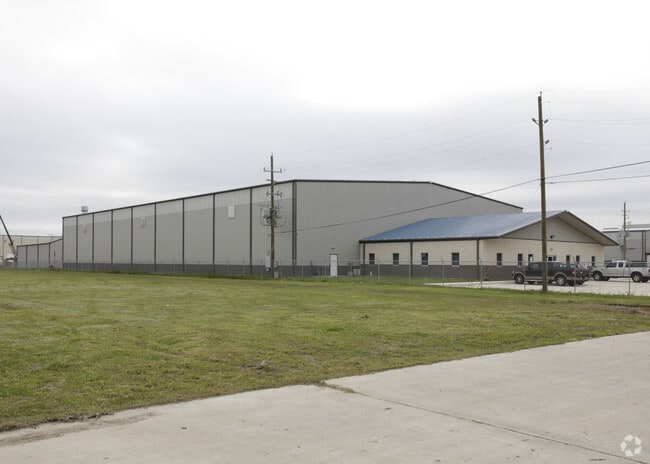
Property Record
8110 Mchard Rd, Houston, TX 77053

Property Detail
8110 Mchard Rd
0279-00-000-0807-907
0279 H LEVERING, ACRES 4.314, PT UNRESTRICTED RESERVE A, BLOCK 1, LONESTAR MCHARD SUBDIVISION
Commercialnec
FORT BEND
B and X Area of moderate flood hazard, usually the area between the limits of the 100-year and 500-year floods.
Texas
2024
4.31 AC
2025
Southwest Far
670700
Houston
33,225 SF
Houston-Pasadena-The Woodlands, TX
NEARBY LISTINGS FOR SALE OR LEASE
DEMOGRAPHICS near 8110 Mchard Rd
1 mile
3 mile
5 mile
2025 Total Population
5,856
80,753
249,588
2030 Population
6,546
88,622
274,604
Pop Growth 2025-2030
+ 11.78%
+ 9.74%
+ 10.02%
Average Age
36
36
37
2025 Total Households
1,781
25,064
80,229
HH Growth 2025-2030
+ 12.07%
+ 10.06%
+ 10.27%
Median Household Inc
$82,529
$80,785
$82,340
Avg Household Size
3.20
3.20
3.10
2025 Avg HH Vehicles
2.00
2.00
2.00
Median Home Value
$244,031
$265,879
$269,596
Median Year Built
1996
2002
2003
Nearby Places
Map Layers
Map Styles
 Street
 Aerial
Layers
 Traffic
 Biking
Places
Listings with unknown addresses are not visible on the map
- Restaurants
- Banks
- Shops
- Fitness
- Groceries
PUBLIC TRANSPORTATION
AIRPORT
William P Hobby
Drive
Walk
Distance
William P Hobby
28 min
14.7 mi
George Bush Intcntl/Houston
Drive
Walk
Distance
George Bush Intcntl/Houston
48 min
33.9 mi
Freight Ports
Port of Houston
Drive
Walk
Distance
Port of Houston
34 min
19.4 mi
Nearby Properties
Address
Land Use
TOTAL SIZE
Lot Size
Zoning
Address
Land Use
TOTAL SIZE
Lot Size
Zoning
1,139,160 SF
75.11 AC
Address
Land Use
TOTAL SIZE
Lot Size
Zoning
542,333 SF
43.95 AC
Address
Land Use
TOTAL SIZE
Lot Size
Zoning
679,822 SF
27.54 AC
Address
Land Use
TOTAL SIZE
Lot Size
Zoning
347,124 SF
Address
Land Use
TOTAL SIZE
Lot Size
Zoning
429,368 SF
27.94 AC
Address
Land Use
TOTAL SIZE
Lot Size
Zoning
181,341 SF
16.73 AC
Address
Land Use
TOTAL SIZE
Lot Size
Zoning
460,711 SF
18.98 AC
Address
Land Use
TOTAL SIZE
Lot Size
Zoning
318,524 SF
20.44 AC
Address
Land Use
TOTAL SIZE
Lot Size
Zoning
670,850 SF
35.98 AC
Address
Land Use
TOTAL SIZE
Lot Size
Zoning
447,956 SF
18.42 AC
Address
Land Use
TOTAL SIZE
Lot Size
Zoning
412,375 SF
22.57 AC
Address
Land Use
TOTAL SIZE
Lot Size
Zoning
400,696 SF
18.88 AC
Address
Land Use
TOTAL SIZE
Lot Size
Zoning
156,214 SF
13.50 AC
0025
Address
Land Use
TOTAL SIZE
Lot Size
Zoning
423,270 SF
32.95 AC
Address
Land Use
TOTAL SIZE
Lot Size
Zoning
281,889 SF
10.84 AC
Address
Land Use
TOTAL SIZE
Lot Size
Zoning
124,254 SF
22.68 AC
0002
Address
Land Use
TOTAL SIZE
Lot Size
Zoning
306,103 SF
64.07 AC
QY
Address
Land Use
TOTAL SIZE
Lot Size
Zoning
170,092 SF
17.90 AC
Address
Land Use
TOTAL SIZE
Lot Size
Zoning
117,729 SF
15.41 AC
Address
Land Use
TOTAL SIZE
Lot Size
Zoning
3,108 SF
57.41 AC
Address
Land Use
TOTAL SIZE
Lot Size
Zoning
179,599 SF
16.45 AC
Address
Land Use
TOTAL SIZE
Lot Size
Zoning
169,176 SF
24.31 AC
Address
Land Use
TOTAL SIZE
Lot Size
Zoning
289,955 SF
11.96 AC
Address
Land Use
TOTAL SIZE
Lot Size
Zoning
66,060 SF
12.85 AC
0016
Address
Land Use
TOTAL SIZE
Lot Size
Zoning
215,900 SF
11.93 AC
Address
Land Use
TOTAL SIZE
Lot Size
Zoning
93,184 SF
7.70 AC
Address
Land Use
TOTAL SIZE
Lot Size
Zoning
165,558 SF
13.86 AC
Address
Land Use
TOTAL SIZE
Lot Size
Zoning
95,150 SF
27.91 AC
Address
Land Use
TOTAL SIZE
Lot Size
Zoning
16,510 SF
5.55 AC
0028
Address
Land Use
TOTAL SIZE
Lot Size
Zoning
88,168 SF
4.69 AC
0024
The World's #1 Commercial Real Estate Marketplace
Connect with us
© 2026 CoStar Group
The information above has been obtained from sources believed reliable. While we do not doubt its accuracy we have not verified it and make no guarantee, warranty or representation about it. It is your responsibility to independently confirm its accuracy and completeness. Any projections, opinions, assumptions, or estimates used are for example only and do not represent the current or future performance of the property. The value of this transaction to you depends on tax and other factors which should be evaluated by your tax, financial, and legal advisors. You and your advisors should conduct a careful, independent investigation of the property to determine to your satisfaction the suitability of the property for your needs.