Property Record
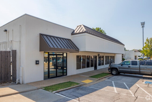
8110 S Harvard Ave, Tulsa, OK 74137


Property Detail
8110 S Harvard Ave
73935-83-17-43010
LT 1 LESS MOST NLY 5 THEREOF BLK 1
Regionalshoppingcenterormallwithanchorstore
Tulsa
CS
Oklahoma
B and X Area of moderate flood hazard, usually the area between the limits of the 100-year and 500-year floods.
1
2025
6.26 AC
2025
South Central Tulsa
007649
Tulsa
63,030 SF
Tulsa, OK
NEARBY LISTINGS FOR SALE OR LEASE
DEMOGRAPHICS near 8110 S Harvard Ave
1 mile
3 mile
5 mile
2025 Total Population
9,990
81,852
201,090
2030 Population
10,168
84,047
207,225
Pop Growth 2025-2030
+ 1.78%
+ 2.68%
+ 3.05%
Average Age
42
40
40
2025 Total Households
4,082
35,944
86,927
HH Growth 2025-2030
+ 1.79%
+ 2.83%
+ 3.10%
Median Household Inc
$86,734
$67,125
$70,180
Avg Household Size
2.30
2.20
2.20
2025 Avg HH Vehicles
2.00
2.00
2.00
Median Home Value
$331,975
$313,883
$304,135
Median Year Built
1979
1980
1981
Nearby Places
Map Layers
Map Styles
 Street
 Aerial
Layers
 Traffic
 Biking
Places
Listings with unknown addresses are not visible on the map
- Restaurants
- Banks
- Shops
- Fitness
- Groceries
PUBLIC TRANSPORTATION
AIRPORT
Tulsa International
Drive
Walk
Distance
Tulsa International
27 min
17.8 mi
Nearby Properties
Address
Land Use
TOTAL SIZE
Lot Size
Zoning
Address
Land Use
TOTAL SIZE
Lot Size
Zoning
2,622,731 SF
26.90 AC
OH
Address
Land Use
TOTAL SIZE
Lot Size
Zoning
1,584,609 SF
84.41 AC
AG
Address
Land Use
TOTAL SIZE
Lot Size
Zoning
717,386 SF
49.74 AC
OL
Address
Land Use
TOTAL SIZE
Lot Size
Zoning
790,247 SF
149.86 AC
RS3
Address
Land Use
TOTAL SIZE
Lot Size
Zoning
358,576 SF
38.21 AC
RM1
Address
Land Use
TOTAL SIZE
Lot Size
Zoning
236,738 SF
11.56 AC
PUD
Address
Land Use
TOTAL SIZE
Lot Size
Zoning
139,648 SF
20.75 AC
RS3
Address
Land Use
TOTAL SIZE
Lot Size
Zoning
61,153 SF
7.16 AC
CH
Address
Land Use
TOTAL SIZE
Lot Size
Zoning
310,629 SF
19.19 AC
OM
Address
Land Use
TOTAL SIZE
Lot Size
Zoning
206,760 SF
78.45 AC
AG
Address
Land Use
TOTAL SIZE
Lot Size
Zoning
325 SF
44.06 AC
RM2
Address
Land Use
TOTAL SIZE
Lot Size
Zoning
72,042 SF
5.10 AC
RS3
Address
Land Use
TOTAL SIZE
Lot Size
Zoning
415.28 AC
IL
Address
Land Use
TOTAL SIZE
Lot Size
Zoning
147,881 SF
35.20 AC
RS2
Address
Land Use
TOTAL SIZE
Lot Size
Zoning
301,267 SF
25.06 AC
IL
Address
Land Use
TOTAL SIZE
Lot Size
Zoning
6,338 SF
104.15 AC
AG
Address
Land Use
TOTAL SIZE
Lot Size
Zoning
358,394 SF
38.86 AC
Address
Land Use
TOTAL SIZE
Lot Size
Zoning
98,590 SF
6.41 AC
OM
Address
Land Use
TOTAL SIZE
Lot Size
Zoning
55,384 SF
14.81 AC
AG
Address
Land Use
TOTAL SIZE
Lot Size
Zoning
107,538 SF
19.74 AC
OM
Address
Land Use
TOTAL SIZE
Lot Size
Zoning
58,977 SF
15.85 AC
CS
Address
Land Use
TOTAL SIZE
Lot Size
Zoning
62,000 SF
7.20 AC
OM
Address
Land Use
TOTAL SIZE
Lot Size
Zoning
8,388 SF
63.49 AC
AG
Address
Land Use
TOTAL SIZE
Lot Size
Zoning
15.98 AC
OMH
Address
Land Use
TOTAL SIZE
Lot Size
Zoning
56,984 SF
5.54 AC
RS3
Address
Land Use
TOTAL SIZE
Lot Size
Zoning
65,385 SF
16.59 AC
AG
Address
Land Use
TOTAL SIZE
Lot Size
Zoning
58,864 SF
5.18 AC
RS3
Address
Land Use
TOTAL SIZE
Lot Size
Zoning
65,812 SF
14.12 AC
RS1
Address
Land Use
TOTAL SIZE
Lot Size
Zoning
62,792 SF
5.18 AC
RM1
Address
Land Use
TOTAL SIZE
Lot Size
Zoning
98,290 SF
19.62 AC
RS3
The World's #1 Commercial Real Estate Marketplace
Connect with us
© 2026 CoStar Group
The information above has been obtained from sources believed reliable. While we do not doubt its accuracy we have not verified it and make no guarantee, warranty or representation about it. It is your responsibility to independently confirm its accuracy and completeness. Any projections, opinions, assumptions, or estimates used are for example only and do not represent the current or future performance of the property. The value of this transaction to you depends on tax and other factors which should be evaluated by your tax, financial, and legal advisors. You and your advisors should conduct a careful, independent investigation of the property to determine to your satisfaction the suitability of the property for your needs.