Property Record
8114 W Britton Rd, Oklahoma City, OK 73132


NEARBY LISTINGS FOR SALE OR LEASE
-
-
View all Oklahoma City listings for sale on LoopNet.com
Property Detail
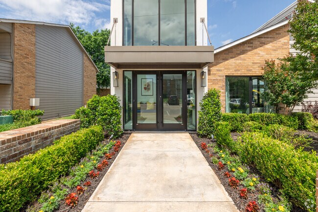
8114 W Britton Rd
140544015
Unpltd Pt Sec 31 13N 4W
Multifamilydwelling
UNPLTD PT SEC 31 13N 4W 000 000 PT NE4 SEC 31 13N 4W BEG 1052.20FT W & 50FT S FROM NE/C NE4TH E216.58FT TH ALONG CURVE TO THE RIGHT 331.01FT SELY 125.58FT TH ALONG CURVE TO THE LEFT 53.80FT SWLY 673.66FT W39.30FT NWLY 291.25FT N685.62FT TO BEG
X
Oklahoma
40109C0135H
Oklahoma
2023
7.96 AC
2024
Council Heights
108526
Oklahoma City
168,536 SF
Oklahoma City, OK
DEMOGRAPHICS near 8114 W Britton Rd
1 Mile
3 Mile
5 Mile
2024 Total Population
12,959
68,936
152,536
2029 Population
13,242
72,241
162,855
Pop Growth 2024-2029
+ 2.18%
+ 4.79%
+ 6.76%
Average Age
40
39
39
2024 Total Households
5,523
27,704
61,781
HH Growth 2024-2029
+ 2.14%
+ 4.53%
+ 6.23%
Median Household Inc
$58,850
$69,658
$69,842
Avg Household Size
2.30
2.40
2.40
2024 Avg HH Vehicles
2.00
2.00
2.00
Median Home Value
$164,249
$212,300
$209,774
Median Year Built
1984
1984
1982
Nearby Places
Map Layers
Map Styles
 Street
 Aerial
- Restaurants
- Banks
- Shops
- Fitness
- Groceries
PUBLIC TRANSPORTATION
AIRPORT
Will Rogers World
DRIVE
WALK
Distance
Will Rogers World
29 min
16.2 mi
Freight Ports
Tulsa Port Of Catoosa
DRIVE
WALK
Distance
Tulsa Port Of Catoosa
140 min
127.9 mi
Nearby Properties
Address
Land Use
TOTAL SIZE
Lot Size
Zoning
Address
Land Use
TOTAL SIZE
Lot Size
Zoning
7,500 SF
55.85 AC
Address
Land Use
TOTAL SIZE
Lot Size
Zoning
37,400 SF
4.23 AC
PUD
Address
Land Use
TOTAL SIZE
Lot Size
Zoning
641,860 SF
62.12 AC
R-4
Address
Land Use
TOTAL SIZE
Lot Size
Zoning
49,950 SF
3.69 AC
R-1
Address
Land Use
TOTAL SIZE
Lot Size
Zoning
356,798 SF
31.11 AC
C-3
Address
Land Use
TOTAL SIZE
Lot Size
Zoning
286,485 SF
14.86 AC
R-4
Address
Land Use
TOTAL SIZE
Lot Size
Zoning
363,374 SF
15.85 AC
R-4
Address
Land Use
TOTAL SIZE
Lot Size
Zoning
226,800 SF
30.07 AC
R-2
Address
Land Use
TOTAL SIZE
Lot Size
Zoning
263,560 SF
13.10 AC
R-4
Address
Land Use
TOTAL SIZE
Lot Size
Zoning
7,350 SF
6 AC
Address
Land Use
TOTAL SIZE
Lot Size
Zoning
157,279 SF
15.07 AC
PUD
Address
Land Use
TOTAL SIZE
Lot Size
Zoning
110,006 SF
6.15 AC
C-3
Address
Land Use
TOTAL SIZE
Lot Size
Zoning
10,400 SF
5.19 AC
Address
Land Use
TOTAL SIZE
Lot Size
Zoning
153,065 SF
13.87 AC
C-3
Address
Land Use
TOTAL SIZE
Lot Size
Zoning
342,342 SF
27.20 AC
R-4
Address
Land Use
TOTAL SIZE
Lot Size
Zoning
245,768 SF
15.93 AC
Address
Land Use
TOTAL SIZE
Lot Size
Zoning
220,304 SF
19.54 AC
PUD
Address
Land Use
TOTAL SIZE
Lot Size
Zoning
199,832 SF
9.72 AC
PUD
Address
Land Use
TOTAL SIZE
Lot Size
Zoning
52,214 SF
6.91 AC
PUD
Address
Land Use
TOTAL SIZE
Lot Size
Zoning
243,906 SF
9.56 AC
C-3
Address
Land Use
TOTAL SIZE
Lot Size
Zoning
175,635 SF
17.14 AC
I-2
Address
Land Use
TOTAL SIZE
Lot Size
Zoning
6,400 SF
3.40 AC
Address
Land Use
TOTAL SIZE
Lot Size
Zoning
172,368 SF
10.72 AC
R-4
Address
Land Use
TOTAL SIZE
Lot Size
Zoning
225,084 SF
18.41 AC
Address
Land Use
TOTAL SIZE
Lot Size
Zoning
69,410 SF
9 AC
PUD
Address
Land Use
TOTAL SIZE
Lot Size
Zoning
640 SF
9.58 AC
Address
Land Use
TOTAL SIZE
Lot Size
Zoning
202,744 SF
14 AC
R-4
Address
Land Use
TOTAL SIZE
Lot Size
Zoning
36,037 SF
8.26 AC
PUD
Address
Land Use
TOTAL SIZE
Lot Size
Zoning
164,512 SF
12.60 AC
The World's #1 Commercial Real Estate Marketplace
Connect with us
© 2025 CoStar Group
The information above has been obtained from sources believed reliable. While we do not doubt its accuracy we have not verified it and make no guarantee, warranty or representation about it. It is your responsibility to independently confirm its accuracy and completeness. Any projections, opinions, assumptions, or estimates used are for example only and do not represent the current or future performance of the property. The value of this transaction to you depends on tax and other factors which should be evaluated by your tax, financial, and legal advisors. You and your advisors should conduct a careful, independent investigation of the property to determine to your satisfaction the suitability of the property for your needs.