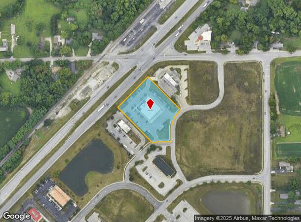
Property Record
8116 Upland Bnd, Plainfield, IN 46168

NEARBY LISTINGS FOR SALE OR LEASE
Property Detail
8116 Upland Bnd
32-16-20-239-001.000-011
LOT -307 REPLAT HEARTLAND CROSSING NORTH LOTS 302 & 305 1.91AC DBA: BELLE TIRE
Autorepair
Hendricks
X
Indiana
18097C0215F
302,305
2024
1.91 AC
2024
Hendricks County
210802
Indianapolis
10,055 SF
Indianapolis-Carmel-Greenwood, IN
DEMOGRAPHICS near 8116 Upland Bnd
1 Mile
3 Mile
5 Mile
2024 Total Population
5,493
22,883
63,201
2029 Population
5,640
23,476
65,496
Pop Growth 2024-2029
+ 2.68%
+ 2.59%
+ 3.63%
Average Age
33
38
38
2024 Total Households
1,935
8,330
22,976
HH Growth 2024-2029
+ 3.26%
+ 2.71%
+ 3.66%
Median Household Inc
$82,127
$75,144
$74,057
Avg Household Size
2.80
2.70
2.60
2024 Avg HH Vehicles
2.00
2.00
2.00
Median Home Value
$181,393
$185,536
$190,532
Median Year Built
2002
1996
1992
Nearby Places
Map Layers
Map Styles
 Street
 Aerial
- Restaurants
- Banks
- Shops
- Fitness
- Groceries
PUBLIC TRANSPORTATION
AIRPORT
Indianapolis International
DRIVE
WALK
Distance
Indianapolis International
16 min
7.7 mi
Freight Ports
Port of Toledo
DRIVE
WALK
Distance
Port of Toledo
289 min
239.2 mi
SALE & LEASE HISTORY
LISTING DATE
SALE/LEASE

Sep 24, 2016
For Sale
Nov 02, 2017
For Sale
Nearby Properties
Address
Land Use
TOTAL SIZE
Lot Size
Zoning
Address
Land Use
TOTAL SIZE
Lot Size
Zoning
911,062 SF
54.40 AC
ZO01
Address
Land Use
TOTAL SIZE
Lot Size
Zoning
86,017 SF
26.95 AC
Address
Land Use
TOTAL SIZE
Lot Size
Zoning
822,500 SF
45.66 AC
Address
Land Use
TOTAL SIZE
Lot Size
Zoning
747,256 SF
41.32 AC
Address
Land Use
TOTAL SIZE
Lot Size
Zoning
665,724 SF
47.25 AC
ZO01
Address
Land Use
TOTAL SIZE
Lot Size
Zoning
798,160 SF
44.46 AC
ZO01
Address
Land Use
TOTAL SIZE
Lot Size
Zoning
997,763 SF
65.80 AC
ZO01
Address
Land Use
TOTAL SIZE
Lot Size
Zoning
650,960 SF
31.95 AC
Address
Land Use
TOTAL SIZE
Lot Size
Zoning
292,315 SF
28.97 AC
Address
Land Use
TOTAL SIZE
Lot Size
Zoning
24.62 AC
Address
Land Use
TOTAL SIZE
Lot Size
Zoning
595,100 SF
28.35 AC
Address
Land Use
TOTAL SIZE
Lot Size
Zoning
695,702 SF
39.68 AC
ZO03
Address
Land Use
TOTAL SIZE
Lot Size
Zoning
480,000 SF
40.60 AC
Address
Land Use
TOTAL SIZE
Lot Size
Zoning
462,275 SF
25.83 AC
ZO01
Address
Land Use
TOTAL SIZE
Lot Size
Zoning
482,016 SF
26.70 AC
Address
Land Use
TOTAL SIZE
Lot Size
Zoning
423,757 SF
28.71 AC
Address
Land Use
TOTAL SIZE
Lot Size
Zoning
465,480 SF
34.07 AC
Address
Land Use
TOTAL SIZE
Lot Size
Zoning
5,881 SF
17.35 AC
Address
Land Use
TOTAL SIZE
Lot Size
Zoning
442,215 SF
24.69 AC
Address
Land Use
TOTAL SIZE
Lot Size
Zoning
328,331 SF
39.63 AC
ZO01
Address
Land Use
TOTAL SIZE
Lot Size
Zoning
168,574 SF
8.30 AC
Address
Land Use
TOTAL SIZE
Lot Size
Zoning
363,072 SF
25.08 AC
Address
Land Use
TOTAL SIZE
Lot Size
Zoning
346,808 SF
21.63 AC
Address
Land Use
TOTAL SIZE
Lot Size
Zoning
11,404 SF
12.58 AC
Address
Land Use
TOTAL SIZE
Lot Size
Zoning
274,534 SF
13.47 AC
Address
Land Use
TOTAL SIZE
Lot Size
Zoning
340,080 SF
16.82 AC
Address
Land Use
TOTAL SIZE
Lot Size
Zoning
353,860 SF
15.40 AC
Address
Land Use
TOTAL SIZE
Lot Size
Zoning
228,839 SF
27.60 AC
ZO01
Address
Land Use
TOTAL SIZE
Lot Size
Zoning
260,400 SF
12.70 AC
Address
Land Use
TOTAL SIZE
Lot Size
Zoning
129,490 SF
27.92 AC
ZO01
The World's #1 Commercial Real Estate Marketplace
Connect with us
© 2026 CoStar Group
The information above has been obtained from sources believed reliable. While we do not doubt its accuracy we have not verified it and make no guarantee, warranty or representation about it. It is your responsibility to independently confirm its accuracy and completeness. Any projections, opinions, assumptions, or estimates used are for example only and do not represent the current or future performance of the property. The value of this transaction to you depends on tax and other factors which should be evaluated by your tax, financial, and legal advisors. You and your advisors should conduct a careful, independent investigation of the property to determine to your satisfaction the suitability of the property for your needs.