Property Record
8119 Park Pl, Brighton, MI 48116


NEARBY LISTINGS FOR SALE OR LEASE
Property Detail
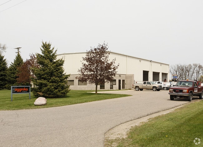
8119 Park Pl
16-14-200-030
Part Of Sec 14 T1n R6e
Commercialnec
SEC 14 T1N R6E COM NE COR, TH S0*20'32"E 614.71 FT FOR POB, TH S0*20'32"E 362.09 FT, TH S89*38'07"W 624.48 FT, TH N6*33'20"E
X
Livingston
26093C0477D
Michigan
2025
4.73 AC
2025
Livingston County
744800
Detroit
10,192 SF
Detroit-Warren-Dearborn, MI
DEMOGRAPHICS near 8119 Park Pl
1 mile
3 mile
5 mile
2024 Total Population
617
22,970
57,797
2029 Population
632
23,236
58,517
Pop Growth 2024-2029
+ 2.43%
+ 1.16%
+ 1.25%
Average Age
44
43
41
2024 Total Households
216
9,198
22,051
HH Growth 2024-2029
+ 2.31%
+ 1.20%
+ 1.25%
Median Household Inc
$132,849
$97,009
$102,578
Avg Household Size
2.80
2.50
2.60
2024 Avg HH Vehicles
3.00
2.00
2.00
Median Home Value
$359,313
$315,300
$337,599
Median Year Built
1993
1991
1991
Nearby Places
Map Layers
Map Styles
 Street
 Aerial
Transit
 Traffic
 Biking
Places
Listings with unknown addresses are not visible on the map
- Restaurants
- Banks
- Shops
- Fitness
- Groceries
PUBLIC TRANSPORTATION
AIRPORT
Bishop International
Drive
Walk
Distance
Bishop International
57 min
39.5 mi
Detroit Metro Wayne County
Drive
Walk
Distance
Detroit Metro Wayne County
53 min
41.0 mi
Nearby Properties
Address
Land Use
TOTAL SIZE
Lot Size
Zoning
Address
Land Use
TOTAL SIZE
Lot Size
Zoning
Address
Land Use
TOTAL SIZE
Lot Size
Zoning
952 SF
85.40 AC
RM
Address
Land Use
TOTAL SIZE
Lot Size
Zoning
45.18 AC
AI
Address
Land Use
TOTAL SIZE
Lot Size
Zoning
394,554 SF
28.66 AC
GI
Address
Land Use
TOTAL SIZE
Lot Size
Zoning
952 SF
16.37 AC
RM
Address
Land Use
TOTAL SIZE
Lot Size
Zoning
139,056 SF
50.33 AC
GI
Address
Land Use
TOTAL SIZE
Lot Size
Zoning
9,784 SF
68.90 AC
MM
Address
Land Use
TOTAL SIZE
Lot Size
Zoning
140,000 SF
9.08 AC
LI PUD
Address
Land Use
TOTAL SIZE
Lot Size
Zoning
164,517 SF
27.78 AC
GI
Address
Land Use
TOTAL SIZE
Lot Size
Zoning
137,373 SF
16.51 AC
AI
Address
Land Use
TOTAL SIZE
Lot Size
Zoning
183,105 SF
13.38 AC
I-1
Address
Land Use
TOTAL SIZE
Lot Size
Zoning
54,615 SF
6.14 AC
LI PUD
Address
Land Use
TOTAL SIZE
Lot Size
Zoning
106,347 SF
11.47 AC
LI
Address
Land Use
TOTAL SIZE
Lot Size
Zoning
55,744 SF
4.40 AC
Address
Land Use
TOTAL SIZE
Lot Size
Zoning
96,480 SF
11.44 AC
GI
Address
Land Use
TOTAL SIZE
Lot Size
Zoning
73,010 SF
25.37 AC
GI
Address
Land Use
TOTAL SIZE
Lot Size
Zoning
87,046 SF
9.76 AC
GI
Address
Land Use
TOTAL SIZE
Lot Size
Zoning
47,339 SF
9.56 AC
GI
Address
Land Use
TOTAL SIZE
Lot Size
Zoning
116,663 SF
8.98 AC
AI
Address
Land Use
TOTAL SIZE
Lot Size
Zoning
91,510 SF
9.73 AC
GI
Address
Land Use
TOTAL SIZE
Lot Size
Zoning
9.86 AC
LI
Address
Land Use
TOTAL SIZE
Lot Size
Zoning
33,808 SF
4.16 AC
LI PUD
Address
Land Use
TOTAL SIZE
Lot Size
Zoning
4.60 AC
RM
Address
Land Use
TOTAL SIZE
Lot Size
Zoning
76,240 SF
4.39 AC
GI
Address
Land Use
TOTAL SIZE
Lot Size
Zoning
45,340 SF
2.86 AC
LI PUD
Address
Land Use
TOTAL SIZE
Lot Size
Zoning
43,838 SF
10.05 AC
GI
Address
Land Use
TOTAL SIZE
Lot Size
Zoning
56,745 SF
5.09 AC
GI
Address
Land Use
TOTAL SIZE
Lot Size
Zoning
34,200 SF
1.53 AC
RO
Address
Land Use
TOTAL SIZE
Lot Size
Zoning
1,472 SF
35.14 AC
MM
The World's #1 Commercial Real Estate Marketplace
Connect with us
© 2026 CoStar Group
The information above has been obtained from sources believed reliable. While we do not doubt its accuracy we have not verified it and make no guarantee, warranty or representation about it. It is your responsibility to independently confirm its accuracy and completeness. Any projections, opinions, assumptions, or estimates used are for example only and do not represent the current or future performance of the property. The value of this transaction to you depends on tax and other factors which should be evaluated by your tax, financial, and legal advisors. You and your advisors should conduct a careful, independent investigation of the property to determine to your satisfaction the suitability of the property for your needs.