Property Record
812 E Highway 16 E, Newnan, GA 30263
NEARBY LISTINGS FOR SALE OR LEASE
Property Detail
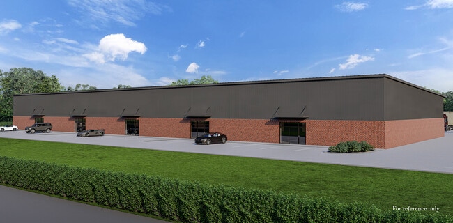
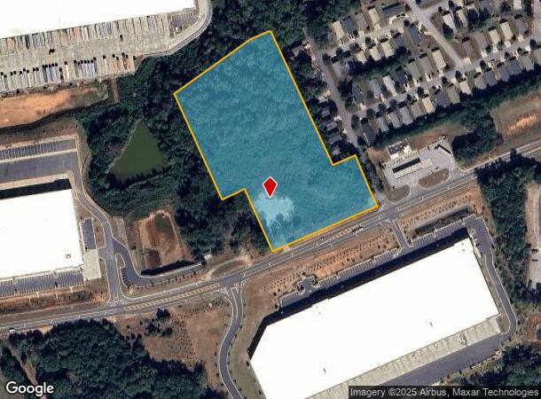
812 E Highway 16 E
088-2060-001
6.858 AC LL 60 2ND LD HWY 16
Commercialnec
Coweta
X
Georgia
13077C0234D
60
2025
6.86 AC
2025
Fayette/Coweta County
170603
Atlanta
1,428 SF
Atlanta-Sandy Springs-Roswell, GA
DEMOGRAPHICS near 812 E Highway 16 E
1 Mile
3 Mile
5 Mile
2024 Total Population
682
18,716
62,803
2029 Population
769
21,156
70,229
Pop Growth 2024-2029
+ 12.76%
+ 13.04%
+ 11.82%
Average Age
39
37
38
2024 Total Households
238
7,000
24,218
HH Growth 2024-2029
+ 13.03%
+ 13.09%
+ 11.84%
Median Household Inc
$103,704
$78,971
$75,616
Avg Household Size
2.80
2.70
2.60
2024 Avg HH Vehicles
2.00
2.00
2.00
Median Home Value
$274,999
$271,814
$265,923
Median Year Built
1992
2004
1999
Nearby Places
Map Layers
Map Styles
 Street
 Aerial
- Restaurants
- Banks
- Shops
- Fitness
- Groceries
PUBLIC TRANSPORTATION
AIRPORT
Hartsfield - Jackson Atlanta International
DRIVE
WALK
Distance
Hartsfield - Jackson Atlanta International
46 min
36.4 mi
SALE & LEASE HISTORY
LISTING DATE
SALE/LEASE

Jan 02, 2024
For Lease
Jan 02, 2024
For Sale
Nearby Properties
Address
Land Use
TOTAL SIZE
Lot Size
Zoning
Address
Land Use
TOTAL SIZE
Lot Size
Zoning
409,449 SF
93.83 AC
R1
Address
Land Use
TOTAL SIZE
Lot Size
Zoning
1,514,040 SF
147.92 AC
C1
Address
Land Use
TOTAL SIZE
Lot Size
Zoning
1,396,640 SF
78.52 AC
C1
Address
Land Use
TOTAL SIZE
Lot Size
Zoning
1,002,450 SF
62.54 AC
R1
Address
Land Use
TOTAL SIZE
Lot Size
Zoning
340,087 SF
24.91 AC
R1
Address
Land Use
TOTAL SIZE
Lot Size
Zoning
562,800 SF
34.39 AC
R1
Address
Land Use
TOTAL SIZE
Lot Size
Zoning
208,524 SF
19.59 AC
R2
Address
Land Use
TOTAL SIZE
Lot Size
Zoning
274,787 SF
31.66 AC
001
Address
Land Use
TOTAL SIZE
Lot Size
Zoning
237,164 SF
16.85 AC
R1
Address
Land Use
TOTAL SIZE
Lot Size
Zoning
188,907 SF
25.22 AC
001
Address
Land Use
TOTAL SIZE
Lot Size
Zoning
113,618 SF
0.88 AC
R1
Address
Land Use
TOTAL SIZE
Lot Size
Zoning
99,789 SF
0.88 AC
R1
Address
Land Use
TOTAL SIZE
Lot Size
Zoning
121,224 SF
15.94 AC
R2
Address
Land Use
TOTAL SIZE
Lot Size
Zoning
271,408 SF
30.33 AC
R1
Address
Land Use
TOTAL SIZE
Lot Size
Zoning
237,975 SF
20 AC
C1
Address
Land Use
TOTAL SIZE
Lot Size
Zoning
124,120 SF
30.64 AC
001
Address
Land Use
TOTAL SIZE
Lot Size
Zoning
145,274 SF
10 AC
R1
Address
Land Use
TOTAL SIZE
Lot Size
Zoning
131,836 SF
16.01 AC
R2
Address
Land Use
TOTAL SIZE
Lot Size
Zoning
135,456 SF
7.28 AC
R1
Address
Land Use
TOTAL SIZE
Lot Size
Zoning
42,672 SF
5.32 AC
R1
Address
Land Use
TOTAL SIZE
Lot Size
Zoning
42,672 SF
3.95 AC
R1
Address
Land Use
TOTAL SIZE
Lot Size
Zoning
180,993 SF
10.80 AC
001
Address
Land Use
TOTAL SIZE
Lot Size
Zoning
42,670 SF
129 AC
R1
Address
Land Use
TOTAL SIZE
Lot Size
Zoning
42,672 SF
3.30 AC
R1
Address
Land Use
TOTAL SIZE
Lot Size
Zoning
58,839 SF
11.31 AC
R1
Address
Land Use
TOTAL SIZE
Lot Size
Zoning
112,444 SF
15.27 AC
R2
Address
Land Use
TOTAL SIZE
Lot Size
Zoning
98,072 SF
17.82 AC
ND
Address
Land Use
TOTAL SIZE
Lot Size
Zoning
166,314 SF
15 AC
R2
The World's #1 Commercial Real Estate Marketplace
Connect with us
© 2026 CoStar Group
The information above has been obtained from sources believed reliable. While we do not doubt its accuracy we have not verified it and make no guarantee, warranty or representation about it. It is your responsibility to independently confirm its accuracy and completeness. Any projections, opinions, assumptions, or estimates used are for example only and do not represent the current or future performance of the property. The value of this transaction to you depends on tax and other factors which should be evaluated by your tax, financial, and legal advisors. You and your advisors should conduct a careful, independent investigation of the property to determine to your satisfaction the suitability of the property for your needs.