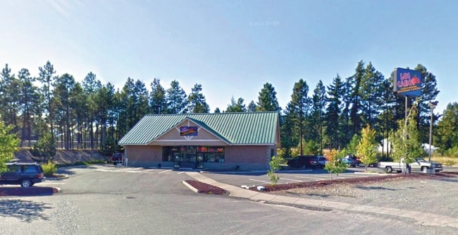
Property Record
812 W Davis St, Cle Elum, WA 98922


NEARBY LISTINGS FOR SALE OR LEASE
Property Detail
812 W Davis St
Ellensburg, WA
Gaub Addition To Cle Elum
14424
GAUB ADDITION TO CLE ELUM; LOT 1; SEC. 27, TWP. 20, RGE. 15
Storebuilding
Kittitas
X
Washington
53037C0679D
1
2024
1 AC
2025
Washington State Area
975104
Other Market Areas
3,500 SF
DEMOGRAPHICS near 812 W Davis St
1 Mile
3 Mile
5 Mile
2024 Total Population
1,893
5,798
8,198
2029 Population
2,132
6,656
9,446
Pop Growth 2024-2029
+ 12.63%
+ 14.80%
+ 15.22%
Average Age
44
44
45
2024 Total Households
867
2,647
3,751
HH Growth 2024-2029
+ 12.80%
+ 14.85%
+ 15.25%
Median Household Inc
$58,234
$65,175
$72,546
Avg Household Size
2.20
2.20
2.20
2024 Avg HH Vehicles
2.00
2.00
2.00
Median Home Value
$499,999
$484,337
$501,366
Median Year Built
1980
1984
1991
Nearby Places
Map Layers
Map Styles
 Street
 Aerial
- Restaurants
- Banks
- Shops
- Fitness
- Groceries
SALE & LEASE HISTORY
LISTING DATE
SALE/LEASE

Jun 02, 2017
For Sale
Jul 21, 2020
For Lease
Nearby Properties
Address
Land Use
TOTAL SIZE
Lot Size
Zoning
Address
Land Use
TOTAL SIZE
Lot Size
Zoning
362.96 AC
KC-F&R
Address
Land Use
TOTAL SIZE
Lot Size
Zoning
38,691 SF
3.46 AC
Address
Land Use
TOTAL SIZE
Lot Size
Zoning
155,332 SF
Address
Land Use
TOTAL SIZE
Lot Size
Zoning
38,593 SF
6.52 AC
EC
Address
Land Use
TOTAL SIZE
Lot Size
Zoning
28,490 SF
1.76 AC
EC
Address
Land Use
TOTAL SIZE
Lot Size
Zoning
36,576 SF
94.37 AC
MPR
Address
Land Use
TOTAL SIZE
Lot Size
Zoning
21,681 SF
0.53 AC
CEC
Address
Land Use
TOTAL SIZE
Lot Size
Zoning
34,528 SF
2.01 AC
KCS
Address
Land Use
TOTAL SIZE
Lot Size
Zoning
14,355 SF
1.99 AC
MPR
Address
Land Use
TOTAL SIZE
Lot Size
Zoning
53,746 SF
2.05 AC
EC
Address
Land Use
TOTAL SIZE
Lot Size
Zoning
23,984 SF
0.72 AC
Address
Land Use
TOTAL SIZE
Lot Size
Zoning
32,600 SF
1.91 AC
CEI
Address
Land Use
TOTAL SIZE
Lot Size
Zoning
8,306 SF
0.16 AC
RCC
Address
Land Use
TOTAL SIZE
Lot Size
Zoning
39,288 SF
0.73 AC
Address
Land Use
TOTAL SIZE
Lot Size
Zoning
9,541 SF
1.36 AC
Address
Land Use
TOTAL SIZE
Lot Size
Zoning
31,395 SF
2.04 AC
Address
Land Use
TOTAL SIZE
Lot Size
Zoning
7,899 SF
1.61 AC
EC
Address
Land Use
TOTAL SIZE
Lot Size
Zoning
20,967 SF
0.55 AC
CER
Address
Land Use
TOTAL SIZE
Lot Size
Zoning
130,048 SF
0.78 AC
CEI
Address
Land Use
TOTAL SIZE
Lot Size
Zoning
10,966 SF
0.39 AC
CEC
Address
Land Use
TOTAL SIZE
Lot Size
Zoning
4,228 SF
64.84 AC
KC-F&R
Address
Land Use
TOTAL SIZE
Lot Size
Zoning
15,721 SF
0.35 AC
CER
Address
Land Use
TOTAL SIZE
Lot Size
Zoning
26,488 SF
2.51 AC
KC-I-L
Address
Land Use
TOTAL SIZE
Lot Size
Zoning
26,540 SF
3.05 AC
CEC
Address
Land Use
TOTAL SIZE
Lot Size
Zoning
50.32 AC
KC-I-G
Address
Land Use
TOTAL SIZE
Lot Size
Zoning
28,417 SF
0.69 AC
CEI
Address
Land Use
TOTAL SIZE
Lot Size
Zoning
9,655 SF
1.03 AC
KC-A-3
Address
Land Use
TOTAL SIZE
Lot Size
Zoning
17,500 SF
0.64 AC
EC
Address
Land Use
TOTAL SIZE
Lot Size
Zoning
23,308 SF
3.01 AC
CEC
Address
Land Use
TOTAL SIZE
Lot Size
Zoning
6,487 SF
0.63 AC
EC
The World's #1 Commercial Real Estate Marketplace
Connect with us
© 2025 CoStar Group
The information above has been obtained from sources believed reliable. While we do not doubt its accuracy we have not verified it and make no guarantee, warranty or representation about it. It is your responsibility to independently confirm its accuracy and completeness. Any projections, opinions, assumptions, or estimates used are for example only and do not represent the current or future performance of the property. The value of this transaction to you depends on tax and other factors which should be evaluated by your tax, financial, and legal advisors. You and your advisors should conduct a careful, independent investigation of the property to determine to your satisfaction the suitability of the property for your needs.