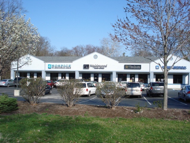
Property Record
8120 Secor Rd, Lambertville, MI 48144


NEARBY LISTINGS FOR SALE OR LEASE
Property Detail
8120 Secor Rd
02-029-026-00
*PART OF NW 1/4 OF NW 1/4 OF SEC 29 T8S R7E 1.259 ACRES COM 369.12 FT S 1D 45M E FR NW COR OF SEC 29 TH S 1D 45M E FROM NW
Communitycenter
Monroe
X
Michigan
26115C0344E
1.25 AC
2025
Monroe County
2025
Detroit
833100
Monroe, MI
14,132 SF
DEMOGRAPHICS near 8120 Secor Rd
1 Mile
3 Mile
5 Mile
2024 Total Population
4,526
28,722
90,453
2029 Population
4,546
28,692
89,632
Pop Growth 2024-2029
+ 0.44%
(0.10%)
(0.91%)
Average Age
43
43
42
2024 Total Households
1,740
11,715
38,561
HH Growth 2024-2029
+ 0.40%
(0.17%)
(0.98%)
Median Household Inc
$89,496
$72,554
$65,804
Avg Household Size
2.60
2.40
2.30
2024 Avg HH Vehicles
2.00
2.00
2.00
Median Home Value
$235,447
$198,940
$165,721
Median Year Built
1975
1971
1966
Nearby Places
Map Layers
Map Styles
 Street
 Aerial
- Restaurants
- Banks
- Shops
- Fitness
- Groceries
PUBLIC TRANSPORTATION
AIRPORT
Eugene F Kranz Toledo Express
DRIVE
WALK
Distance
Eugene F Kranz Toledo Express
41 min
24.8 mi
Freight Ports
Port of Toledo
DRIVE
WALK
Distance
Port of Toledo
32 min
16.4 mi
SALE & LEASE HISTORY
LISTING DATE
SALE/LEASE

Sep 25, 2016
For Lease
Nearby Properties
Address
Land Use
TOTAL SIZE
Lot Size
Zoning
Address
Land Use
TOTAL SIZE
Lot Size
Zoning
165,739 SF
17.77 AC
Address
Land Use
TOTAL SIZE
Lot Size
Zoning
223,900 SF
17.26 AC
Address
Land Use
TOTAL SIZE
Lot Size
Zoning
222,493 SF
29.88 AC
10-IC
Address
Land Use
TOTAL SIZE
Lot Size
Zoning
61,718 SF
7 AC
Address
Land Use
TOTAL SIZE
Lot Size
Zoning
6.58 AC
Address
Land Use
TOTAL SIZE
Lot Size
Zoning
87,898 SF
9.17 AC
Address
Land Use
TOTAL SIZE
Lot Size
Zoning
170,528 SF
15 AC
Address
Land Use
TOTAL SIZE
Lot Size
Zoning
64,980 SF
5.80 AC
Address
Land Use
TOTAL SIZE
Lot Size
Zoning
49,875 SF
3.97 AC
Address
Land Use
TOTAL SIZE
Lot Size
Zoning
18,970 SF
3.72 AC
Address
Land Use
TOTAL SIZE
Lot Size
Zoning
53,933 SF
5.26 AC
Address
Land Use
TOTAL SIZE
Lot Size
Zoning
5.31 AC
Address
Land Use
TOTAL SIZE
Lot Size
Zoning
124,772 SF
4.22 AC
10-IC
Address
Land Use
TOTAL SIZE
Lot Size
Zoning
30,108 SF
4.43 AC
Address
Land Use
TOTAL SIZE
Lot Size
Zoning
54,786 SF
7 AC
10-RS6
Address
Land Use
TOTAL SIZE
Lot Size
Zoning
34,634 SF
37.38 AC
B2
Address
Land Use
TOTAL SIZE
Lot Size
Zoning
6,164 SF
124.64 AC
Address
Land Use
TOTAL SIZE
Lot Size
Zoning
42,066 SF
7.26 AC
10-MX
Address
Land Use
TOTAL SIZE
Lot Size
Zoning
6,420 SF
2.12 AC
Address
Land Use
TOTAL SIZE
Lot Size
Zoning
71,140 SF
6.43 AC
10-CR
Address
Land Use
TOTAL SIZE
Lot Size
Zoning
12,400 SF
3.54 AC
Address
Land Use
TOTAL SIZE
Lot Size
Zoning
5,848 SF
1.09 AC
Address
Land Use
TOTAL SIZE
Lot Size
Zoning
100,680 SF
4 AC
10-RM36
Address
Land Use
TOTAL SIZE
Lot Size
Zoning
6,400 SF
12 AC
Address
Land Use
TOTAL SIZE
Lot Size
Zoning
87,299 SF
6.25 AC
Address
Land Use
TOTAL SIZE
Lot Size
Zoning
7,606 SF
1.35 AC
Address
Land Use
TOTAL SIZE
Lot Size
Zoning
43,086 SF
0.46 AC
10-CR
Address
Land Use
TOTAL SIZE
Lot Size
Zoning
1.61 AC
Address
Land Use
TOTAL SIZE
Lot Size
Zoning
5,364 SF
0.46 AC
PUD
Address
Land Use
TOTAL SIZE
Lot Size
Zoning
10,200 SF
1.15 AC
The World's #1 Commercial Real Estate Marketplace
Connect with us
© 2026 CoStar Group
The information above has been obtained from sources believed reliable. While we do not doubt its accuracy we have not verified it and make no guarantee, warranty or representation about it. It is your responsibility to independently confirm its accuracy and completeness. Any projections, opinions, assumptions, or estimates used are for example only and do not represent the current or future performance of the property. The value of this transaction to you depends on tax and other factors which should be evaluated by your tax, financial, and legal advisors. You and your advisors should conduct a careful, independent investigation of the property to determine to your satisfaction the suitability of the property for your needs.