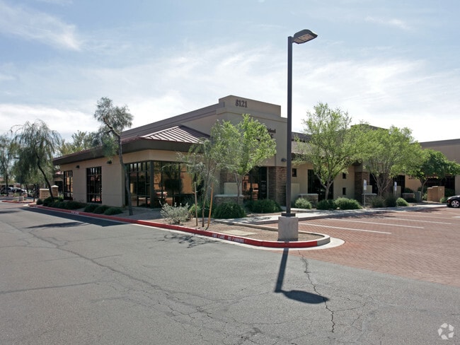
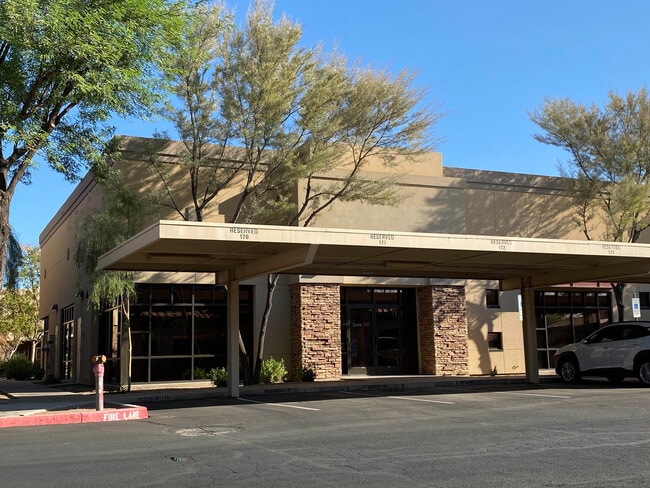
Property Record
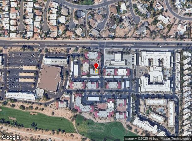
8121 E Indian Bend Rd, Scottsdale, AZ 85250
Current Lease Availabilities
NEARBY LISTINGS FOR SALE OR LEASE
Property Detail
8121 E Indian Bend Rd
Phoenix-Mesa-Chandler, AZ
Indian Bend Corporate Centre Condominium
174-11-329
INDIAN BEND CORPORATE CENTRE CONDOMINIUM MCR 625-02
Officecondo
Maricopa
X
Arizona
04013C1770M
127
2025
0.02 AC
2025
Central Scottsdale
216902
Phoenix
6,046 SF
DEMOGRAPHICS near 8121 E Indian Bend Rd
1 mile
3 mile
5 mile
2024 Total Population
12,190
71,780
166,943
2029 Population
13,443
79,828
183,864
Pop Growth 2024-2029
+ 10.28%
+ 11.21%
+ 10.14%
Average Age
47
47
45
2024 Total Households
6,187
37,086
79,809
HH Growth 2024-2029
+ 10.36%
+ 11.50%
+ 10.44%
Median Household Inc
$94,917
$95,122
$96,828
Avg Household Size
1.90
1.90
2.00
2024 Avg HH Vehicles
2.00
2.00
2.00
Median Home Value
$615,943
$655,669
$675,400
Median Year Built
1979
1982
1982
Nearby Places
Map Layers
Map Styles
 Street
 Aerial
Transit
 Traffic
 Biking
Places
Listings with unknown addresses are not visible on the map
- Restaurants
- Banks
- Shops
- Fitness
- Groceries
PUBLIC TRANSPORTATION
AIRPORT
Phoenix Sky Harbor International
Drive
Walk
Distance
Phoenix Sky Harbor International
23 min
15.2 mi
Phoenix-Mesa Gateway
Drive
Walk
Distance
Phoenix-Mesa Gateway
44 min
30.6 mi
Nearby Properties
Address
Land Use
TOTAL SIZE
Lot Size
Zoning
Address
Land Use
TOTAL SIZE
Lot Size
Zoning
2,636,740 SF
21.88 AC
C-DT
Address
Land Use
TOTAL SIZE
Lot Size
Zoning
33,483 SF
7.82 AC
PF
Address
Land Use
TOTAL SIZE
Lot Size
Zoning
981,325 SF
8.31 AC
Address
Land Use
TOTAL SIZE
Lot Size
Zoning
2.68 AC
R-43
Address
Land Use
TOTAL SIZE
Lot Size
Zoning
623,263 SF
27.34 AC
M-H
Address
Land Use
TOTAL SIZE
Lot Size
Zoning
440,573 SF
19.10 AC
SUPR
Address
Land Use
TOTAL SIZE
Lot Size
Zoning
1,229,384 SF
4.81 AC
Address
Land Use
TOTAL SIZE
Lot Size
Zoning
457,979 SF
9.26 AC
CO
Address
Land Use
TOTAL SIZE
Lot Size
Zoning
734,506 SF
7.75 AC
C-T
Address
Land Use
TOTAL SIZE
Lot Size
Zoning
8,051 SF
3.19 AC
R-43
Address
Land Use
TOTAL SIZE
Lot Size
Zoning
22,630 SF
1.06 AC
SUPP
Address
Land Use
TOTAL SIZE
Lot Size
Zoning
515,127 SF
7.57 AC
C-T
Address
Land Use
TOTAL SIZE
Lot Size
Zoning
289,633 SF
9.11 AC
R-10
Address
Land Use
TOTAL SIZE
Lot Size
Zoning
590,903 SF
9.41 AC
C-DT
Address
Land Use
TOTAL SIZE
Lot Size
Zoning
245,175 SF
6.94 AC
DDRU2
Address
Land Use
TOTAL SIZE
Lot Size
Zoning
250,415 SF
21 AC
I-P
Address
Land Use
TOTAL SIZE
Lot Size
Zoning
355,399 SF
7.13 AC
C-C
Address
Land Use
TOTAL SIZE
Lot Size
Zoning
121,740 SF
22.13 AC
SUPR
Address
Land Use
TOTAL SIZE
Lot Size
Zoning
345,713 SF
18.25 AC
M-H
Address
Land Use
TOTAL SIZE
Lot Size
Zoning
138,984 SF
14.30 AC
C-C
Address
Land Use
TOTAL SIZE
Lot Size
Zoning
341,324 SF
1.93 AC
Address
Land Use
TOTAL SIZE
Lot Size
Zoning
194,044 SF
4.93 AC
C-2
Address
Land Use
TOTAL SIZE
Lot Size
Zoning
145,146 SF
8.21 AC
M-H
Address
Land Use
TOTAL SIZE
Lot Size
Zoning
608,714 SF
0.67 AC
TH
Address
Land Use
TOTAL SIZE
Lot Size
Zoning
358,139 SF
5.31 AC
PUD
Address
Land Use
TOTAL SIZE
Lot Size
Zoning
270,059 SF
10.61 AC
M-H
Address
Land Use
TOTAL SIZE
Lot Size
Zoning
132,764 SF
3.97 AC
DDRU2
Address
Land Use
TOTAL SIZE
Lot Size
Zoning
359,568 SF
19 AC
RT
Address
Land Use
TOTAL SIZE
Lot Size
Zoning
240,248 SF
4.67 AC
C-T
Address
Land Use
TOTAL SIZE
Lot Size
Zoning
141,484 SF
13.27 AC
PNC
The World's #1 Commercial Real Estate Marketplace
Connect with us
© 2026 CoStar Group
The information above has been obtained from sources believed reliable. While we do not doubt its accuracy we have not verified it and make no guarantee, warranty or representation about it. It is your responsibility to independently confirm its accuracy and completeness. Any projections, opinions, assumptions, or estimates used are for example only and do not represent the current or future performance of the property. The value of this transaction to you depends on tax and other factors which should be evaluated by your tax, financial, and legal advisors. You and your advisors should conduct a careful, independent investigation of the property to determine to your satisfaction the suitability of the property for your needs.