Property Record
8179 Ardrey Kell Rd, Charlotte, NC 28277


NEARBY LISTINGS FOR SALE OR LEASE
Property Detail
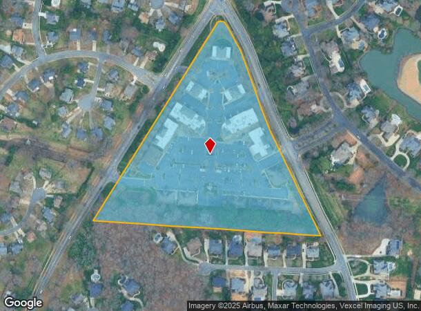
8179 Ardrey Kell Rd
Charlotte-Concord-Gastonia, NC-SC
Fountains
229-124-07
BLDG B UNIT 101 U/F 775-1,4
Commercialcondominium
Mecklenburg
X
North Carolina
3710446700L
99
2024
11.94 AC
2025
South/485
005846
Charlotte
2,504 SF
DEMOGRAPHICS near 8179 Ardrey Kell Rd
1 Mile
3 Mile
5 Mile
2024 Total Population
8,421
65,325
159,589
2029 Population
8,824
69,179
171,263
Pop Growth 2024-2029
+ 4.79%
+ 5.90%
+ 7.32%
Average Age
40
39
39
2024 Total Households
3,083
23,806
58,643
HH Growth 2024-2029
+ 4.77%
+ 5.85%
+ 7.21%
Median Household Inc
$139,164
$137,915
$126,805
Avg Household Size
2.70
2.70
2.70
2024 Avg HH Vehicles
2.00
2.00
2.00
Median Home Value
$444,751
$493,534
$474,472
Median Year Built
2000
2001
1999
Nearby Places
Map Layers
Map Styles
 Street
 Aerial
- Restaurants
- Banks
- Shops
- Fitness
- Groceries
PUBLIC TRANSPORTATION
AIRPORT
Charlotte/Douglas International
DRIVE
WALK
Distance
Charlotte/Douglas International
31 min
18.6 mi
Concord-Padgett Regional
DRIVE
WALK
Distance
Concord-Padgett Regional
42 min
33.0 mi
Freight Ports
North Charleston Terminal
DRIVE
WALK
Distance
North Charleston Terminal
226 min
193.1 mi
Nearby Properties
Address
Land Use
TOTAL SIZE
Lot Size
Zoning
Address
Land Use
TOTAL SIZE
Lot Size
Zoning
476,565 SF
13.18 AC
Address
Land Use
TOTAL SIZE
Lot Size
Zoning
339,072 SF
20.65 AC
B1SCD
Address
Land Use
TOTAL SIZE
Lot Size
Zoning
295,548 SF
43.48 AC
CC
Address
Land Use
TOTAL SIZE
Lot Size
Zoning
539,429 SF
5.37 AC
Address
Land Use
TOTAL SIZE
Lot Size
Zoning
480,041 SF
4.76 AC
Address
Land Use
TOTAL SIZE
Lot Size
Zoning
215,600 SF
6.97 AC
R3
Address
Land Use
TOTAL SIZE
Lot Size
Zoning
698,101 SF
5 AC
Address
Land Use
TOTAL SIZE
Lot Size
Zoning
343,125 SF
24.48 AC
R12MFCD
Address
Land Use
TOTAL SIZE
Lot Size
Zoning
324,188 SF
51.13 AC
Address
Land Use
TOTAL SIZE
Lot Size
Zoning
291,482 SF
23.12 AC
R12MFCD
Address
Land Use
TOTAL SIZE
Lot Size
Zoning
287,004 SF
14.52 AC
R3
Address
Land Use
TOTAL SIZE
Lot Size
Zoning
357,068 SF
28.04 AC
R15MFCD
Address
Land Use
TOTAL SIZE
Lot Size
Zoning
497,462 SF
5.64 AC
BPCD
Address
Land Use
TOTAL SIZE
Lot Size
Zoning
261,874 SF
7.18 AC
Address
Land Use
TOTAL SIZE
Lot Size
Zoning
248,806 SF
6.12 AC
Address
Land Use
TOTAL SIZE
Lot Size
Zoning
353,996 SF
58.49 AC
R3
Address
Land Use
TOTAL SIZE
Lot Size
Zoning
257,686 SF
26.78 AC
R8MFCD
Address
Land Use
TOTAL SIZE
Lot Size
Zoning
195,262 SF
4.56 AC
Address
Land Use
TOTAL SIZE
Lot Size
Zoning
296,002 SF
3 AC
Address
Land Use
TOTAL SIZE
Lot Size
Zoning
315,524 SF
3.84 AC
Address
Land Use
TOTAL SIZE
Lot Size
Zoning
234,773 SF
12.96 AC
Address
Land Use
TOTAL SIZE
Lot Size
Zoning
201,638 SF
7.44 AC
R-12PUD
Address
Land Use
TOTAL SIZE
Lot Size
Zoning
254,527 SF
9.34 AC
MX2
Address
Land Use
TOTAL SIZE
Lot Size
Zoning
222,310 SF
3.51 AC
Address
Land Use
TOTAL SIZE
Lot Size
Zoning
117,672 SF
16.68 AC
CC
Address
Land Use
TOTAL SIZE
Lot Size
Zoning
192,527 SF
24.08 AC
Address
Land Use
TOTAL SIZE
Lot Size
Zoning
154,021 SF
15.08 AC
Address
Land Use
TOTAL SIZE
Lot Size
Zoning
121,464 SF
13.35 AC
Address
Land Use
TOTAL SIZE
Lot Size
Zoning
299,040 SF
4.43 AC
BPCD
Address
Land Use
TOTAL SIZE
Lot Size
Zoning
284,396 SF
4.54 AC
The World's #1 Commercial Real Estate Marketplace
Connect with us
© 2025 CoStar Group
The information above has been obtained from sources believed reliable. While we do not doubt its accuracy we have not verified it and make no guarantee, warranty or representation about it. It is your responsibility to independently confirm its accuracy and completeness. Any projections, opinions, assumptions, or estimates used are for example only and do not represent the current or future performance of the property. The value of this transaction to you depends on tax and other factors which should be evaluated by your tax, financial, and legal advisors. You and your advisors should conduct a careful, independent investigation of the property to determine to your satisfaction the suitability of the property for your needs.