Property Record
8129 165Th Ave Ne, Forest Lake, MN 55025
NEARBY LISTINGS FOR SALE OR LEASE
-
-
View all Forest Lake listings for sale on LoopNet.com
Property Detail
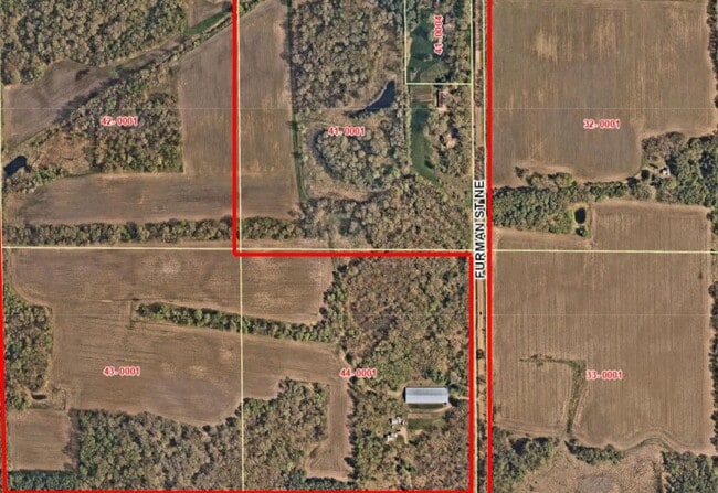
8129 165Th Ave Ne
10-32-22-44-0001
UNPLATTED COLUMBUS TWP NW1/4 OF SE1/4 10 32 22
Agriculturalland
Anoka
A
Minnesota
27003C0245E
40 AC
2025
Anoka County Outlying
2025
Minneapolis/St Paul
070103
Minneapolis-St. Paul-Bloomington, MN-WI
1,424 SF
DEMOGRAPHICS near 8129 165Th Ave Ne
1 Mile
3 Mile
5 Mile
2024 Total Population
657
5,832
23,786
2029 Population
710
6,400
26,601
Pop Growth 2024-2029
+ 8.07%
+ 9.74%
+ 11.83%
Average Age
44
41
40
2024 Total Households
249
2,218
9,340
HH Growth 2024-2029
+ 8.43%
+ 10.14%
+ 12.45%
Median Household Inc
$104,286
$98,355
$89,137
Avg Household Size
2.60
2.60
2.50
2024 Avg HH Vehicles
3.00
2.00
2.00
Median Home Value
$376,499
$430,983
$403,979
Median Year Built
1978
1994
1993
Nearby Places
Map Layers
Map Styles
 Street
 Aerial
- Restaurants
- Banks
- Shops
- Fitness
- Groceries
PUBLIC TRANSPORTATION
AIRPORT
Minneapolis-St Paul International/Wold-Chamberlain
DRIVE
WALK
Distance
Minneapolis-St Paul International/Wold-Chamberlain
51 min
36.2 mi
Freight Ports
Port Milwaukee
DRIVE
WALK
Distance
Port Milwaukee
392 min
352.6 mi
Nearby Properties
Address
Land Use
TOTAL SIZE
Lot Size
Zoning
Address
Land Use
TOTAL SIZE
Lot Size
Zoning
56,512 SF
18.60 AC
Address
Land Use
TOTAL SIZE
Lot Size
Zoning
183,622 SF
20.24 AC
Address
Land Use
TOTAL SIZE
Lot Size
Zoning
103,200 SF
13.20 AC
Address
Land Use
TOTAL SIZE
Lot Size
Zoning
71,450 SF
Address
Land Use
TOTAL SIZE
Lot Size
Zoning
68,008 SF
Address
Land Use
TOTAL SIZE
Lot Size
Zoning
50,304 SF
29.31 AC
Address
Land Use
TOTAL SIZE
Lot Size
Zoning
74,178 SF
5.02 AC
Address
Land Use
TOTAL SIZE
Lot Size
Zoning
81,248 SF
1.07 AC
Address
Land Use
TOTAL SIZE
Lot Size
Zoning
69,020 SF
10.20 AC
Address
Land Use
TOTAL SIZE
Lot Size
Zoning
95,384 SF
13.40 AC
Address
Land Use
TOTAL SIZE
Lot Size
Zoning
45,087 SF
0.85 AC
Address
Land Use
TOTAL SIZE
Lot Size
Zoning
45,087 SF
0.80 AC
Address
Land Use
TOTAL SIZE
Lot Size
Zoning
15,850 SF
23.79 AC
Address
Land Use
TOTAL SIZE
Lot Size
Zoning
45,576 SF
Address
Land Use
TOTAL SIZE
Lot Size
Zoning
69,290 SF
7.68 AC
Address
Land Use
TOTAL SIZE
Lot Size
Zoning
3,600 SF
67.80 AC
Address
Land Use
TOTAL SIZE
Lot Size
Zoning
25,763 SF
2.73 AC
Address
Land Use
TOTAL SIZE
Lot Size
Zoning
93,168 SF
9.43 AC
Address
Land Use
TOTAL SIZE
Lot Size
Zoning
47,774 SF
2.72 AC
Address
Land Use
TOTAL SIZE
Lot Size
Zoning
68,623 SF
20 AC
Address
Land Use
TOTAL SIZE
Lot Size
Zoning
55,237 SF
Address
Land Use
TOTAL SIZE
Lot Size
Zoning
764 SF
4.10 AC
Address
Land Use
TOTAL SIZE
Lot Size
Zoning
10,424 SF
Address
Land Use
TOTAL SIZE
Lot Size
Zoning
32,945 SF
2.02 AC
Address
Land Use
TOTAL SIZE
Lot Size
Zoning
30,846 SF
2.95 AC
Address
Land Use
TOTAL SIZE
Lot Size
Zoning
39,330 SF
4.64 AC
Address
Land Use
TOTAL SIZE
Lot Size
Zoning
47,638 SF
3.03 AC
Address
Land Use
TOTAL SIZE
Lot Size
Zoning
21,748 SF
27.40 AC
Address
Land Use
TOTAL SIZE
Lot Size
Zoning
34,885 SF
3.57 AC
Address
Land Use
TOTAL SIZE
Lot Size
Zoning
20,866 SF
2.40 AC
The World's #1 Commercial Real Estate Marketplace
Connect with us
© 2025 CoStar Group
The information above has been obtained from sources believed reliable. While we do not doubt its accuracy we have not verified it and make no guarantee, warranty or representation about it. It is your responsibility to independently confirm its accuracy and completeness. Any projections, opinions, assumptions, or estimates used are for example only and do not represent the current or future performance of the property. The value of this transaction to you depends on tax and other factors which should be evaluated by your tax, financial, and legal advisors. You and your advisors should conduct a careful, independent investigation of the property to determine to your satisfaction the suitability of the property for your needs.