Property Record
81291 Avenue 42, Indio, CA 92203
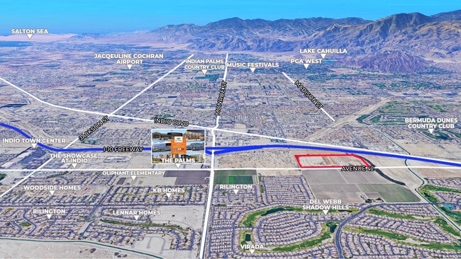


NEARBY LISTINGS FOR SALE OR LEASE
Property Detail
81291 Avenue 42
Riverside-San Bernardino-Ontario, CA
Coachella Land & Water Co Sub
610-020-001
61.00 ACRES M/L IN POR LOTS 1 & 2 MB 006/024 COACHELLA LAND & WATER CO SUB
Commercialacreage
Riverside
X
California
06065C2251H
2
2024
61 AC
2025
Coachella Valley
045216
Inland Empire (California)
DEMOGRAPHICS near 81291 Avenue 42
1 Mile
3 Mile
5 Mile
2024 Total Population
7,726
87,824
166,868
2029 Population
8,283
93,115
179,586
Pop Growth 2024-2029
+ 7.21%
+ 6.02%
+ 7.62%
Average Age
46
39
43
2024 Total Households
2,903
28,531
60,788
HH Growth 2024-2029
+ 7.10%
+ 5.88%
+ 7.99%
Median Household Inc
$74,789
$67,002
$69,670
Avg Household Size
2.60
2.90
2.60
2024 Avg HH Vehicles
2.00
2.00
2.00
Median Home Value
$410,102
$404,282
$458,985
Median Year Built
2003
1995
1996
Nearby Places
Map Layers
Map Styles
 Street
 Aerial
- Restaurants
- Banks
- Shops
- Fitness
- Groceries
PUBLIC TRANSPORTATION
AIRPORT
Palm Springs International
DRIVE
WALK
Distance
Palm Springs International
25 min
18.9 mi
Freight Ports
Port of San Diego
DRIVE
WALK
Distance
Port of San Diego
170 min
143.1 mi
SALE & LEASE HISTORY
LISTING DATE
SALE/LEASE

Jan 28, 2020
For Sale
Feb 02, 2018
For Sale
Aug 16, 2018
For Sale
Nearby Properties
Address
Land Use
TOTAL SIZE
Lot Size
Zoning
Address
Land Use
TOTAL SIZE
Lot Size
Zoning
73,832 SF
7.71 AC
Address
Land Use
TOTAL SIZE
Lot Size
Zoning
128,503 SF
6.25 AC
R3
Address
Land Use
TOTAL SIZE
Lot Size
Zoning
139,456 SF
8.02 AC
R-3
Address
Land Use
TOTAL SIZE
Lot Size
Zoning
189,101 SF
8.98 AC
C1
Address
Land Use
TOTAL SIZE
Lot Size
Zoning
55,072 SF
6.88 AC
C2
Address
Land Use
TOTAL SIZE
Lot Size
Zoning
171,910 SF
14.89 AC
C1
Address
Land Use
TOTAL SIZE
Lot Size
Zoning
197,244 SF
20.44 AC
Address
Land Use
TOTAL SIZE
Lot Size
Zoning
55,695 SF
10.60 AC
C1
Address
Land Use
TOTAL SIZE
Lot Size
Zoning
58,560 SF
3.01 AC
Address
Land Use
TOTAL SIZE
Lot Size
Zoning
81,004 SF
2.99 AC
Address
Land Use
TOTAL SIZE
Lot Size
Zoning
102,400 SF
6.98 AC
Address
Land Use
TOTAL SIZE
Lot Size
Zoning
39,776 SF
4.46 AC
C2
Address
Land Use
TOTAL SIZE
Lot Size
Zoning
38,644 SF
18.57 AC
Address
Land Use
TOTAL SIZE
Lot Size
Zoning
102,867 SF
11.10 AC
Address
Land Use
TOTAL SIZE
Lot Size
Zoning
35,760 SF
3.74 AC
Address
Land Use
TOTAL SIZE
Lot Size
Zoning
94,642 SF
10 AC
Address
Land Use
TOTAL SIZE
Lot Size
Zoning
59,420 SF
5.57 AC
Address
Land Use
TOTAL SIZE
Lot Size
Zoning
104,741 SF
5.80 AC
R1
Address
Land Use
TOTAL SIZE
Lot Size
Zoning
48,578 SF
7.88 AC
Address
Land Use
TOTAL SIZE
Lot Size
Zoning
67,787 SF
3.93 AC
R3
Address
Land Use
TOTAL SIZE
Lot Size
Zoning
53,250 SF
6.62 AC
Address
Land Use
TOTAL SIZE
Lot Size
Zoning
86,063 SF
4.11 AC
Address
Land Use
TOTAL SIZE
Lot Size
Zoning
114,716 SF
6.38 AC
Address
Land Use
TOTAL SIZE
Lot Size
Zoning
42,414 SF
1.43 AC
NC
Address
Land Use
TOTAL SIZE
Lot Size
Zoning
84,490 SF
4.20 AC
R3
Address
Land Use
TOTAL SIZE
Lot Size
Zoning
46,827 SF
3.23 AC
Address
Land Use
TOTAL SIZE
Lot Size
Zoning
185,793 SF
9.50 AC
RO
Address
Land Use
TOTAL SIZE
Lot Size
Zoning
93,200 SF
8.84 AC
RO
Address
Land Use
TOTAL SIZE
Lot Size
Zoning
38,083 SF
5.83 AC
C2
The World's #1 Commercial Real Estate Marketplace
Connect with us
© 2025 CoStar Group
The information above has been obtained from sources believed reliable. While we do not doubt its accuracy we have not verified it and make no guarantee, warranty or representation about it. It is your responsibility to independently confirm its accuracy and completeness. Any projections, opinions, assumptions, or estimates used are for example only and do not represent the current or future performance of the property. The value of this transaction to you depends on tax and other factors which should be evaluated by your tax, financial, and legal advisors. You and your advisors should conduct a careful, independent investigation of the property to determine to your satisfaction the suitability of the property for your needs.