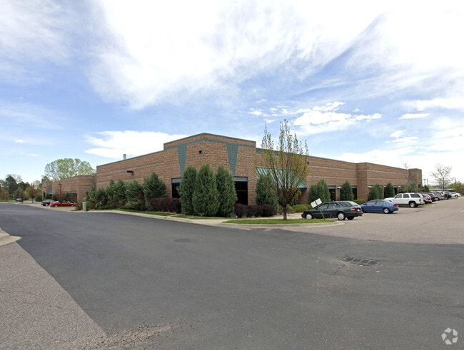
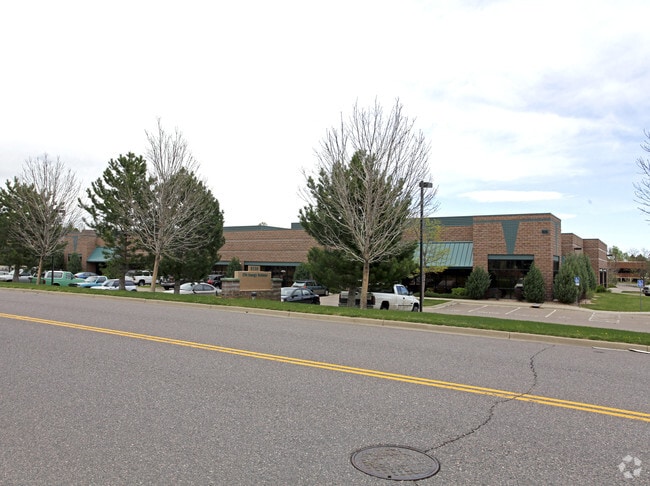
Property Record
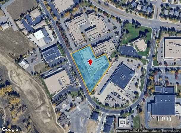
8130 Shaffer Pkwy, Littleton, CO 80127
NEARBY LISTINGS FOR SALE OR LEASE
Property Detail
8130 Shaffer Pkwy
Denver-Aurora-Centennial, CO
Ken-Caryl Business Center Phase 2
59-333-19-019
SECTION 33 TOWNSHIP 05 RANGE 69 QTR SW SUBDIVISIONCD 396437 SUBDIVISIONNAME KEN CARYL BUSINESS CENTER PH 2 AMD 1 EX SUR 4 BLOCK LOT 004B SIZE: 102668 TRACT VALUE: 2.357
Industrialgeneral
Jefferson
X
Colorado
08059C0384F
4b
2023
2.36 AC
2024
Southwest C-470
012024
Denver
27,128 SF
DEMOGRAPHICS near 8130 Shaffer Pkwy
1 Mile
3 Mile
5 Mile
2024 Total Population
6,679
58,568
122,952
2029 Population
6,622
57,511
121,384
Pop Growth 2024-2029
(0.85%)
(1.80%)
(1.28%)
Average Age
43
42
42
2024 Total Households
2,770
22,560
47,360
HH Growth 2024-2029
(0.72%)
(1.88%)
(1.33%)
Median Household Inc
$113,117
$114,888
$112,434
Avg Household Size
2.40
2.50
2.50
2024 Avg HH Vehicles
2.00
2.00
2.00
Median Home Value
$668,521
$581,713
$587,822
Median Year Built
1987
1987
1987
Nearby Places
Map Layers
Map Styles
 Street
 Aerial
- Restaurants
- Banks
- Shops
- Fitness
- Groceries
PUBLIC TRANSPORTATION
AIRPORT
Denver International
DRIVE
WALK
Distance
Denver International
55 min
48.5 mi
SALE & LEASE HISTORY
LISTING DATE
SALE/LEASE

Sep 25, 2016
For Lease
Sep 23, 2016
For Sale
Aug 26, 2024
For Lease
Nearby Properties
Address
Land Use
TOTAL SIZE
Lot Size
Zoning
Address
Land Use
TOTAL SIZE
Lot Size
Zoning
895,137 SF
124.99 AC
PD
Address
Land Use
TOTAL SIZE
Lot Size
Zoning
272,246 SF
31.76 AC
PD
Address
Land Use
TOTAL SIZE
Lot Size
Zoning
2,884.97 AC
A1
Address
Land Use
TOTAL SIZE
Lot Size
Zoning
214,066 SF
82.60 AC
PD
Address
Land Use
TOTAL SIZE
Lot Size
Zoning
392,710 SF
21.23 AC
PD
Address
Land Use
TOTAL SIZE
Lot Size
Zoning
150,951 SF
17.90 AC
PD
Address
Land Use
TOTAL SIZE
Lot Size
Zoning
101,699 SF
10.34 AC
Address
Land Use
TOTAL SIZE
Lot Size
Zoning
175,000 SF
36.25 AC
PD
Address
Land Use
TOTAL SIZE
Lot Size
Zoning
297,003 SF
26.77 AC
PD
Address
Land Use
TOTAL SIZE
Lot Size
Zoning
218,391 SF
9.73 AC
PD
Address
Land Use
TOTAL SIZE
Lot Size
Zoning
120,766 SF
20.56 AC
PD
Address
Land Use
TOTAL SIZE
Lot Size
Zoning
100,550 SF
7.72 AC
PD
Address
Land Use
TOTAL SIZE
Lot Size
Zoning
65,463 SF
4.80 AC
PD
Address
Land Use
TOTAL SIZE
Lot Size
Zoning
68,365 SF
12.17 AC
PD
Address
Land Use
TOTAL SIZE
Lot Size
Zoning
107,693 SF
9.17 AC
PD
Address
Land Use
TOTAL SIZE
Lot Size
Zoning
177,688 SF
8.45 AC
Address
Land Use
TOTAL SIZE
Lot Size
Zoning
71,791 SF
24.38 AC
PD
Address
Land Use
TOTAL SIZE
Lot Size
Zoning
12,367 SF
4.18 AC
Address
Land Use
TOTAL SIZE
Lot Size
Zoning
29,094 SF
11.33 AC
Address
Land Use
TOTAL SIZE
Lot Size
Zoning
59,816 SF
16.92 AC
Address
Land Use
TOTAL SIZE
Lot Size
Zoning
58,550 SF
9.67 AC
Address
Land Use
TOTAL SIZE
Lot Size
Zoning
105,392 SF
7.44 AC
Address
Land Use
TOTAL SIZE
Lot Size
Zoning
28,533 SF
11.07 AC
Address
Land Use
TOTAL SIZE
Lot Size
Zoning
71,091 SF
4.93 AC
PD
Address
Land Use
TOTAL SIZE
Lot Size
Zoning
82,765 SF
4.85 AC
PD
Address
Land Use
TOTAL SIZE
Lot Size
Zoning
104,984 SF
3.11 AC
Address
Land Use
TOTAL SIZE
Lot Size
Zoning
36,847 SF
3.02 AC
PD
Address
Land Use
TOTAL SIZE
Lot Size
Zoning
61,038 SF
8.19 AC
Address
Land Use
TOTAL SIZE
Lot Size
Zoning
40,129 SF
5.47 AC
Address
Land Use
TOTAL SIZE
Lot Size
Zoning
97,668 SF
5.90 AC
PD
The World's #1 Commercial Real Estate Marketplace
Connect with us
© 2026 CoStar Group
The information above has been obtained from sources believed reliable. While we do not doubt its accuracy we have not verified it and make no guarantee, warranty or representation about it. It is your responsibility to independently confirm its accuracy and completeness. Any projections, opinions, assumptions, or estimates used are for example only and do not represent the current or future performance of the property. The value of this transaction to you depends on tax and other factors which should be evaluated by your tax, financial, and legal advisors. You and your advisors should conduct a careful, independent investigation of the property to determine to your satisfaction the suitability of the property for your needs.