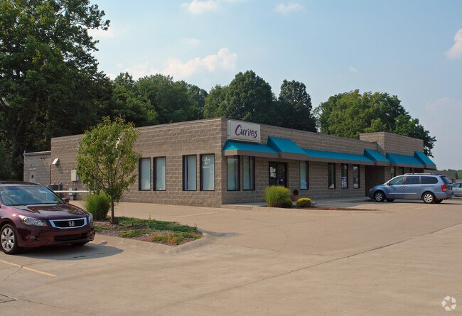
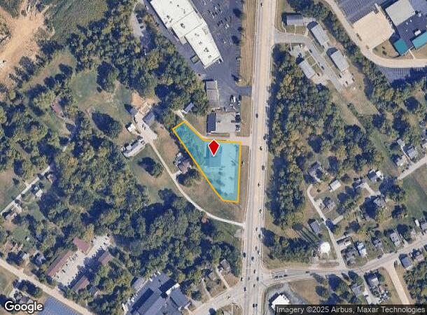
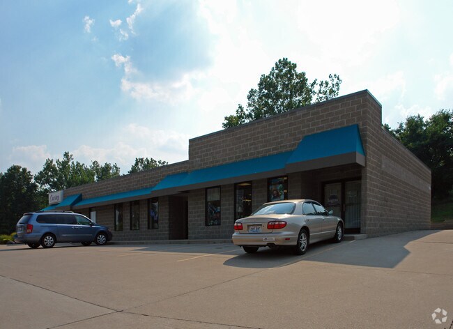
Property Record
8131 Alexandria Pike, Alexandria, KY 41001
NEARBY LISTINGS FOR SALE OR LEASE
Property Detail
8131 Alexandria Pike
999-99-25-419.00
1.0951 ACRES
Commercialnec
Campbell
X
Kentucky
21037C0084E
1.10 AC
2024
Outlying N Kentucky
2025
Cincinnati/Dayton
051903
Cincinnati, OH-KY-IN
4,465 SF
DEMOGRAPHICS near 8131 Alexandria Pike
1 Mile
3 Mile
5 Mile
2024 Total Population
3,772
15,488
28,948
2029 Population
3,860
15,697
29,117
Pop Growth 2024-2029
+ 2.33%
+ 1.35%
+ 0.58%
Average Age
41
41
42
2024 Total Households
1,408
5,643
10,952
HH Growth 2024-2029
+ 2.49%
+ 1.40%
+ 0.52%
Median Household Inc
$99,464
$95,348
$89,528
Avg Household Size
2.70
2.70
2.60
2024 Avg HH Vehicles
2.00
2.00
2.00
Median Home Value
$254,184
$251,011
$248,707
Median Year Built
1994
1991
1990
Nearby Places
Map Layers
Map Styles
 Street
 Aerial
- Restaurants
- Banks
- Shops
- Fitness
- Groceries
PUBLIC TRANSPORTATION
AIRPORT
Cincinnati/Northern Kentucky International
DRIVE
WALK
Distance
Cincinnati/Northern Kentucky International
33 min
19.9 mi
Nearby Properties
Address
Land Use
TOTAL SIZE
Lot Size
Zoning
Address
Land Use
TOTAL SIZE
Lot Size
Zoning
336,060 SF
61.32 AC
Address
Land Use
TOTAL SIZE
Lot Size
Zoning
54.90 AC
Address
Land Use
TOTAL SIZE
Lot Size
Zoning
42,855 SF
9.07 AC
Address
Land Use
TOTAL SIZE
Lot Size
Zoning
207,606 SF
24.33 AC
Address
Land Use
TOTAL SIZE
Lot Size
Zoning
137,878 SF
14.55 AC
Address
Land Use
TOTAL SIZE
Lot Size
Zoning
211,091 SF
28.29 AC
Address
Land Use
TOTAL SIZE
Lot Size
Zoning
1,500 SF
21.25 AC
Address
Land Use
TOTAL SIZE
Lot Size
Zoning
83,680 SF
26.71 AC
Address
Land Use
TOTAL SIZE
Lot Size
Zoning
5,142 SF
55.57 AC
Address
Land Use
TOTAL SIZE
Lot Size
Zoning
82,000 SF
4.60 AC
Address
Land Use
TOTAL SIZE
Lot Size
Zoning
4,331 SF
7.27 AC
Address
Land Use
TOTAL SIZE
Lot Size
Zoning
0.78 AC
Address
Land Use
TOTAL SIZE
Lot Size
Zoning
15,095 SF
1.20 AC
Address
Land Use
TOTAL SIZE
Lot Size
Zoning
Address
Land Use
TOTAL SIZE
Lot Size
Zoning
44,788 SF
9.42 AC
Address
Land Use
TOTAL SIZE
Lot Size
Zoning
21,788 SF
13.41 AC
Address
Land Use
TOTAL SIZE
Lot Size
Zoning
12,148 SF
0.43 AC
Address
Land Use
TOTAL SIZE
Lot Size
Zoning
22,740 SF
10.36 AC
Address
Land Use
TOTAL SIZE
Lot Size
Zoning
40.01 AC
Address
Land Use
TOTAL SIZE
Lot Size
Zoning
39,434 SF
5.46 AC
Address
Land Use
TOTAL SIZE
Lot Size
Zoning
Address
Land Use
TOTAL SIZE
Lot Size
Zoning
10.05 AC
Address
Land Use
TOTAL SIZE
Lot Size
Zoning
844 SF
25.46 AC
Address
Land Use
TOTAL SIZE
Lot Size
Zoning
5,200 SF
2.20 AC
Address
Land Use
TOTAL SIZE
Lot Size
Zoning
9,100 SF
2.03 AC
Address
Land Use
TOTAL SIZE
Lot Size
Zoning
676 SF
84.05 AC
Address
Land Use
TOTAL SIZE
Lot Size
Zoning
1,500 SF
0.99 AC
Address
Land Use
TOTAL SIZE
Lot Size
Zoning
10,098 SF
2.36 AC
Address
Land Use
TOTAL SIZE
Lot Size
Zoning
3.46 AC
Address
Land Use
TOTAL SIZE
Lot Size
Zoning
6,000 SF
1.07 AC
The World's #1 Commercial Real Estate Marketplace
Connect with us
© 2025 CoStar Group
The information above has been obtained from sources believed reliable. While we do not doubt its accuracy we have not verified it and make no guarantee, warranty or representation about it. It is your responsibility to independently confirm its accuracy and completeness. Any projections, opinions, assumptions, or estimates used are for example only and do not represent the current or future performance of the property. The value of this transaction to you depends on tax and other factors which should be evaluated by your tax, financial, and legal advisors. You and your advisors should conduct a careful, independent investigation of the property to determine to your satisfaction the suitability of the property for your needs.