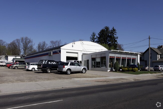
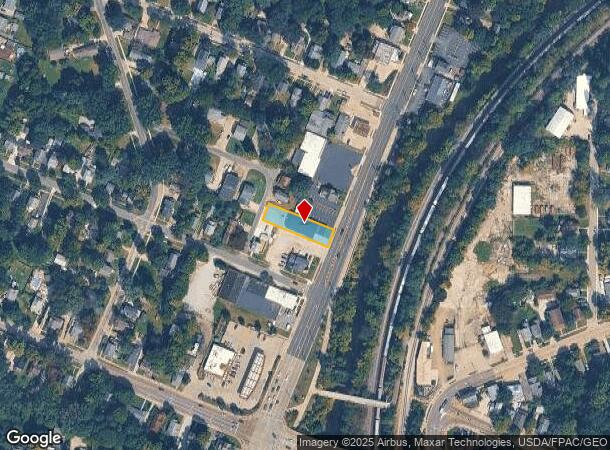
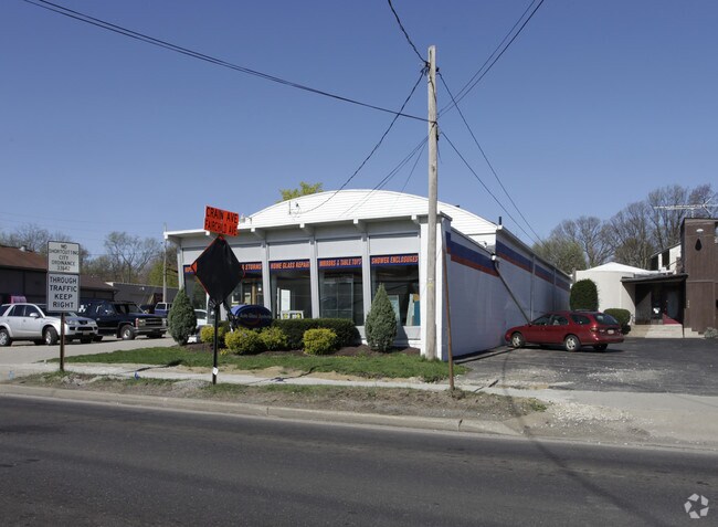
Property Record
814 N Mantua St, Kent, OH 44240
NEARBY LISTINGS FOR SALE OR LEASE
-
-
View all Kent listings for sale on LoopNet.com
Property Detail
814 N Mantua St
Cleveland
North Mantua Street 36
Akron, OH
LOT 30 SD-36 DEFICIENT LEGAL 2010
17-030-20-00-180-000
Portage
Autorepair
Ohio
2024
30
2024
0.25 AC
601300
Portage County
4,878 SF
DEMOGRAPHICS near 814 N Mantua St
1 Mile
3 Mile
5 Mile
2024 Total Population
8,567
41,996
90,509
2029 Population
8,729
42,460
90,987
Pop Growth 2024-2029
+ 1.89%
+ 1.10%
+ 0.53%
Average Age
37
36
39
2024 Total Households
3,885
17,056
37,097
HH Growth 2024-2029
+ 1.80%
+ 1.37%
+ 0.65%
Median Household Inc
$45,882
$49,628
$67,218
Avg Household Size
2.10
2.10
2.20
2024 Avg HH Vehicles
2.00
2.00
2.00
Median Home Value
$222,943
$222,504
$208,596
Median Year Built
1961
1973
1976
Nearby Places
Map Layers
Map Styles
 Street
 Aerial
- Restaurants
- Banks
- Shops
- Fitness
- Groceries
PUBLIC TRANSPORTATION
AIRPORT
Akron-Canton Regional
DRIVE
WALK
Distance
Akron-Canton Regional
35 min
24.4 mi
Cleveland-Hopkins International
DRIVE
WALK
Distance
Cleveland-Hopkins International
61 min
40.9 mi
Nearby Properties
Address
Land Use
TOTAL SIZE
Lot Size
Zoning
Address
Land Use
TOTAL SIZE
Lot Size
Zoning
871,059 SF
404.65 AC
Address
Land Use
TOTAL SIZE
Lot Size
Zoning
342,850 SF
86.98 AC
Address
Land Use
TOTAL SIZE
Lot Size
Zoning
139,790 SF
102.12 AC
Address
Land Use
TOTAL SIZE
Lot Size
Zoning
183,977 SF
10.12 AC
Address
Land Use
TOTAL SIZE
Lot Size
Zoning
86,411 SF
0.23 AC
Address
Land Use
TOTAL SIZE
Lot Size
Zoning
77,663 SF
83.47 AC
Address
Land Use
TOTAL SIZE
Lot Size
Zoning
173,811 SF
9.34 AC
Address
Land Use
TOTAL SIZE
Lot Size
Zoning
61,748 SF
17.12 AC
Address
Land Use
TOTAL SIZE
Lot Size
Zoning
57,908 SF
6.36 AC
Address
Land Use
TOTAL SIZE
Lot Size
Zoning
57,455 SF
28.81 AC
Address
Land Use
TOTAL SIZE
Lot Size
Zoning
141,562 SF
1.63 AC
Address
Land Use
TOTAL SIZE
Lot Size
Zoning
150,616 SF
12.63 AC
Address
Land Use
TOTAL SIZE
Lot Size
Zoning
213,347 SF
30.75 AC
Address
Land Use
TOTAL SIZE
Lot Size
Zoning
146,435 SF
59.76 AC
Address
Land Use
TOTAL SIZE
Lot Size
Zoning
278,319 SF
34.50 AC
Address
Land Use
TOTAL SIZE
Lot Size
Zoning
179,055 SF
19.68 AC
Address
Land Use
TOTAL SIZE
Lot Size
Zoning
8.12 AC
Address
Land Use
TOTAL SIZE
Lot Size
Zoning
28,438 SF
9 AC
Address
Land Use
TOTAL SIZE
Lot Size
Zoning
310,705 SF
9.96 AC
Address
Land Use
TOTAL SIZE
Lot Size
Zoning
216,994 SF
10.94 AC
Address
Land Use
TOTAL SIZE
Lot Size
Zoning
52,575 SF
1.33 AC
Address
Land Use
TOTAL SIZE
Lot Size
Zoning
89,449 SF
14.59 AC
Address
Land Use
TOTAL SIZE
Lot Size
Zoning
34,394 SF
3.59 AC
Address
Land Use
TOTAL SIZE
Lot Size
Zoning
78,446 SF
18.02 AC
Address
Land Use
TOTAL SIZE
Lot Size
Zoning
176,320 SF
1.73 AC
Address
Land Use
TOTAL SIZE
Lot Size
Zoning
33,561 SF
2.62 AC
Address
Land Use
TOTAL SIZE
Lot Size
Zoning
67,107 SF
9.29 AC
Address
Land Use
TOTAL SIZE
Lot Size
Zoning
63,288 SF
0.88 AC
Address
Land Use
TOTAL SIZE
Lot Size
Zoning
73,306 SF
0.78 AC
Address
Land Use
TOTAL SIZE
Lot Size
Zoning
24,210 SF
2.34 AC
The World's #1 Commercial Real Estate Marketplace
Connect with us
© 2025 CoStar Group
The information above has been obtained from sources believed reliable. While we do not doubt its accuracy we have not verified it and make no guarantee, warranty or representation about it. It is your responsibility to independently confirm its accuracy and completeness. Any projections, opinions, assumptions, or estimates used are for example only and do not represent the current or future performance of the property. The value of this transaction to you depends on tax and other factors which should be evaluated by your tax, financial, and legal advisors. You and your advisors should conduct a careful, independent investigation of the property to determine to your satisfaction the suitability of the property for your needs.