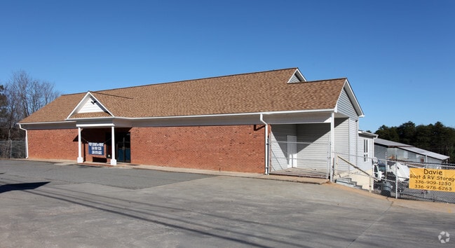
Property Record
814 S Main St, Mocksville, NC 27028
NEARBY LISTINGS FOR SALE OR LEASE
Property Detail
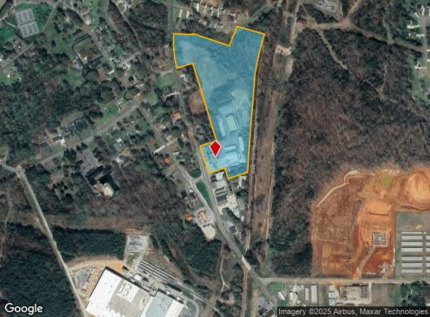
814 S Main St
J4-120-C0-008
Clement Crest Subdivision
Warehouse
5.361 AC S MAIN ST CLEMENT CREST
X
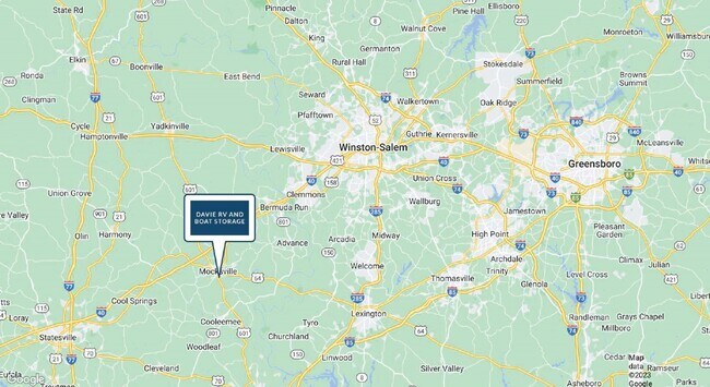
Davie
3710573700J
North Carolina
2025
14.14 AC
2025
Davie County
080500
Greensboro/Winston-Salem
9,600 SF
Winston-Salem, NC
DEMOGRAPHICS near 814 S Main St
1 Mile
3 Mile
5 Mile
2024 Total Population
2,099
10,192
17,841
2029 Population
2,295
11,144
19,479
Pop Growth 2024-2029
+ 9.34%
+ 9.34%
+ 9.18%
Average Age
41
41
41
2024 Total Households
817
4,001
6,989
HH Growth 2024-2029
+ 8.94%
+ 9.02%
+ 8.89%
Median Household Inc
$58,859
$57,548
$58,249
Avg Household Size
2.50
2.50
2.50
2024 Avg HH Vehicles
2.00
2.00
2.00
Median Home Value
$221,052
$192,652
$185,800
Median Year Built
1988
1987
1984
Nearby Places
Map Layers
Map Styles
 Street
 Aerial
- Restaurants
- Banks
- Shops
- Fitness
- Groceries
SALE & LEASE HISTORY
LISTING DATE
SALE/LEASE

Jan 01, 2024
For Sale
Nearby Properties
Address
Land Use
TOTAL SIZE
Lot Size
Zoning
Address
Land Use
TOTAL SIZE
Lot Size
Zoning
50,164 SF
118.49 AC
TC
Address
Land Use
TOTAL SIZE
Lot Size
Zoning
30,970 SF
71.88 AC
TC
Address
Land Use
TOTAL SIZE
Lot Size
Zoning
151,423 SF
93.36 AC
TC
Address
Land Use
TOTAL SIZE
Lot Size
Zoning
19,708 SF
44.50 AC
CI
Address
Land Use
TOTAL SIZE
Lot Size
Zoning
136,000 SF
18.79 AC
TC
Address
Land Use
TOTAL SIZE
Lot Size
Zoning
55,920 SF
41.96 AC
Address
Land Use
TOTAL SIZE
Lot Size
Zoning
235,064 SF
27.27 AC
TC
Address
Land Use
TOTAL SIZE
Lot Size
Zoning
130,655 SF
17.73 AC
HB
Address
Land Use
TOTAL SIZE
Lot Size
Zoning
37,437 SF
3.24 AC
TC
Address
Land Use
TOTAL SIZE
Lot Size
Zoning
109,337 SF
6.01 AC
TC
Address
Land Use
TOTAL SIZE
Lot Size
Zoning
6,560 SF
49.38 AC
Address
Land Use
TOTAL SIZE
Lot Size
Zoning
26,000 SF
28.21 AC
CI
Address
Land Use
TOTAL SIZE
Lot Size
Zoning
99,281 SF
25.44 AC
TC
Address
Land Use
TOTAL SIZE
Lot Size
Zoning
76,806 SF
60.98 AC
HC
Address
Land Use
TOTAL SIZE
Lot Size
Zoning
233,076 SF
10.25 AC
TC
Address
Land Use
TOTAL SIZE
Lot Size
Zoning
29,427 SF
4.60 AC
NR
Address
Land Use
TOTAL SIZE
Lot Size
Zoning
2,194 SF
8.96 AC
TND
Address
Land Use
TOTAL SIZE
Lot Size
Zoning
33,020 SF
5.05 AC
Address
Land Use
TOTAL SIZE
Lot Size
Zoning
5,760 SF
15.25 AC
NR
Address
Land Use
TOTAL SIZE
Lot Size
Zoning
62,800 SF
21.61 AC
CI
Address
Land Use
TOTAL SIZE
Lot Size
Zoning
394,265 SF
46.94 AC
TC
Address
Land Use
TOTAL SIZE
Lot Size
Zoning
9,050 SF
16.33 AC
NR
Address
Land Use
TOTAL SIZE
Lot Size
Zoning
168,820 SF
30.67 AC
CB
Address
Land Use
TOTAL SIZE
Lot Size
Zoning
171,794 SF
16.08 AC
Address
Land Use
TOTAL SIZE
Lot Size
Zoning
25,966 SF
0.55 AC
TC
Address
Land Use
TOTAL SIZE
Lot Size
Zoning
49,836 SF
8.97 AC
HC
Address
Land Use
TOTAL SIZE
Lot Size
Zoning
106,920 SF
6.85 AC
TC
Address
Land Use
TOTAL SIZE
Lot Size
Zoning
105,712 SF
12.03 AC
R20
Address
Land Use
TOTAL SIZE
Lot Size
Zoning
35,145 SF
11.54 AC
CI
Address
Land Use
TOTAL SIZE
Lot Size
Zoning
68,700 SF
14.98 AC
The World's #1 Commercial Real Estate Marketplace
Connect with us
© 2026 CoStar Group
The information above has been obtained from sources believed reliable. While we do not doubt its accuracy we have not verified it and make no guarantee, warranty or representation about it. It is your responsibility to independently confirm its accuracy and completeness. Any projections, opinions, assumptions, or estimates used are for example only and do not represent the current or future performance of the property. The value of this transaction to you depends on tax and other factors which should be evaluated by your tax, financial, and legal advisors. You and your advisors should conduct a careful, independent investigation of the property to determine to your satisfaction the suitability of the property for your needs.