Property Record
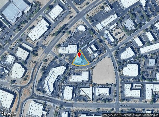
8140 E Butherus Dr, Scottsdale, AZ 85260

Current Lease Availabilities
NEARBY LISTINGS FOR SALE OR LEASE
Property Detail
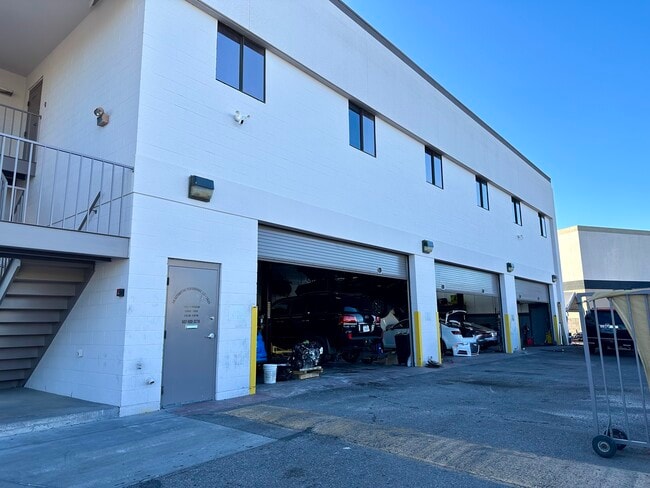
8140 E Butherus Dr
Phoenix-Mesa-Scottsdale, AZ
Scottspark Business Center Unit 1
215-55-014A
SCOTTSPARK BUSINESS CENTER UNIT 1 MCR 232-07
Vehiclerentalsvehiclesales
Maricopa
X
Arizona
04013C1760L
12
2025
0.54 AC
2025
North Scottsdale
216816
Phoenix
3,936 SF
DEMOGRAPHICS near 8140 E Butherus Dr
1 Mile
3 Mile
5 Mile
2024 Total Population
2,850
80,945
191,432
2029 Population
3,207
88,885
209,572
Pop Growth 2024-2029
+ 12.53%
+ 9.81%
+ 9.48%
Average Age
42
44
44
2024 Total Households
1,174
37,075
85,752
HH Growth 2024-2029
+ 12.69%
+ 10.16%
+ 9.76%
Median Household Inc
$150,497
$108,848
$109,589
Avg Household Size
2.30
2.10
2.20
2024 Avg HH Vehicles
2.00
2.00
2.00
Median Home Value
$877,934
$652,912
$690,125
Median Year Built
1993
1994
1991
Nearby Places
- Restaurants
- Banks
- Shops
- Fitness
- Groceries
PUBLIC TRANSPORTATION
AIRPORT
Phoenix Sky Harbor International
DRIVE
WALK
Distance
Phoenix Sky Harbor International
30 min
20.7 mi
Phoenix-Mesa Gateway
DRIVE
WALK
Distance
Phoenix-Mesa Gateway
50 min
36.1 mi
Nearby Properties
Address
Land Use
TOTAL SIZE
Lot Size
Zoning
Address
Land Use
TOTAL SIZE
Lot Size
Zoning
35.76 AC
R1-18
Address
Land Use
TOTAL SIZE
Lot Size
Zoning
1,293,284 SF
14.50 AC
C-R
Address
Land Use
TOTAL SIZE
Lot Size
Zoning
1,479,005 SF
12.55 AC
PC
Address
Land Use
TOTAL SIZE
Lot Size
Zoning
3.15 AC
I-P
Address
Land Use
TOTAL SIZE
Lot Size
Zoning
667,688 SF
277.21 AC
Address
Land Use
TOTAL SIZE
Lot Size
Zoning
694,644 SF
34.41 AC
C-C
Address
Land Use
TOTAL SIZE
Lot Size
Zoning
794,304 SF
14.59 AC
WTP
Address
Land Use
TOTAL SIZE
Lot Size
Zoning
6.71 AC
PAD
Address
Land Use
TOTAL SIZE
Lot Size
Zoning
762,044 SF
16.66 AC
I1
Address
Land Use
TOTAL SIZE
Lot Size
Zoning
7,803 SF
2.31 AC
I-P
Address
Land Use
TOTAL SIZE
Lot Size
Zoning
368,657 SF
40.11 AC
Address
Land Use
TOTAL SIZE
Lot Size
Zoning
514,088 SF
6.70 AC
PAD
Address
Land Use
TOTAL SIZE
Lot Size
Zoning
533,288 SF
18.61 AC
I-P
Address
Land Use
TOTAL SIZE
Lot Size
Zoning
428,891 SF
6.48 AC
PAD
Address
Land Use
TOTAL SIZE
Lot Size
Zoning
707,542 SF
28.49 AC
R-3A
Address
Land Use
TOTAL SIZE
Lot Size
Zoning
421,002 SF
23.48 AC
Address
Land Use
TOTAL SIZE
Lot Size
Zoning
824,672 SF
11.52 AC
Address
Land Use
TOTAL SIZE
Lot Size
Zoning
487,786 SF
18.42 AC
S1
Address
Land Use
TOTAL SIZE
Lot Size
Zoning
884,258 SF
30.63 AC
PCD
Address
Land Use
TOTAL SIZE
Lot Size
Zoning
90.73 AC
O-S
Address
Land Use
TOTAL SIZE
Lot Size
Zoning
497,704 SF
6.77 AC
Address
Land Use
TOTAL SIZE
Lot Size
Zoning
9,232 SF
4.07 AC
R-35
Address
Land Use
TOTAL SIZE
Lot Size
Zoning
355,757 SF
32.44 AC
C-R
Address
Land Use
TOTAL SIZE
Lot Size
Zoning
337,668 SF
8.14 AC
PAD
Address
Land Use
TOTAL SIZE
Lot Size
Zoning
539,135 SF
15.11 AC
R3A
Address
Land Use
TOTAL SIZE
Lot Size
Zoning
417,831 SF
2.68 AC
C-R
Address
Land Use
TOTAL SIZE
Lot Size
Zoning
542,795 SF
5.56 AC
PCP
Address
Land Use
TOTAL SIZE
Lot Size
Zoning
530,588 SF
20.58 AC
C-C
Address
Land Use
TOTAL SIZE
Lot Size
Zoning
494,970 SF
4.90 AC
PUD
Address
Land Use
TOTAL SIZE
Lot Size
Zoning
495,877 SF
21.08 AC
C-C
The World's #1 Commercial Real Estate Marketplace
Connect with us
© 2025 CoStar Group
The information above has been obtained from sources believed reliable. While we do not doubt its accuracy we have not verified it and make no guarantee, warranty or representation about it. It is your responsibility to independently confirm its accuracy and completeness. Any projections, opinions, assumptions, or estimates used are for example only and do not represent the current or future performance of the property. The value of this transaction to you depends on tax and other factors which should be evaluated by your tax, financial, and legal advisors. You and your advisors should conduct a careful, independent investigation of the property to determine to your satisfaction the suitability of the property for your needs.