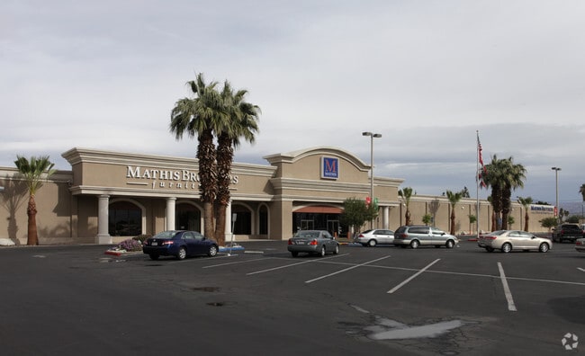
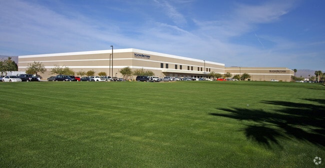
Property Record
81410 Us Highway 111, Indio, CA 92201


Property Detail
81410 Us Highway 111
616-090-010
14.89 ACRES M/L IN PARS 3 & 4 PM 001/011
Storebuilding
Riverside
C1
California
B and X Area of moderate flood hazard, usually the area between the limits of the 100-year and 500-year floods.
14.89 AC
2024
Coachella Valley
2025
Inland Empire (California)
045207
Riverside-San Bernardino-Ontario, CA
171,910 SF
NEARBY LISTINGS FOR SALE OR LEASE
DEMOGRAPHICS near 81410 Us Highway 111
1 mile
3 mile
5 mile
2025 Total Population
21,918
101,569
199,645
2030 Population
22,372
105,335
209,622
Pop Growth 2025-2030
+ 2.07%
+ 3.71%
+ 5.00%
Average Age
37
40
41
2025 Total Households
6,987
32,843
68,469
HH Growth 2025-2030
+ 1.70%
+ 4.00%
+ 5.59%
Median Household Inc
$65,622
$81,595
$84,315
Avg Household Size
3.00
3.00
2.80
2025 Avg HH Vehicles
2.00
2.00
2.00
Median Home Value
$422,483
$532,861
$585,653
Median Year Built
1987
1995
1996
Nearby Places
Map Layers
Map Styles
 Street
 Aerial
Layers
 Traffic
 Biking
Places
Listings with unknown addresses are not visible on the map
- Restaurants
- Banks
- Shops
- Fitness
- Groceries
PUBLIC TRANSPORTATION
AIRPORT
Palm Springs International
Drive
Walk
Distance
Palm Springs International
30 min
22.1 mi
Nearby Properties
Address
Land Use
TOTAL SIZE
Lot Size
Zoning
Address
Land Use
TOTAL SIZE
Lot Size
Zoning
21,992 SF
16.71 AC
Address
Land Use
TOTAL SIZE
Lot Size
Zoning
162,192 SF
15.42 AC
Address
Land Use
TOTAL SIZE
Lot Size
Zoning
73,832 SF
7.71 AC
Address
Land Use
TOTAL SIZE
Lot Size
Zoning
233,006 SF
19.12 AC
Address
Land Use
TOTAL SIZE
Lot Size
Zoning
92,591 SF
4.56 AC
Address
Land Use
TOTAL SIZE
Lot Size
Zoning
128,503 SF
6.25 AC
R3
Address
Land Use
TOTAL SIZE
Lot Size
Zoning
229,800 SF
3.89 AC
Address
Land Use
TOTAL SIZE
Lot Size
Zoning
13.85 AC
Address
Land Use
TOTAL SIZE
Lot Size
Zoning
182,439 SF
10.76 AC
A110
Address
Land Use
TOTAL SIZE
Lot Size
Zoning
123,134 SF
6.61 AC
RM
Address
Land Use
TOTAL SIZE
Lot Size
Zoning
189,101 SF
8.98 AC
C1
Address
Land Use
TOTAL SIZE
Lot Size
Zoning
55,072 SF
6.88 AC
C2
Address
Land Use
TOTAL SIZE
Lot Size
Zoning
170,272 SF
16.28 AC
Address
Land Use
TOTAL SIZE
Lot Size
Zoning
42,000 SF
3.20 AC
CR
Address
Land Use
TOTAL SIZE
Lot Size
Zoning
144,647 SF
16.60 AC
Address
Land Use
TOTAL SIZE
Lot Size
Zoning
197,244 SF
20.44 AC
Address
Land Use
TOTAL SIZE
Lot Size
Zoning
83,753 SF
2.77 AC
RM
Address
Land Use
TOTAL SIZE
Lot Size
Zoning
55,695 SF
10.60 AC
C1
Address
Land Use
TOTAL SIZE
Lot Size
Zoning
58,560 SF
3.01 AC
Address
Land Use
TOTAL SIZE
Lot Size
Zoning
81,004 SF
2.99 AC
Address
Land Use
TOTAL SIZE
Lot Size
Zoning
99,301 SF
Address
Land Use
TOTAL SIZE
Lot Size
Zoning
47,305 SF
7.24 AC
RC
Address
Land Use
TOTAL SIZE
Lot Size
Zoning
52,971 SF
7.29 AC
Address
Land Use
TOTAL SIZE
Lot Size
Zoning
162,335 SF
13.66 AC
Address
Land Use
TOTAL SIZE
Lot Size
Zoning
2,841 SF
7.51 AC
A1
Address
Land Use
TOTAL SIZE
Lot Size
Zoning
103,618 SF
10.51 AC
Address
Land Use
TOTAL SIZE
Lot Size
Zoning
102,400 SF
6.98 AC
Address
Land Use
TOTAL SIZE
Lot Size
Zoning
Address
Land Use
TOTAL SIZE
Lot Size
Zoning
124,313 SF
11 AC
The World's #1 Commercial Real Estate Marketplace
Connect with us
© 2026 CoStar Group
The information above has been obtained from sources believed reliable. While we do not doubt its accuracy we have not verified it and make no guarantee, warranty or representation about it. It is your responsibility to independently confirm its accuracy and completeness. Any projections, opinions, assumptions, or estimates used are for example only and do not represent the current or future performance of the property. The value of this transaction to you depends on tax and other factors which should be evaluated by your tax, financial, and legal advisors. You and your advisors should conduct a careful, independent investigation of the property to determine to your satisfaction the suitability of the property for your needs.