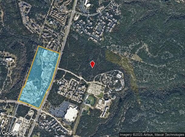
Property Record
8142 N Ranch Rd 620 Rd, Austin, TX 78726
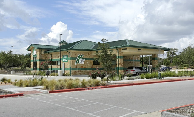
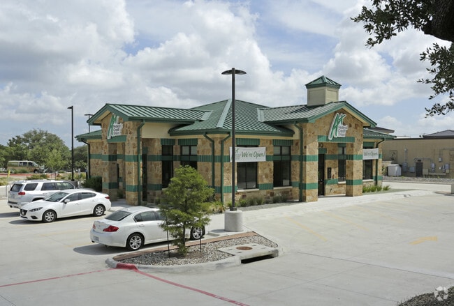
Property Detail
8142 N Ranch Rd 620 Rd
Austin-Round Rock-San Marcos, TX
UNT M2 TRAILS AT 620 COMMERCIAL CONDOMINIUMS PHS 2 THE PLUS 23.24 % INT IN COM AREA
825481
TRAVIS
Commercialcondominium
Texas
B and X Area of moderate flood hazard, usually the area between the limits of the 100-year and 500-year floods.
m2
2025
7.37 AC
2025
Far Northwest
034600
Austin
32,541 SF
NEARBY LISTINGS FOR SALE OR LEASE
DEMOGRAPHICS near 8142 N Ranch Rd 620 Rd
1 mile
3 mile
5 mile
2025 Total Population
6,063
29,560
122,486
2030 Population
6,277
30,612
131,292
Pop Growth 2025-2030
+ 3.53%
+ 3.56%
+ 7.19%
Average Age
36
39
39
2025 Total Households
2,865
11,855
49,390
HH Growth 2025-2030
+ 4.05%
+ 4.26%
+ 8.24%
Median Household Inc
$80,346
$130,092
$122,055
Avg Household Size
2.00
2.50
2.40
2025 Avg HH Vehicles
2.00
2.00
2.00
Median Home Value
$738,383
$779,140
$691,404
Median Year Built
2005
2001
1997
Nearby Places
Map Layers
Map Styles
 Street
 Aerial
Layers
 Traffic
 Biking
Places
Listings with unknown addresses are not visible on the map
- Restaurants
- Banks
- Shops
- Fitness
- Groceries
PUBLIC TRANSPORTATION
AIRPORT
Austin-Bergstrom International
Drive
Walk
Distance
Austin-Bergstrom International
46 min
27.7 mi
Freight Ports
Calhoun Port
Drive
Walk
Distance
Calhoun Port
211 min
171.2 mi
Nearby Properties
Address
Land Use
TOTAL SIZE
Lot Size
Zoning
Address
Land Use
TOTAL SIZE
Lot Size
Zoning
1,396,406 SF
107.21 AC
Address
Land Use
TOTAL SIZE
Lot Size
Zoning
525,852 SF
30.92 AC
Address
Land Use
TOTAL SIZE
Lot Size
Zoning
494,958 SF
39.50 AC
Address
Land Use
TOTAL SIZE
Lot Size
Zoning
411,288 SF
27.68 AC
Address
Land Use
TOTAL SIZE
Lot Size
Zoning
342,992 SF
17.53 AC
Address
Land Use
TOTAL SIZE
Lot Size
Zoning
576,996 SF
38.77 AC
Address
Land Use
TOTAL SIZE
Lot Size
Zoning
610,326 SF
43.30 AC
Address
Land Use
TOTAL SIZE
Lot Size
Zoning
388,673 SF
30.98 AC
Address
Land Use
TOTAL SIZE
Lot Size
Zoning
306,900 SF
34.50 AC
Address
Land Use
TOTAL SIZE
Lot Size
Zoning
323,718 SF
17.45 AC
Address
Land Use
TOTAL SIZE
Lot Size
Zoning
172,975 SF
33.88 AC
Address
Land Use
TOTAL SIZE
Lot Size
Zoning
349,600 SF
14.62 AC
Address
Land Use
TOTAL SIZE
Lot Size
Zoning
349,200 SF
28.91 AC
Address
Land Use
TOTAL SIZE
Lot Size
Zoning
638,467 SF
47.71 AC
Address
Land Use
TOTAL SIZE
Lot Size
Zoning
276,728 SF
16.25 AC
Address
Land Use
TOTAL SIZE
Lot Size
Zoning
285,768 SF
23.77 AC
Address
Land Use
TOTAL SIZE
Lot Size
Zoning
262,480 SF
27.52 AC
Address
Land Use
TOTAL SIZE
Lot Size
Zoning
270,504 SF
21.75 AC
Address
Land Use
TOTAL SIZE
Lot Size
Zoning
153,450 SF
14.70 AC
Address
Land Use
TOTAL SIZE
Lot Size
Zoning
173,608 SF
16.20 AC
Address
Land Use
TOTAL SIZE
Lot Size
Zoning
196,610 SF
383.96 AC
Address
Land Use
TOTAL SIZE
Lot Size
Zoning
182,320 SF
13.67 AC
Address
Land Use
TOTAL SIZE
Lot Size
Zoning
155,600 SF
6.19 AC
Address
Land Use
TOTAL SIZE
Lot Size
Zoning
942.27 AC
Address
Land Use
TOTAL SIZE
Lot Size
Zoning
222,200 SF
39.03 AC
Address
Land Use
TOTAL SIZE
Lot Size
Zoning
116,463 SF
15.27 AC
Address
Land Use
TOTAL SIZE
Lot Size
Zoning
179,796 SF
5.08 AC
Address
Land Use
TOTAL SIZE
Lot Size
Zoning
273,841 SF
14.69 AC
Address
Land Use
TOTAL SIZE
Lot Size
Zoning
128,040 SF
14.99 AC
Address
Land Use
TOTAL SIZE
Lot Size
Zoning
52,022 SF
32 AC
The World's #1 Commercial Real Estate Marketplace
Connect with us
© 2026 CoStar Group
The information above has been obtained from sources believed reliable. While we do not doubt its accuracy we have not verified it and make no guarantee, warranty or representation about it. It is your responsibility to independently confirm its accuracy and completeness. Any projections, opinions, assumptions, or estimates used are for example only and do not represent the current or future performance of the property. The value of this transaction to you depends on tax and other factors which should be evaluated by your tax, financial, and legal advisors. You and your advisors should conduct a careful, independent investigation of the property to determine to your satisfaction the suitability of the property for your needs.