Property Record
8145 Alexander Rd, Olive Branch, MS 38654
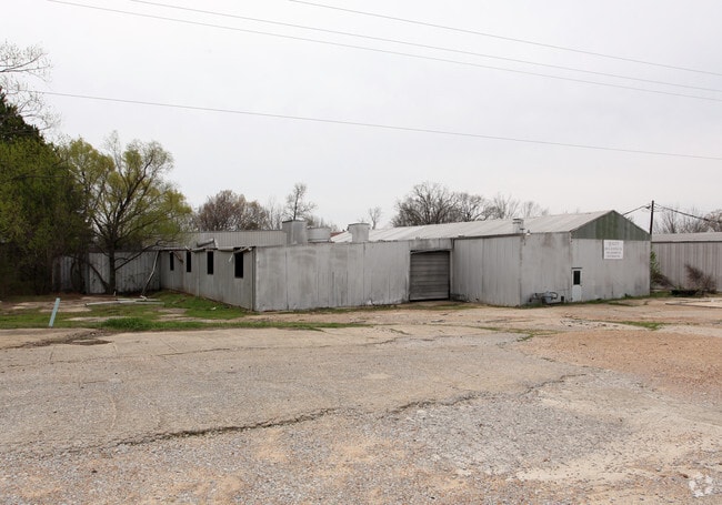


Property Detail
8145 Alexander Rd
1065220000001100
22-1-6 E PT OF SE 1/4
Commercialnec
Desoto
M-2
Mississippi
B and X Area of moderate flood hazard, usually the area between the limits of the 100-year and 500-year floods.
11
2025
10 AC
2025
DeSoto
070812
Memphis
8,912 SF
Memphis, TN-MS-AR
NEARBY LISTINGS FOR SALE OR LEASE
DEMOGRAPHICS near 8145 Alexander Rd
1 mile
3 mile
5 mile
2025 Total Population
5,319
43,599
105,486
2030 Population
5,441
43,743
105,195
Pop Growth 2025-2030
+ 2.29%
+ 0.33%
(0.28%)
Average Age
38
38
38
2025 Total Households
2,021
16,080
38,140
HH Growth 2025-2030
+ 2.33%
+ 0.41%
(0.31%)
Median Household Inc
$85,876
$86,697
$86,094
Avg Household Size
2.60
2.70
2.70
2025 Avg HH Vehicles
2.00
2.00
2.00
Median Home Value
$283,434
$251,092
$259,670
Median Year Built
1999
1995
1994
Nearby Places
Map Layers
Map Styles
 Street
 Aerial
Layers
 Traffic
 Biking
Places
Listings with unknown addresses are not visible on the map
- Restaurants
- Banks
- Shops
- Fitness
- Groceries
PUBLIC TRANSPORTATION
AIRPORT
Memphis International
Drive
Walk
Distance
Memphis International
26 min
14.5 mi
Nearby Properties
Address
Land Use
TOTAL SIZE
Lot Size
Zoning
Address
Land Use
TOTAL SIZE
Lot Size
Zoning
1,059,729 SF
74.33 AC
M-2
Address
Land Use
TOTAL SIZE
Lot Size
Zoning
434,122 SF
23.97 AC
R-6
Address
Land Use
TOTAL SIZE
Lot Size
Zoning
158,366 SF
24.31 AC
R-6
Address
Land Use
TOTAL SIZE
Lot Size
Zoning
326,743 SF
22.91 AC
R-8
Address
Land Use
TOTAL SIZE
Lot Size
Zoning
1,150,296 SF
68.41 AC
M-1
Address
Land Use
TOTAL SIZE
Lot Size
Zoning
466,532 SF
21.76 AC
EMP
Address
Land Use
TOTAL SIZE
Lot Size
Zoning
1,093,788 SF
60.98 AC
M-1
Address
Land Use
TOTAL SIZE
Lot Size
Zoning
990,952 SF
60.30 AC
PUD
Address
Land Use
TOTAL SIZE
Lot Size
Zoning
1,299,800 SF
50.22 AC
M-1
Address
Land Use
TOTAL SIZE
Lot Size
Zoning
990,080 SF
55.79 AC
M-1
Address
Land Use
TOTAL SIZE
Lot Size
Zoning
622,675 SF
67.55 AC
M-1
Address
Land Use
TOTAL SIZE
Lot Size
Zoning
722,560 SF
66.85 AC
M-1
Address
Land Use
TOTAL SIZE
Lot Size
Zoning
307,100 SF
18.95 AC
CA
Address
Land Use
TOTAL SIZE
Lot Size
Zoning
615,853 SF
39.07 AC
M-1
Address
Land Use
TOTAL SIZE
Lot Size
Zoning
869,020 SF
43.85 AC
M-1
Address
Land Use
TOTAL SIZE
Lot Size
Zoning
309,885 SF
17.49 AC
R-8
Address
Land Use
TOTAL SIZE
Lot Size
Zoning
860,464 SF
54.55 AC
M-1
Address
Land Use
TOTAL SIZE
Lot Size
Zoning
813,440 SF
38.72 AC
PB
Address
Land Use
TOTAL SIZE
Lot Size
Zoning
616,191 SF
61.92 AC
PUD
Address
Land Use
TOTAL SIZE
Lot Size
Zoning
860,040 SF
43.13 AC
M-1
Address
Land Use
TOTAL SIZE
Lot Size
Zoning
693,680 SF
47.15 AC
M-1
Address
Land Use
TOTAL SIZE
Lot Size
Zoning
927,742 SF
42.73 AC
PB
Address
Land Use
TOTAL SIZE
Lot Size
Zoning
217,172 SF
12.32 AC
R-6
Address
Land Use
TOTAL SIZE
Lot Size
Zoning
416,000 SF
40.66 AC
M-1
Address
Land Use
TOTAL SIZE
Lot Size
Zoning
210,161 SF
14.86 AC
R-6
Address
Land Use
TOTAL SIZE
Lot Size
Zoning
210,354 SF
17.31 AC
R-8
Address
Land Use
TOTAL SIZE
Lot Size
Zoning
447,008 SF
28.41 AC
PB
Address
Land Use
TOTAL SIZE
Lot Size
Zoning
689,628 SF
43.78 AC
M-1
Address
Land Use
TOTAL SIZE
Lot Size
Zoning
599,752 SF
40.17 AC
M-1
Address
Land Use
TOTAL SIZE
Lot Size
Zoning
1,082,465 SF
57.74 AC
PB
The World's #1 Commercial Real Estate Marketplace
Connect with us
© 2026 CoStar Group
The information above has been obtained from sources believed reliable. While we do not doubt its accuracy we have not verified it and make no guarantee, warranty or representation about it. It is your responsibility to independently confirm its accuracy and completeness. Any projections, opinions, assumptions, or estimates used are for example only and do not represent the current or future performance of the property. The value of this transaction to you depends on tax and other factors which should be evaluated by your tax, financial, and legal advisors. You and your advisors should conduct a careful, independent investigation of the property to determine to your satisfaction the suitability of the property for your needs.