Property Record
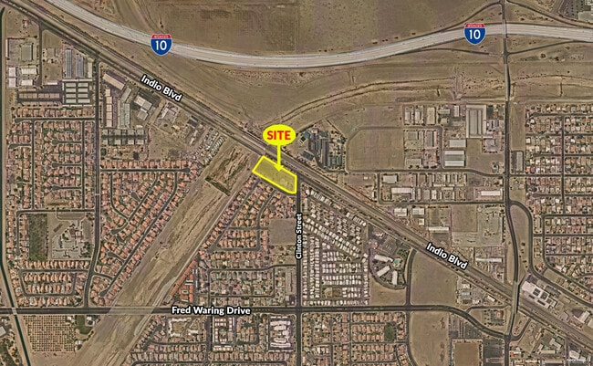
81450 Jonquil Ave, Indio, CA 92201


Property Detail
81450 Jonquil Ave
Riverside-San Bernardino-Ontario, CA
2.96 ACRES NET IN PAR 1 PM 135/064 PM 20850
610-030-018
RIVERSIDE
Commercialacreage
California
B and X Area of moderate flood hazard, usually the area between the limits of the 100-year and 500-year floods.
1
2024
2.96 AC
2025
Coachella Valley
045501
Inland Empire (California)
NEARBY LISTINGS FOR SALE OR LEASE
DEMOGRAPHICS near 81450 Jonquil Ave
1 mile
3 mile
5 mile
2025 Total Population
12,218
100,461
176,010
2030 Population
12,459
104,046
184,762
Pop Growth 2025-2030
+ 1.97%
+ 3.57%
+ 4.97%
Average Age
37
39
43
2025 Total Households
3,406
32,754
63,156
HH Growth 2025-2030
+ 1.76%
+ 3.63%
+ 5.46%
Median Household Inc
$75,725
$81,243
$85,243
Avg Household Size
3.40
2.90
2.70
2025 Avg HH Vehicles
2.00
2.00
2.00
Median Home Value
$416,071
$520,156
$595,070
Median Year Built
1986
1995
1997
Nearby Places
Map Layers
Map Styles
 Street
 Aerial
Transit
 Traffic
 Biking
Places
Listings with unknown addresses are not visible on the map
- Restaurants
- Banks
- Shops
- Fitness
- Groceries
PUBLIC TRANSPORTATION
AIRPORT
Palm Springs International
Drive
Walk
Distance
Palm Springs International
27 min
19.5 mi
Freight Ports
Port of San Diego
Drive
Walk
Distance
Port of San Diego
172 min
143.7 mi
SALE & LEASE HISTORY
LISTING DATE
SALE/LEASE

May 31, 2023
For Sale
Nearby Properties
Address
Land Use
TOTAL SIZE
Lot Size
Zoning
Address
Land Use
TOTAL SIZE
Lot Size
Zoning
162,192 SF
15.42 AC
Address
Land Use
TOTAL SIZE
Lot Size
Zoning
73,832 SF
7.71 AC
Address
Land Use
TOTAL SIZE
Lot Size
Zoning
128,503 SF
6.25 AC
R3
Address
Land Use
TOTAL SIZE
Lot Size
Zoning
123,134 SF
6.61 AC
RM
Address
Land Use
TOTAL SIZE
Lot Size
Zoning
139,456 SF
8.02 AC
R-3
Address
Land Use
TOTAL SIZE
Lot Size
Zoning
189,101 SF
8.98 AC
C1
Address
Land Use
TOTAL SIZE
Lot Size
Zoning
55,072 SF
6.88 AC
C2
Address
Land Use
TOTAL SIZE
Lot Size
Zoning
170,272 SF
16.28 AC
Address
Land Use
TOTAL SIZE
Lot Size
Zoning
171,910 SF
14.89 AC
C1
Address
Land Use
TOTAL SIZE
Lot Size
Zoning
144,647 SF
16.60 AC
Address
Land Use
TOTAL SIZE
Lot Size
Zoning
197,244 SF
20.44 AC
Address
Land Use
TOTAL SIZE
Lot Size
Zoning
83,753 SF
2.77 AC
RM
Address
Land Use
TOTAL SIZE
Lot Size
Zoning
55,695 SF
10.60 AC
C1
Address
Land Use
TOTAL SIZE
Lot Size
Zoning
58,560 SF
3.01 AC
Address
Land Use
TOTAL SIZE
Lot Size
Zoning
81,004 SF
2.99 AC
Address
Land Use
TOTAL SIZE
Lot Size
Zoning
99,301 SF
Address
Land Use
TOTAL SIZE
Lot Size
Zoning
52,971 SF
7.29 AC
Address
Land Use
TOTAL SIZE
Lot Size
Zoning
2,841 SF
7.51 AC
A1
Address
Land Use
TOTAL SIZE
Lot Size
Zoning
103,618 SF
10.51 AC
Address
Land Use
TOTAL SIZE
Lot Size
Zoning
102,400 SF
6.98 AC
Address
Land Use
TOTAL SIZE
Lot Size
Zoning
Address
Land Use
TOTAL SIZE
Lot Size
Zoning
39,776 SF
4.46 AC
C2
Address
Land Use
TOTAL SIZE
Lot Size
Zoning
38,644 SF
18.57 AC
Address
Land Use
TOTAL SIZE
Lot Size
Zoning
102,867 SF
11.10 AC
Address
Land Use
TOTAL SIZE
Lot Size
Zoning
35,760 SF
3.74 AC
Address
Land Use
TOTAL SIZE
Lot Size
Zoning
94,642 SF
10 AC
Address
Land Use
TOTAL SIZE
Lot Size
Zoning
59,420 SF
5.57 AC
Address
Land Use
TOTAL SIZE
Lot Size
Zoning
104,741 SF
5.80 AC
R1
Address
Land Use
TOTAL SIZE
Lot Size
Zoning
48,578 SF
7.88 AC
The World's #1 Commercial Real Estate Marketplace
Connect with us
© 2026 CoStar Group
The information above has been obtained from sources believed reliable. While we do not doubt its accuracy we have not verified it and make no guarantee, warranty or representation about it. It is your responsibility to independently confirm its accuracy and completeness. Any projections, opinions, assumptions, or estimates used are for example only and do not represent the current or future performance of the property. The value of this transaction to you depends on tax and other factors which should be evaluated by your tax, financial, and legal advisors. You and your advisors should conduct a careful, independent investigation of the property to determine to your satisfaction the suitability of the property for your needs.