Property Record
815 6Th Ave, Brackenridge, PA 15014

NEARBY LISTINGS FOR SALE OR LEASE
Property Detail
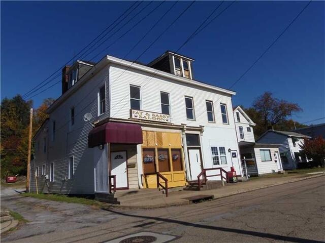
815 6Th Ave
Pittsburgh, PA
Tarentum Extn 2Nd
1224-F-00063-0000-00
TARENTUM EXTN 2ND PLAN 430 LOT 50X150 6TH AVE 2 STY FRA INSL BRK HSE & HOTEL 815 2 CAR C B GAR
Bartavern
Allegheny
X
Pennsylvania
42003C0251H
63
2024
0.17 AC
2025
Northeast Pittsburgh
402000
Pittsburgh
DEMOGRAPHICS near 815 6Th Ave
1 Mile
3 Mile
5 Mile
2024 Total Population
9,080
42,256
62,468
2029 Population
8,890
41,812
61,719
Pop Growth 2024-2029
(2.09%)
(1.05%)
(1.20%)
Average Age
43
44
45
2024 Total Households
4,085
19,152
28,167
HH Growth 2024-2029
(2.20%)
(1.11%)
(1.25%)
Median Household Inc
$42,594
$51,009
$55,210
Avg Household Size
2.20
2.20
2.20
2024 Avg HH Vehicles
1.00
2.00
2.00
Median Home Value
$85,369
$123,871
$137,296
Median Year Built
1948
1953
1954
Nearby Places
Map Layers
Map Styles
 Street
 Aerial
- Restaurants
- Banks
- Shops
- Fitness
- Groceries
PUBLIC TRANSPORTATION
AIRPORT
Pittsburgh International
DRIVE
WALK
Distance
Pittsburgh International
59 min
37.2 mi
Arnold Palmer Regional
DRIVE
WALK
Distance
Arnold Palmer Regional
68 min
39.5 mi
Nearby Properties
Address
Land Use
TOTAL SIZE
Lot Size
Zoning
Address
Land Use
TOTAL SIZE
Lot Size
Zoning
Address
Land Use
TOTAL SIZE
Lot Size
Zoning
Address
Land Use
TOTAL SIZE
Lot Size
Zoning
95.69 AC
Address
Land Use
TOTAL SIZE
Lot Size
Zoning
Address
Land Use
TOTAL SIZE
Lot Size
Zoning
Address
Land Use
TOTAL SIZE
Lot Size
Zoning
1.77 AC
Address
Land Use
TOTAL SIZE
Lot Size
Zoning
35.56 AC
Address
Land Use
TOTAL SIZE
Lot Size
Zoning
26.76 AC
Address
Land Use
TOTAL SIZE
Lot Size
Zoning
Address
Land Use
TOTAL SIZE
Lot Size
Zoning
3,248 SF
2.41 AC
Address
Land Use
TOTAL SIZE
Lot Size
Zoning
Address
Land Use
TOTAL SIZE
Lot Size
Zoning
67.50 AC
Address
Land Use
TOTAL SIZE
Lot Size
Zoning
0.79 AC
Address
Land Use
TOTAL SIZE
Lot Size
Zoning
Address
Land Use
TOTAL SIZE
Lot Size
Zoning
Address
Land Use
TOTAL SIZE
Lot Size
Zoning
1.54 AC
Address
Land Use
TOTAL SIZE
Lot Size
Zoning
Address
Land Use
TOTAL SIZE
Lot Size
Zoning
12.11 AC
Address
Land Use
TOTAL SIZE
Lot Size
Zoning
14.92 AC
Address
Land Use
TOTAL SIZE
Lot Size
Zoning
4.25 AC
Address
Land Use
TOTAL SIZE
Lot Size
Zoning
2,528 SF
1.25 AC
Address
Land Use
TOTAL SIZE
Lot Size
Zoning
Address
Land Use
TOTAL SIZE
Lot Size
Zoning
3,253 SF
1.19 AC
Address
Land Use
TOTAL SIZE
Lot Size
Zoning
Address
Land Use
TOTAL SIZE
Lot Size
Zoning
Address
Land Use
TOTAL SIZE
Lot Size
Zoning
0.21 AC
Address
Land Use
TOTAL SIZE
Lot Size
Zoning
Address
Land Use
TOTAL SIZE
Lot Size
Zoning
0.48 AC
Address
Land Use
TOTAL SIZE
Lot Size
Zoning
2,382 SF
0.80 AC
Address
Land Use
TOTAL SIZE
Lot Size
Zoning
The World's #1 Commercial Real Estate Marketplace
Connect with us
© 2026 CoStar Group
The information above has been obtained from sources believed reliable. While we do not doubt its accuracy we have not verified it and make no guarantee, warranty or representation about it. It is your responsibility to independently confirm its accuracy and completeness. Any projections, opinions, assumptions, or estimates used are for example only and do not represent the current or future performance of the property. The value of this transaction to you depends on tax and other factors which should be evaluated by your tax, financial, and legal advisors. You and your advisors should conduct a careful, independent investigation of the property to determine to your satisfaction the suitability of the property for your needs.