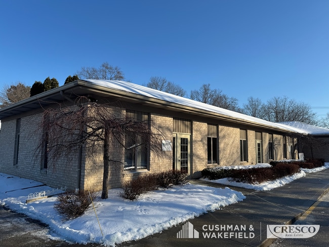
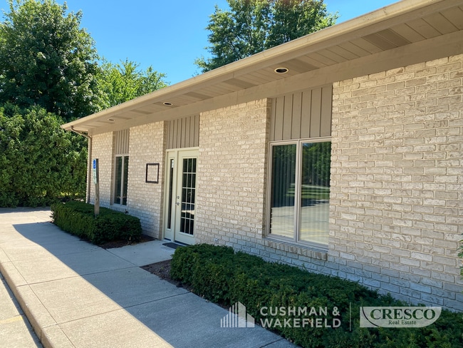
Property Record
815 Crocker Rd, Westlake, OH 44145
NEARBY LISTINGS FOR SALE OR LEASE
Property Detail
815 Crocker Rd
Cleveland
Dover
Cleveland-Elyria, OH
73 SP 21114007
211-14-006
Cuyahoga
Officebuilding
Ohio
2024
73
2024
1.85 AC
189110
West
13,200 SF
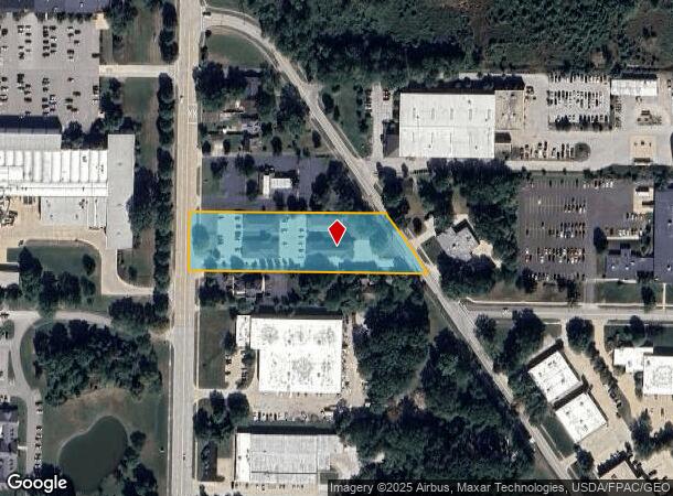
DEMOGRAPHICS near 815 Crocker Rd
1 Mile
3 Mile
5 Mile
2024 Total Population
6,862
48,055
122,640
2029 Population
6,662
47,439
121,761
Pop Growth 2024-2029
(2.91%)
(1.28%)
(0.72%)
Average Age
42
44
44
2024 Total Households
3,051
19,628
50,162
HH Growth 2024-2029
(3.05%)
(1.47%)
(0.97%)
Median Household Inc
$89,112
$103,670
$93,135
Avg Household Size
2.10
2.40
2.40
2024 Avg HH Vehicles
2.00
2.00
2.00
Median Home Value
$289,876
$322,080
$275,104
Median Year Built
1976
1979
1973
Nearby Places
Map Layers
Map Styles
 Street
 Aerial
- Restaurants
- Banks
- Shops
- Fitness
- Groceries
PUBLIC TRANSPORTATION
AIRPORT
Cleveland-Hopkins International
DRIVE
WALK
Distance
Cleveland-Hopkins International
21 min
10.1 mi
SALE & LEASE HISTORY
LISTING DATE
SALE/LEASE

Mar 28, 2024
For Lease
Jun 26, 2024
For Lease
Nearby Properties
Address
Land Use
TOTAL SIZE
Lot Size
Zoning
Address
Land Use
TOTAL SIZE
Lot Size
Zoning
1,239,072 SF
26.47 AC
PUD
Address
Land Use
TOTAL SIZE
Lot Size
Zoning
602,400 SF
5.04 AC
PUD
Address
Land Use
TOTAL SIZE
Lot Size
Zoning
321,868 SF
71.81 AC
Address
Land Use
TOTAL SIZE
Lot Size
Zoning
354,041 SF
6.16 AC
F-1F80
Address
Land Use
TOTAL SIZE
Lot Size
Zoning
115,677 SF
33.09 AC
EI
Address
Land Use
TOTAL SIZE
Lot Size
Zoning
154,058 SF
29.97 AC
Address
Land Use
TOTAL SIZE
Lot Size
Zoning
126,640 SF
93.63 AC
Address
Land Use
TOTAL SIZE
Lot Size
Zoning
264,435 SF
25.85 AC
SC
Address
Land Use
TOTAL SIZE
Lot Size
Zoning
148,688 SF
17.15 AC
Address
Land Use
TOTAL SIZE
Lot Size
Zoning
117,673 SF
7.35 AC
1F-5
Address
Land Use
TOTAL SIZE
Lot Size
Zoning
116,942 SF
37.28 AC
Address
Land Use
TOTAL SIZE
Lot Size
Zoning
144,000 SF
10.79 AC
1F5
Address
Land Use
TOTAL SIZE
Lot Size
Zoning
230,687 SF
15.98 AC
Address
Land Use
TOTAL SIZE
Lot Size
Zoning
45,810 SF
36.64 AC
EI
Address
Land Use
TOTAL SIZE
Lot Size
Zoning
553,692 SF
80.04 AC
Address
Land Use
TOTAL SIZE
Lot Size
Zoning
36,844 SF
13.44 AC
EOP
Address
Land Use
TOTAL SIZE
Lot Size
Zoning
193,858 SF
19.65 AC
R-MF24
Address
Land Use
TOTAL SIZE
Lot Size
Zoning
194,392 SF
11.18 AC
Address
Land Use
TOTAL SIZE
Lot Size
Zoning
17,121 SF
19.06 AC
R-MF24
Address
Land Use
TOTAL SIZE
Lot Size
Zoning
153,082 SF
13.93 AC
R-MF24
Address
Land Use
TOTAL SIZE
Lot Size
Zoning
163,038 SF
21.16 AC
Address
Land Use
TOTAL SIZE
Lot Size
Zoning
78,879 SF
16.63 AC
R-MF24
Address
Land Use
TOTAL SIZE
Lot Size
Zoning
251,049 SF
13.95 AC
R-MF24
Address
Land Use
TOTAL SIZE
Lot Size
Zoning
123,093 SF
7.31 AC
MFS
Address
Land Use
TOTAL SIZE
Lot Size
Zoning
103,795 SF
19.39 AC
F-1F80
Address
Land Use
TOTAL SIZE
Lot Size
Zoning
34,908 SF
21.46 AC
Address
Land Use
TOTAL SIZE
Lot Size
Zoning
240,506 SF
18.95 AC
Address
Land Use
TOTAL SIZE
Lot Size
Zoning
184,174 SF
24.39 AC
RB
Address
Land Use
TOTAL SIZE
Lot Size
Zoning
63,135 SF
9.85 AC
Address
Land Use
TOTAL SIZE
Lot Size
Zoning
111,856 SF
0.99 AC
The World's #1 Commercial Real Estate Marketplace
Connect with us
© 2025 CoStar Group
The information above has been obtained from sources believed reliable. While we do not doubt its accuracy we have not verified it and make no guarantee, warranty or representation about it. It is your responsibility to independently confirm its accuracy and completeness. Any projections, opinions, assumptions, or estimates used are for example only and do not represent the current or future performance of the property. The value of this transaction to you depends on tax and other factors which should be evaluated by your tax, financial, and legal advisors. You and your advisors should conduct a careful, independent investigation of the property to determine to your satisfaction the suitability of the property for your needs.