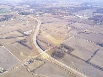
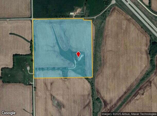
Property Record
815 N Tower Rd, Freeport, IL 61032
NEARBY LISTINGS FOR SALE OR LEASE
-
-
View all Freeport listings for sale on LoopNet.com
Property Detail
815 N Tower Rd
07-14-28-100-005
PT NW 1/4 SEC 28-27-8
Ruralimprovednonresidential
Stephenson
X
Illinois
17177C0350D
38.43 AC
2024
Illinois North Area
2024
Other Market Areas
000700
Freeport, IL
5,019 SF
DEMOGRAPHICS near 815 N Tower Rd
1 Mile
3 Mile
5 Mile
2024 Total Population
227
16,638
27,974
2029 Population
225
16,434
27,446
Pop Growth 2024-2029
(0.88%)
(1.23%)
(1.89%)
Average Age
41
40
43
2024 Total Households
99
7,096
12,267
HH Growth 2024-2029
0.00%
(1.34%)
(1.98%)
Median Household Inc
$32,500
$39,786
$45,773
Avg Household Size
2.30
2.20
2.20
2024 Avg HH Vehicles
1.00
1.00
2.00
Median Home Value
$82,926
$64,073
$82,672
Median Year Built
1949
1949
1959
Nearby Places
Map Layers
Map Styles
 Street
 Aerial
- Restaurants
- Banks
- Shops
- Fitness
- Groceries
PUBLIC TRANSPORTATION
AIRPORT
Chicago/Rockford International
DRIVE
WALK
Distance
Chicago/Rockford International
49 min
34.4 mi
Freight Ports
Port Milwaukee
DRIVE
WALK
Distance
Port Milwaukee
146 min
112.7 mi
Nearby Properties
Address
Land Use
TOTAL SIZE
Lot Size
Zoning
Address
Land Use
TOTAL SIZE
Lot Size
Zoning
499,200 SF
36.03 AC
Address
Land Use
TOTAL SIZE
Lot Size
Zoning
Address
Land Use
TOTAL SIZE
Lot Size
Zoning
148.08 AC
Address
Land Use
TOTAL SIZE
Lot Size
Zoning
4.13 AC
Address
Land Use
TOTAL SIZE
Lot Size
Zoning
1.39 AC
Address
Land Use
TOTAL SIZE
Lot Size
Zoning
7,754 SF
0.61 AC
Address
Land Use
TOTAL SIZE
Lot Size
Zoning
28.06 AC
Address
Land Use
TOTAL SIZE
Lot Size
Zoning
1.77 AC
Address
Land Use
TOTAL SIZE
Lot Size
Zoning
19.66 AC
Address
Land Use
TOTAL SIZE
Lot Size
Zoning
15.25 AC
Address
Land Use
TOTAL SIZE
Lot Size
Zoning
11,364 SF
1.97 AC
Address
Land Use
TOTAL SIZE
Lot Size
Zoning
9.08 AC
Address
Land Use
TOTAL SIZE
Lot Size
Zoning
2.53 AC
Address
Land Use
TOTAL SIZE
Lot Size
Zoning
Address
Land Use
TOTAL SIZE
Lot Size
Zoning
18,688 SF
2.70 AC
Address
Land Use
TOTAL SIZE
Lot Size
Zoning
27,502 SF
0.83 AC
Address
Land Use
TOTAL SIZE
Lot Size
Zoning
Address
Land Use
TOTAL SIZE
Lot Size
Zoning
Address
Land Use
TOTAL SIZE
Lot Size
Zoning
Address
Land Use
TOTAL SIZE
Lot Size
Zoning
0.38 AC
Address
Land Use
TOTAL SIZE
Lot Size
Zoning
7,000 SF
4.87 AC
Address
Land Use
TOTAL SIZE
Lot Size
Zoning
16.60 AC
Address
Land Use
TOTAL SIZE
Lot Size
Zoning
11,868 SF
0.99 AC
Address
Land Use
TOTAL SIZE
Lot Size
Zoning
19.12 AC
Address
Land Use
TOTAL SIZE
Lot Size
Zoning
1,672 SF
5.03 AC
Address
Land Use
TOTAL SIZE
Lot Size
Zoning
8,000 SF
14.36 AC
Address
Land Use
TOTAL SIZE
Lot Size
Zoning
21,840 SF
8 AC
Address
Land Use
TOTAL SIZE
Lot Size
Zoning
10,269 SF
3.44 AC
Address
Land Use
TOTAL SIZE
Lot Size
Zoning
7,272 SF
1.33 AC
Address
Land Use
TOTAL SIZE
Lot Size
Zoning
0.44 AC
The World's #1 Commercial Real Estate Marketplace
Connect with us
© 2025 CoStar Group
The information above has been obtained from sources believed reliable. While we do not doubt its accuracy we have not verified it and make no guarantee, warranty or representation about it. It is your responsibility to independently confirm its accuracy and completeness. Any projections, opinions, assumptions, or estimates used are for example only and do not represent the current or future performance of the property. The value of this transaction to you depends on tax and other factors which should be evaluated by your tax, financial, and legal advisors. You and your advisors should conduct a careful, independent investigation of the property to determine to your satisfaction the suitability of the property for your needs.