Property Record
815 Sunpark Dr, Fenton, MO 63026


Save to a Folder
{{folder.Name}}
{{folder.ListingIds.length}} Properties
{{folder.ListingIds.length}} Property
Create a New Folder
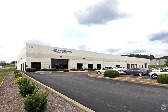
Property Detail
815 Sunpark Dr
02-2.0-04.0-1-001-007.21
SUN VALLEY PHS 2 2ND AMENDED LOT 5
Warehouse
Jefferson
PB
Missouri
B and X Area of moderate flood hazard, usually the area between the limits of the 100-year and 500-year floods.
5
2024
2.27 AC
2025
Jefferson County
700210
St. Louis
33,600 SF
St. Louis, MO-IL
NEARBY LISTINGS FOR SALE OR LEASE
DEMOGRAPHICS near 815 Sunpark Dr
1 mile
3 mile
5 mile
2025 Total Population
6,537
46,564
96,864
2030 Population
6,587
46,823
97,161
Pop Growth 2025-2030
+ 0.76%
+ 0.56%
+ 0.31%
Average Age
41
41
43
2025 Total Households
2,600
18,056
38,568
HH Growth 2025-2030
+ 0.85%
+ 0.61%
+ 0.31%
Median Household Inc
$91,052
$96,576
$94,632
Avg Household Size
2.40
2.50
2.40
2025 Avg HH Vehicles
2.00
2.00
2.00
Median Home Value
$238,720
$290,055
$304,053
Median Year Built
1987
1985
1983
Nearby Places
Map Layers
Map Styles
 Street
 Aerial
Layers
 Traffic
 Biking
Places
Listings with unknown addresses are not visible on the map
- Restaurants
- Banks
- Shops
- Fitness
- Groceries
PUBLIC TRANSPORTATION
COMMUTER RAIL
Kirkwood Amtrak Station (Lincoln Service Missouri River Runner - Amtrak, Missouri River Runner - Amtrak)
Drive
Walk
Distance
Kirkwood Amtrak Station (Lincoln Service Missouri River Runner - Amtrak, Missouri River Runner - Amtrak)
16 min
9.6 mi
AIRPORT
St Louis Lambert International
Drive
Walk
Distance
St Louis Lambert International
37 min
25.0 mi
Freight Ports
Tulsa Port of Inola
Drive
Walk
Distance
Tulsa Port of Inola
409 min
371.0 mi
SALE & LEASE HISTORY
LISTING DATE
SALE/LEASE

Sep 25, 2016
For Lease
Oct 26, 2016
For Sale
Aug 17, 2017
For Lease
Nearby Properties
Address
Land Use
TOTAL SIZE
Lot Size
Zoning
Address
Land Use
TOTAL SIZE
Lot Size
Zoning
429,212 SF
53.13 AC
C-8
Address
Land Use
TOTAL SIZE
Lot Size
Zoning
62.50 AC
NU
Address
Land Use
TOTAL SIZE
Lot Size
Zoning
258,312 SF
16.34 AC
CC2
Address
Land Use
TOTAL SIZE
Lot Size
Zoning
139,212 SF
15.58 AC
21C-1
Address
Land Use
TOTAL SIZE
Lot Size
Zoning
112,840 SF
0.54 AC
C-8
Address
Land Use
TOTAL SIZE
Lot Size
Zoning
26.56 AC
NU
Address
Land Use
TOTAL SIZE
Lot Size
Zoning
154,844 SF
13.29 AC
21OT-3
Address
Land Use
TOTAL SIZE
Lot Size
Zoning
129,090 SF
17.78 AC
21C-1
Address
Land Use
TOTAL SIZE
Lot Size
Zoning
211,612 SF
41.36 AC
PB
Address
Land Use
TOTAL SIZE
Lot Size
Zoning
221,724 SF
21.98 AC
21OT-4
Address
Land Use
TOTAL SIZE
Lot Size
Zoning
265,291 SF
14.91 AC
PR2
Address
Land Use
TOTAL SIZE
Lot Size
Zoning
164,166 SF
16.88 AC
21C-1
Address
Land Use
TOTAL SIZE
Lot Size
Zoning
118,820 SF
13.30 AC
Address
Land Use
TOTAL SIZE
Lot Size
Zoning
156,592 SF
9.80 AC
PR2
Address
Land Use
TOTAL SIZE
Lot Size
Zoning
396 SF
61.20 AC
A
Address
Land Use
TOTAL SIZE
Lot Size
Zoning
99,230 SF
17.56 AC
HP1
Address
Land Use
TOTAL SIZE
Lot Size
Zoning
90,300 SF
9.42 AC
21OT-3
Address
Land Use
TOTAL SIZE
Lot Size
Zoning
20.85 AC
AFP
Address
Land Use
TOTAL SIZE
Lot Size
Zoning
94,421 SF
10.94 AC
21OT-2
Address
Land Use
TOTAL SIZE
Lot Size
Zoning
75,885 SF
7.75 AC
J1
Address
Land Use
TOTAL SIZE
Lot Size
Zoning
134,885 SF
16.91 AC
21C-1
Address
Land Use
TOTAL SIZE
Lot Size
Zoning
54,348 SF
6.61 AC
C-8
Address
Land Use
TOTAL SIZE
Lot Size
Zoning
125,762 SF
10.42 AC
21C-1
Address
Land Use
TOTAL SIZE
Lot Size
Zoning
97,476 SF
4.13 AC
R-3
Address
Land Use
TOTAL SIZE
Lot Size
Zoning
66,785 SF
50 AC
21R-1
Address
Land Use
TOTAL SIZE
Lot Size
Zoning
195,508 SF
6.81 AC
21BP-3
Address
Land Use
TOTAL SIZE
Lot Size
Zoning
76,662 SF
35.89 AC
FPM1
Address
Land Use
TOTAL SIZE
Lot Size
Zoning
85,150 SF
8.62 AC
21R-6A
Address
Land Use
TOTAL SIZE
Lot Size
Zoning
12.62 AC
21R-1
Address
Land Use
TOTAL SIZE
Lot Size
Zoning
7.41 AC
R3
The World's #1 Commercial Real Estate Marketplace
Connect with us
© 2026 CoStar Group
The information above has been obtained from sources believed reliable. While we do not doubt its accuracy we have not verified it and make no guarantee, warranty or representation about it. It is your responsibility to independently confirm its accuracy and completeness. Any projections, opinions, assumptions, or estimates used are for example only and do not represent the current or future performance of the property. The value of this transaction to you depends on tax and other factors which should be evaluated by your tax, financial, and legal advisors. You and your advisors should conduct a careful, independent investigation of the property to determine to your satisfaction the suitability of the property for your needs.