Property Record
815 Whitney Rd W, Fairport, NY 14450


Current Lease Availabilities
NEARBY LISTINGS FOR SALE OR LEASE
Property Detail
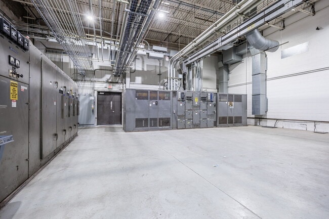
815 Whitney Rd W
264403-152-080-0002-002-000
LOT 44 TWP 12 RNG 4 N R MAP 1989-24
Manufacturinglight
Monroe
X
New York
36055C0377G
2.000
2025
22.11 AC
2024
Southeast
011800
Rochester
287,176 SF
Rochester, NY
DEMOGRAPHICS near 815 Whitney Rd W
1 Mile
3 Mile
5 Mile
2024 Total Population
8,629
60,495
108,475
2029 Population
8,465
59,642
107,058
Pop Growth 2024-2029
(1.90%)
(1.41%)
(1.31%)
Average Age
45
44
44
2024 Total Households
3,982
25,972
44,329
HH Growth 2024-2029
(1.98%)
(1.51%)
(1.40%)
Median Household Inc
$68,499
$82,071
$95,878
Avg Household Size
2.10
2.30
2.30
2024 Avg HH Vehicles
2.00
2.00
2.00
Median Home Value
$252,995
$234,811
$258,386
Median Year Built
1969
1972
1972
Nearby Places
Map Layers
Map Styles
 Street
 Aerial
- Restaurants
- Banks
- Shops
- Fitness
- Groceries
PUBLIC TRANSPORTATION
AIRPORT
Frederick Douglass/Greater Rochester International
DRIVE
WALK
Distance
Frederick Douglass/Greater Rochester International
25 min
14.2 mi
Freight Ports
Albany, NY Port
DRIVE
WALK
Distance
Albany, NY Port
262 min
219.3 mi
Nearby Properties
Address
Land Use
TOTAL SIZE
Lot Size
Zoning
Address
Land Use
TOTAL SIZE
Lot Size
Zoning
640 SF
84.10 AC
RA-2
Address
Land Use
TOTAL SIZE
Lot Size
Zoning
295,482 SF
83.23 AC
RES B
Address
Land Use
TOTAL SIZE
Lot Size
Zoning
408,790 SF
31.90 AC
02 - SINGL
Address
Land Use
TOTAL SIZE
Lot Size
Zoning
3,752 SF
36.50 AC
MR
Address
Land Use
TOTAL SIZE
Lot Size
Zoning
191,117 SF
31.86 AC
Address
Land Use
TOTAL SIZE
Lot Size
Zoning
251,359 SF
46.83 AC
GB
Address
Land Use
TOTAL SIZE
Lot Size
Zoning
2,902 SF
127.70 AC
CEMETERY
Address
Land Use
TOTAL SIZE
Lot Size
Zoning
364,800 SF
28.40 AC
R-1-15
Address
Land Use
TOTAL SIZE
Lot Size
Zoning
65,750 SF
42.60 AC
APT
Address
Land Use
TOTAL SIZE
Lot Size
Zoning
193,120 SF
10.83 AC
INDUSTRIAL
Address
Land Use
TOTAL SIZE
Lot Size
Zoning
105,768 SF
51.10 AC
R-B
Address
Land Use
TOTAL SIZE
Lot Size
Zoning
74,490 SF
16.20 AC
MIXED USE
Address
Land Use
TOTAL SIZE
Lot Size
Zoning
88,859 SF
82.38 AC
RES B
Address
Land Use
TOTAL SIZE
Lot Size
Zoning
90,684 SF
20.51 AC
LI
Address
Land Use
TOTAL SIZE
Lot Size
Zoning
196,411 SF
23.40 AC
COMMERCIAL
Address
Land Use
TOTAL SIZE
Lot Size
Zoning
4,210 SF
14.85 AC
PDD
Address
Land Use
TOTAL SIZE
Lot Size
Zoning
7,282 SF
24.04 AC
APT
Address
Land Use
TOTAL SIZE
Lot Size
Zoning
114,692 SF
27.10 AC
RES B
Address
Land Use
TOTAL SIZE
Lot Size
Zoning
247,668 SF
36.68 AC
GB
Address
Land Use
TOTAL SIZE
Lot Size
Zoning
48,582 SF
18.08 AC
APT
Address
Land Use
TOTAL SIZE
Lot Size
Zoning
50,387 SF
4.10 AC
02 - SINGL
Address
Land Use
TOTAL SIZE
Lot Size
Zoning
72,747 SF
5.98 AC
Address
Land Use
TOTAL SIZE
Lot Size
Zoning
6,768 SF
14.32 AC
APT
Address
Land Use
TOTAL SIZE
Lot Size
Zoning
11,630 SF
15.80 AC
APT
Address
Land Use
TOTAL SIZE
Lot Size
Zoning
122,000 SF
11.39 AC
COMMERCIAL
Address
Land Use
TOTAL SIZE
Lot Size
Zoning
130,674 SF
42 AC
RES B
Address
Land Use
TOTAL SIZE
Lot Size
Zoning
182,943 SF
15.83 AC
LI
Address
Land Use
TOTAL SIZE
Lot Size
Zoning
123,630 SF
11.72 AC
GB
Address
Land Use
TOTAL SIZE
Lot Size
Zoning
75,677 SF
47.69 AC
RES B
Address
Land Use
TOTAL SIZE
Lot Size
Zoning
85,838 SF
3.70 AC
R-C
The World's #1 Commercial Real Estate Marketplace
Connect with us
© 2026 CoStar Group
The information above has been obtained from sources believed reliable. While we do not doubt its accuracy we have not verified it and make no guarantee, warranty or representation about it. It is your responsibility to independently confirm its accuracy and completeness. Any projections, opinions, assumptions, or estimates used are for example only and do not represent the current or future performance of the property. The value of this transaction to you depends on tax and other factors which should be evaluated by your tax, financial, and legal advisors. You and your advisors should conduct a careful, independent investigation of the property to determine to your satisfaction the suitability of the property for your needs.