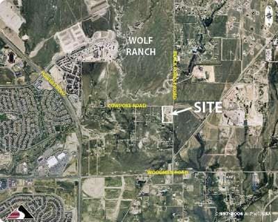
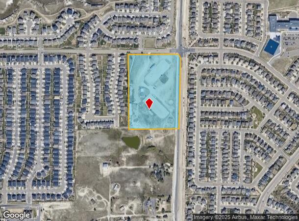
Property Record
8150 Black Forest Rd, Colorado Springs, CO 80908

This Property Is For Sale
NEARBY LISTINGS FOR SALE OR LEASE
-
-
NEC E. Woodmen Rd. & Marksheffel rd
Colorado Springs, CO 80908
$1,050,000 - $3,550,000
1.28 - 3.13 AC Lot
Land
-
-
-
7452 Solace Forest View, Colorado Spgs
Colorado Springs, CO 80927
Rent Upon Request
1.58 AC Lots
Land
-
-
-
View all Colorado Springs listings for sale on LoopNet.com
Property Detail
8150 Black Forest Rd
Colorado Springs, CO
Carpenter Sub
53060-02-009
LOT 1 BLK 1 CARPENTER SUB EX THAT PT CONV TO ROW BY REC #221120113
Charitableorganization
El Paso
X
Colorado
08041C0529G
1
0
15.43 AC
2025
Northeast
007602
Colorado Springs
3,736 SF
DEMOGRAPHICS near 8150 Black Forest Rd
1 Mile
3 Mile
5 Mile
2024 Total Population
9,800
87,009
188,356
2029 Population
10,676
92,009
197,833
Pop Growth 2024-2029
+ 8.94%
+ 5.75%
+ 5.03%
Average Age
35
35
37
2024 Total Households
3,335
29,895
67,800
HH Growth 2024-2029
+ 9.30%
+ 5.88%
+ 5.16%
Median Household Inc
$104,518
$108,054
$99,744
Avg Household Size
2.90
2.90
2.70
2024 Avg HH Vehicles
2.00
2.00
2.00
Median Home Value
$496,874
$441,163
$417,780
Median Year Built
2011
2008
2000
Nearby Places
Map Layers
Map Styles
 Street
 Aerial
- Restaurants
- Banks
- Shops
- Fitness
- Groceries
PUBLIC TRANSPORTATION
AIRPORT
City of Colorado Springs Municipal
DRIVE
WALK
Distance
City of Colorado Springs Municipal
22 min
12.2 mi
Freight Ports
Tulsa Port Of Catoosa
DRIVE
WALK
Distance
Tulsa Port Of Catoosa
726 min
685.2 mi
Nearby Properties
Address
Land Use
TOTAL SIZE
Lot Size
Zoning
Address
Land Use
TOTAL SIZE
Lot Size
Zoning
1,129,761 SF
32.88 AC
MX-M HR AO
Address
Land Use
TOTAL SIZE
Lot Size
Zoning
356,093 SF
16.27 AC
R-5 AO SS
Address
Land Use
TOTAL SIZE
Lot Size
Zoning
262,950 SF
13.23 AC
PDZ AO
Address
Land Use
TOTAL SIZE
Lot Size
Zoning
32,792 SF
7 AC
MX-M AO
Address
Land Use
TOTAL SIZE
Lot Size
Zoning
172,822 SF
8.74 AC
R-5 AO
Address
Land Use
TOTAL SIZE
Lot Size
Zoning
82,316 SF
4.08 AC
R-5/CR SS
Address
Land Use
TOTAL SIZE
Lot Size
Zoning
43,033 SF
17 AC
MX-M AO
Address
Land Use
TOTAL SIZE
Lot Size
Zoning
15,559 SF
6 AC
MX-M CU AO
Address
Land Use
TOTAL SIZE
Lot Size
Zoning
15,559 SF
6 AC
MX-M CU AO
Address
Land Use
TOTAL SIZE
Lot Size
Zoning
15,559 SF
6 AC
MX-M CU AO
Address
Land Use
TOTAL SIZE
Lot Size
Zoning
14,257 SF
6 AC
MX-M CU AO
Address
Land Use
TOTAL SIZE
Lot Size
Zoning
14,257 SF
6 AC
MX-M CU AO
Address
Land Use
TOTAL SIZE
Lot Size
Zoning
14,257 SF
6 AC
MX-M CU AO
Address
Land Use
TOTAL SIZE
Lot Size
Zoning
13,882 SF
6 AC
MX-M CU AO
Address
Land Use
TOTAL SIZE
Lot Size
Zoning
12,827 SF
6 AC
MX-M CU AO
Address
Land Use
TOTAL SIZE
Lot Size
Zoning
80,503 SF
14.36 AC
PDZ AO
Address
Land Use
TOTAL SIZE
Lot Size
Zoning
41,117 SF
5.04 AC
MX-M
Address
Land Use
TOTAL SIZE
Lot Size
Zoning
64,928 SF
31.47 AC
A
Address
Land Use
TOTAL SIZE
Lot Size
Zoning
35,197 SF
8.38 AC
PDZ AO
Address
Land Use
TOTAL SIZE
Lot Size
Zoning
8,830 SF
6 AC
MX-M CU AO
Address
Land Use
TOTAL SIZE
Lot Size
Zoning
8,830 SF
6 AC
MX-M CU AO
Address
Land Use
TOTAL SIZE
Lot Size
Zoning
58,630 SF
17.84 AC
A-5 CAD-O
Address
Land Use
TOTAL SIZE
Lot Size
Zoning
30,475 SF
13.03 AC
MX-M/CR AO
Address
Land Use
TOTAL SIZE
Lot Size
Zoning
5,934 SF
6 AC
MX-M CU AO
Address
Land Use
TOTAL SIZE
Lot Size
Zoning
Address
Land Use
TOTAL SIZE
Lot Size
Zoning
4,752 SF
6 AC
MX-M CU AO
Address
Land Use
TOTAL SIZE
Lot Size
Zoning
53,103 SF
8.93 AC
RR-5
Address
Land Use
TOTAL SIZE
Lot Size
Zoning
44,844 SF
21.84 AC
PDZ AO
Address
Land Use
TOTAL SIZE
Lot Size
Zoning
48,363 SF
5.60 AC
A AO SS
Address
Land Use
TOTAL SIZE
Lot Size
Zoning
121,372 SF
59.10 AC
The World's #1 Commercial Real Estate Marketplace
Connect with us
© 2026 CoStar Group
The information above has been obtained from sources believed reliable. While we do not doubt its accuracy we have not verified it and make no guarantee, warranty or representation about it. It is your responsibility to independently confirm its accuracy and completeness. Any projections, opinions, assumptions, or estimates used are for example only and do not represent the current or future performance of the property. The value of this transaction to you depends on tax and other factors which should be evaluated by your tax, financial, and legal advisors. You and your advisors should conduct a careful, independent investigation of the property to determine to your satisfaction the suitability of the property for your needs.