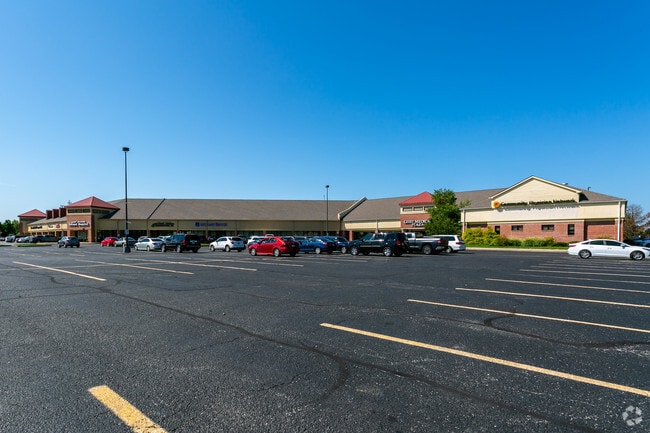
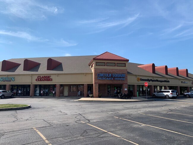
Property Record
8150 Oaklandon Rd, Indianapolis, IN 46236

NEARBY LISTINGS FOR SALE OR LEASE
Property Detail
8150 Oaklandon Rd
49-01-21-123-008.000-400
PT NE1/4 SE1/4 S21 T17 R5 BEG 47 S & 293 W OF NECOR S 230 E 293 S 40 W 215 S 275 E 215 S 40W 215 S 275 E 215 S 40 W 275 S 253 SW 40N IRR 1835 E 40 TO BEG 5.533AC (5.478AC TAX)
Regionalshoppingcenterormallwithanchorstore
Marion
X
Indiana
18097C0089F
5.53 AC
2023
Castleton
2024
Indianapolis
330203
Indianapolis-Carmel-Anderson, IN
33,299 SF
DEMOGRAPHICS near 8150 Oaklandon Rd
1 Mile
3 Mile
5 Mile
2024 Total Population
8,217
48,582
128,833
2029 Population
7,994
50,347
135,973
Pop Growth 2024-2029
(2.71%)
+ 3.63%
+ 5.54%
Average Age
42
40
38
2024 Total Households
3,241
17,700
48,418
HH Growth 2024-2029
(2.81%)
+ 3.32%
+ 5.05%
Median Household Inc
$119,999
$116,816
$98,620
Avg Household Size
2.50
2.70
2.60
2024 Avg HH Vehicles
2.00
2.00
2.00
Median Home Value
$291,486
$301,801
$284,456
Median Year Built
1991
1994
1996
Nearby Places
Map Layers
Map Styles
 Street
 Aerial
- Restaurants
- Banks
- Shops
- Fitness
- Groceries
PUBLIC TRANSPORTATION
AIRPORT
Indianapolis International
DRIVE
WALK
Distance
Indianapolis International
53 min
30.3 mi
Freight Ports
Port of Toledo
DRIVE
WALK
Distance
Port of Toledo
255 min
211.0 mi
SALE & LEASE HISTORY
LISTING DATE
SALE/LEASE

Sep 22, 2020
For Lease
May 16, 2017
For Lease
Nearby Properties
Address
Land Use
TOTAL SIZE
Lot Size
Zoning
Address
Land Use
TOTAL SIZE
Lot Size
Zoning
129,608 SF
54.85 AC
ZO01
Address
Land Use
TOTAL SIZE
Lot Size
Zoning
94,472 SF
15.91 AC
Address
Land Use
TOTAL SIZE
Lot Size
Zoning
43,530 SF
5.06 AC
Address
Land Use
TOTAL SIZE
Lot Size
Zoning
16,836 SF
16.90 AC
Address
Land Use
TOTAL SIZE
Lot Size
Zoning
1,769 SF
18.27 AC
Address
Land Use
TOTAL SIZE
Lot Size
Zoning
88,772 SF
20.05 AC
Address
Land Use
TOTAL SIZE
Lot Size
Zoning
107,364 SF
29.96 AC
Address
Land Use
TOTAL SIZE
Lot Size
Zoning
109,200 SF
4.63 AC
ZO01
Address
Land Use
TOTAL SIZE
Lot Size
Zoning
28,144 SF
10.70 AC
Address
Land Use
TOTAL SIZE
Lot Size
Zoning
192,246 SF
27.51 AC
Address
Land Use
TOTAL SIZE
Lot Size
Zoning
67,241 SF
172.37 AC
Address
Land Use
TOTAL SIZE
Lot Size
Zoning
116,233 SF
5.29 AC
Address
Land Use
TOTAL SIZE
Lot Size
Zoning
40,092 SF
8.44 AC
Address
Land Use
TOTAL SIZE
Lot Size
Zoning
151,107 SF
18.64 AC
Address
Land Use
TOTAL SIZE
Lot Size
Zoning
40,105 SF
10.02 AC
ZO01
Address
Land Use
TOTAL SIZE
Lot Size
Zoning
58,252 SF
4.59 AC
Address
Land Use
TOTAL SIZE
Lot Size
Zoning
52,800 SF
5.28 AC
ZO01
Address
Land Use
TOTAL SIZE
Lot Size
Zoning
152,577 SF
8.94 AC
ZO01
Address
Land Use
TOTAL SIZE
Lot Size
Zoning
64,649 SF
6.95 AC
ZO01
Address
Land Use
TOTAL SIZE
Lot Size
Zoning
38,251 SF
10.45 AC
Address
Land Use
TOTAL SIZE
Lot Size
Zoning
34,412 SF
6.96 AC
Address
Land Use
TOTAL SIZE
Lot Size
Zoning
66,665 SF
7.22 AC
ZO01
Address
Land Use
TOTAL SIZE
Lot Size
Zoning
85,176 SF
6.93 AC
Address
Land Use
TOTAL SIZE
Lot Size
Zoning
25,370 SF
3.50 AC
Address
Land Use
TOTAL SIZE
Lot Size
Zoning
41,664 SF
6.11 AC
Address
Land Use
TOTAL SIZE
Lot Size
Zoning
28,494 SF
50.93 AC
Address
Land Use
TOTAL SIZE
Lot Size
Zoning
55,424 SF
5.20 AC
Address
Land Use
TOTAL SIZE
Lot Size
Zoning
10,373 SF
5.44 AC
Address
Land Use
TOTAL SIZE
Lot Size
Zoning
114,675 SF
17.65 AC
Address
Land Use
TOTAL SIZE
Lot Size
Zoning
19,200 SF
2.33 AC
The World's #1 Commercial Real Estate Marketplace
Connect with us
© 2025 CoStar Group
The information above has been obtained from sources believed reliable. While we do not doubt its accuracy we have not verified it and make no guarantee, warranty or representation about it. It is your responsibility to independently confirm its accuracy and completeness. Any projections, opinions, assumptions, or estimates used are for example only and do not represent the current or future performance of the property. The value of this transaction to you depends on tax and other factors which should be evaluated by your tax, financial, and legal advisors. You and your advisors should conduct a careful, independent investigation of the property to determine to your satisfaction the suitability of the property for your needs.