Property Record
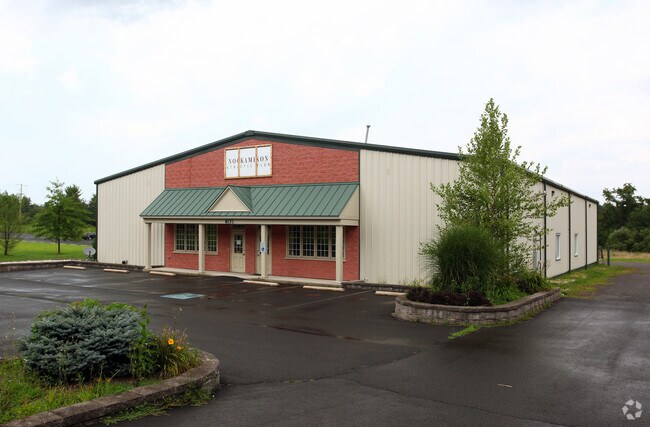
8151 Easton Rd, Ottsville, PA 18942

NEARBY LISTINGS FOR SALE OR LEASE
Property Detail
8151 Easton Rd
Philadelphia-Camden-Wilmington, PA-NJ-DE-MD
Gross Plan
30-015-002-002
1.1883AC LOT 3 GROSS PLAN 147 ON EASTON RD
Warehouse
Bucks
X
Pennsylvania
42017C0160J
3
2024
1.19 AC
2025
Bucks
103700
Philadelphia
8,000 SF
DEMOGRAPHICS near 8151 Easton Rd
1 Mile
3 Mile
5 Mile
2024 Total Population
408
3,294
8,954
2029 Population
398
3,219
8,760
Pop Growth 2024-2029
(2.45%)
(2.28%)
(2.17%)
Average Age
48
48
48
2024 Total Households
172
1,362
3,662
HH Growth 2024-2029
(2.91%)
(2.35%)
(2.21%)
Median Household Inc
$102,439
$107,536
$110,893
Avg Household Size
2.40
2.40
2.40
2024 Avg HH Vehicles
3.00
3.00
3.00
Median Home Value
$406,000
$488,070
$510,587
Median Year Built
1962
1968
1969
Nearby Places
Map Layers
Map Styles
 Street
 Aerial
- Restaurants
- Banks
- Shops
- Fitness
- Groceries
PUBLIC TRANSPORTATION
AIRPORT
Lehigh Valley International
DRIVE
WALK
Distance
Lehigh Valley International
44 min
23.8 mi
Trenton Mercer
DRIVE
WALK
Distance
Trenton Mercer
52 min
28.8 mi
Freight Ports
Port of Philadelphia
DRIVE
WALK
Distance
Port of Philadelphia
70 min
39.0 mi
Nearby Properties
Address
Land Use
TOTAL SIZE
Lot Size
Zoning
Address
Land Use
TOTAL SIZE
Lot Size
Zoning
37,145 SF
13.69 AC
VC
Address
Land Use
TOTAL SIZE
Lot Size
Zoning
64.96 AC
VC
Address
Land Use
TOTAL SIZE
Lot Size
Zoning
12,476 SF
10.23 AC
R
Address
Land Use
TOTAL SIZE
Lot Size
Zoning
44,720 SF
8.45 AC
VC
Address
Land Use
TOTAL SIZE
Lot Size
Zoning
12,452 SF
15.94 AC
VR
Address
Land Use
TOTAL SIZE
Lot Size
Zoning
9,151 SF
5.93 AC
CC
Address
Land Use
TOTAL SIZE
Lot Size
Zoning
11,572 SF
3.84 AC
VC
Address
Land Use
TOTAL SIZE
Lot Size
Zoning
17,287 SF
3.17 AC
VC
Address
Land Use
TOTAL SIZE
Lot Size
Zoning
20,400 SF
4.81 AC
C
Address
Land Use
TOTAL SIZE
Lot Size
Zoning
13,126 SF
21.75 AC
CC
Address
Land Use
TOTAL SIZE
Lot Size
Zoning
18,500 SF
9.20 AC
VC
Address
Land Use
TOTAL SIZE
Lot Size
Zoning
10,920 SF
1.72 AC
R
Address
Land Use
TOTAL SIZE
Lot Size
Zoning
15,918 SF
7.54 AC
VC
Address
Land Use
TOTAL SIZE
Lot Size
Zoning
18 AC
VC
Address
Land Use
TOTAL SIZE
Lot Size
Zoning
5,083 SF
67.54 AC
RA
Address
Land Use
TOTAL SIZE
Lot Size
Zoning
19,993 SF
4 AC
I
Address
Land Use
TOTAL SIZE
Lot Size
Zoning
12,088 SF
2.38 AC
VC
Address
Land Use
TOTAL SIZE
Lot Size
Zoning
9,100 SF
2.30 AC
VC
Address
Land Use
TOTAL SIZE
Lot Size
Zoning
3,360 SF
5 AC
CC
Address
Land Use
TOTAL SIZE
Lot Size
Zoning
11,000 SF
5.25 AC
I
Address
Land Use
TOTAL SIZE
Lot Size
Zoning
20,000 SF
102.16 AC
I
Address
Land Use
TOTAL SIZE
Lot Size
Zoning
9,415 SF
5.01 AC
VR
Address
Land Use
TOTAL SIZE
Lot Size
Zoning
6,987 SF
1.28 AC
VC
Address
Land Use
TOTAL SIZE
Lot Size
Zoning
6,942 SF
1.63 AC
VR
Address
Land Use
TOTAL SIZE
Lot Size
Zoning
14,275 SF
7.31 AC
R
Address
Land Use
TOTAL SIZE
Lot Size
Zoning
7,864 SF
2.06 AC
VC
Address
Land Use
TOTAL SIZE
Lot Size
Zoning
5,353 SF
3.92 AC
RA
Address
Land Use
TOTAL SIZE
Lot Size
Zoning
4,166 SF
12.04 AC
RA
Address
Land Use
TOTAL SIZE
Lot Size
Zoning
8,926 SF
2.95 AC
RA
Address
Land Use
TOTAL SIZE
Lot Size
Zoning
15,228 SF
1.97 AC
VC
The World's #1 Commercial Real Estate Marketplace
Connect with us
© 2026 CoStar Group
The information above has been obtained from sources believed reliable. While we do not doubt its accuracy we have not verified it and make no guarantee, warranty or representation about it. It is your responsibility to independently confirm its accuracy and completeness. Any projections, opinions, assumptions, or estimates used are for example only and do not represent the current or future performance of the property. The value of this transaction to you depends on tax and other factors which should be evaluated by your tax, financial, and legal advisors. You and your advisors should conduct a careful, independent investigation of the property to determine to your satisfaction the suitability of the property for your needs.