Property Record
816 Chenoweth Loop W, The Dalles, OR 97058
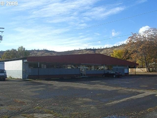

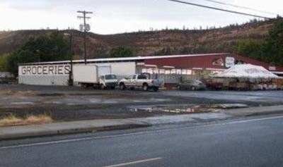

Property Detail
816 Chenoweth Loop W
The Dalles, OR
SECTION 29 TOWNSHIP 2N RANGE 13E QUARTER DB PRCL 7400 MAPTAX LOT: 02N13 E29DB07400 00
2N 13E 29 DB 7400
Wasco
Charitableorganization
Oregon
CG
1.73 AC
0
Oregon East Area
2025
Other Market Areas
970400
NEARBY LISTINGS FOR SALE OR LEASE
DEMOGRAPHICS near 816 Chenoweth Loop W
1 mile
3 mile
5 mile
2025 Total Population
3,789
13,649
20,266
2030 Population
3,668
13,429
19,907
Pop Growth 2025-2030
(3.19%)
(1.61%)
(1.77%)
Average Age
40
41
42
2025 Total Households
1,476
5,278
7,847
HH Growth 2025-2030
(3.39%)
(1.80%)
(1.99%)
Median Household Inc
$43,518
$59,975
$63,929
Avg Household Size
2.50
2.50
2.50
2025 Avg HH Vehicles
2.00
2.00
2.00
Median Home Value
$225,388
$354,300
$380,486
Median Year Built
1978
1970
1970
Nearby Places
Map Layers
Map Styles
 Street
 Aerial
Transit
 Traffic
 Biking
Places
Listings with unknown addresses are not visible on the map
- Restaurants
- Banks
- Shops
- Fitness
- Groceries
SALE & LEASE HISTORY
LISTING DATE
SALE/LEASE

May 26, 2020
For Sale
May 24, 2018
For Lease
May 24, 2017
For Sale
Nearby Properties
Address
Land Use
TOTAL SIZE
Lot Size
Zoning
Address
Land Use
TOTAL SIZE
Lot Size
Zoning
Address
Land Use
TOTAL SIZE
Lot Size
Zoning
Address
Land Use
TOTAL SIZE
Lot Size
Zoning
26.33 AC
Address
Land Use
TOTAL SIZE
Lot Size
Zoning
Address
Land Use
TOTAL SIZE
Lot Size
Zoning
Address
Land Use
TOTAL SIZE
Lot Size
Zoning
Address
Land Use
TOTAL SIZE
Lot Size
Zoning
Address
Land Use
TOTAL SIZE
Lot Size
Zoning
Address
Land Use
TOTAL SIZE
Lot Size
Zoning
Address
Land Use
TOTAL SIZE
Lot Size
Zoning
30.74 AC
I INDUSTRI
Address
Land Use
TOTAL SIZE
Lot Size
Zoning
5.52 AC
CG GENERAL
Address
Land Use
TOTAL SIZE
Lot Size
Zoning
Address
Land Use
TOTAL SIZE
Lot Size
Zoning
9.38 AC
CG GENERAL
Address
Land Use
TOTAL SIZE
Lot Size
Zoning
3.69 AC
RH HIGH/ME
Address
Land Use
TOTAL SIZE
Lot Size
Zoning
Address
Land Use
TOTAL SIZE
Lot Size
Zoning
Address
Land Use
TOTAL SIZE
Lot Size
Zoning
2.10 AC
CG
Address
Land Use
TOTAL SIZE
Lot Size
Zoning
3.49 AC
CG GENERAL
Address
Land Use
TOTAL SIZE
Lot Size
Zoning
4.13 AC
CG GENERAL
Address
Land Use
TOTAL SIZE
Lot Size
Zoning
Address
Land Use
TOTAL SIZE
Lot Size
Zoning
1.20 AC
Address
Land Use
TOTAL SIZE
Lot Size
Zoning
Address
Land Use
TOTAL SIZE
Lot Size
Zoning
4.28 AC
CG GENERAL
Address
Land Use
TOTAL SIZE
Lot Size
Zoning
7.78 AC
CG
Address
Land Use
TOTAL SIZE
Lot Size
Zoning
4.23 AC
Address
Land Use
TOTAL SIZE
Lot Size
Zoning
82.43 AC
I
Address
Land Use
TOTAL SIZE
Lot Size
Zoning
6.69 AC
I
Address
Land Use
TOTAL SIZE
Lot Size
Zoning
2.02 AC
CG
Address
Land Use
TOTAL SIZE
Lot Size
Zoning
1.15 AC
RH
Address
Land Use
TOTAL SIZE
Lot Size
Zoning
3.41 AC
CG GENERAL
The World's #1 Commercial Real Estate Marketplace
Connect with us
© 2026 CoStar Group
The information above has been obtained from sources believed reliable. While we do not doubt its accuracy we have not verified it and make no guarantee, warranty or representation about it. It is your responsibility to independently confirm its accuracy and completeness. Any projections, opinions, assumptions, or estimates used are for example only and do not represent the current or future performance of the property. The value of this transaction to you depends on tax and other factors which should be evaluated by your tax, financial, and legal advisors. You and your advisors should conduct a careful, independent investigation of the property to determine to your satisfaction the suitability of the property for your needs.