Property Record
8180 High Pointe Dr, Newburgh, IN 47630


NEARBY LISTINGS FOR SALE OR LEASE
Property Detail
8180 High Pointe Dr
Evansville, IN-KY
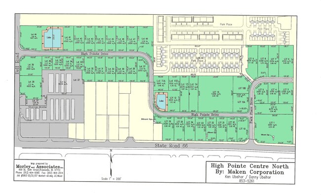
Park Plac Iv Pud
87-12-22-420-013.000-019
LOT 13 PARK PLACE IV PUD .41 A
Commercialacreage
Warrick
X
Indiana
21101C0110F
13
2024
0.41 AC
2024
Warrick County
030707
Evansville
DEMOGRAPHICS near 8180 High Pointe Dr
1 Mile
3 Mile
5 Mile
2024 Total Population
8,119
37,148
60,624
2029 Population
8,473
38,778
62,473
Pop Growth 2024-2029
+ 4.36%
+ 4.39%
+ 3.05%
Average Age
42
41
41
2024 Total Households
3,257
14,456
24,619
HH Growth 2024-2029
+ 4.42%
+ 4.36%
+ 2.85%
Median Household Inc
$88,641
$97,188
$81,170
Avg Household Size
2.40
2.50
2.40
2024 Avg HH Vehicles
2.00
2.00
2.00
Median Home Value
$237,142
$246,434
$217,211
Median Year Built
1992
1991
1986
Nearby Places
Map Layers
Map Styles
 Street
 Aerial
- Restaurants
- Banks
- Shops
- Fitness
- Groceries
PUBLIC TRANSPORTATION
AIRPORT
Evansville Regional
DRIVE
WALK
Distance
Evansville Regional
20 min
11.8 mi
Freight Ports
Port of Toledo
DRIVE
WALK
Distance
Port of Toledo
456 min
392.8 mi
Nearby Properties
Address
Land Use
TOTAL SIZE
Lot Size
Zoning
Address
Land Use
TOTAL SIZE
Lot Size
Zoning
43,824 SF
32.02 AC
Address
Land Use
TOTAL SIZE
Lot Size
Zoning
6,110 SF
28.46 AC
Address
Land Use
TOTAL SIZE
Lot Size
Zoning
136,449 SF
14.07 AC
Address
Land Use
TOTAL SIZE
Lot Size
Zoning
130,000 SF
Address
Land Use
TOTAL SIZE
Lot Size
Zoning
75,107 SF
13.68 AC
Address
Land Use
TOTAL SIZE
Lot Size
Zoning
3,940 SF
17.67 AC
Address
Land Use
TOTAL SIZE
Lot Size
Zoning
30,039 SF
6.67 AC
Address
Land Use
TOTAL SIZE
Lot Size
Zoning
3,260 SF
9.96 AC
Address
Land Use
TOTAL SIZE
Lot Size
Zoning
31,950 SF
6.22 AC
Address
Land Use
TOTAL SIZE
Lot Size
Zoning
26,664 SF
10.81 AC
Address
Land Use
TOTAL SIZE
Lot Size
Zoning
49,154 SF
3.60 AC
Address
Land Use
TOTAL SIZE
Lot Size
Zoning
43,230 SF
7.08 AC
Address
Land Use
TOTAL SIZE
Lot Size
Zoning
4,389 SF
9.09 AC
Address
Land Use
TOTAL SIZE
Lot Size
Zoning
114,160 SF
11 AC
Address
Land Use
TOTAL SIZE
Lot Size
Zoning
45,431 SF
22.08 AC
Address
Land Use
TOTAL SIZE
Lot Size
Zoning
28,632 SF
6.27 AC
Address
Land Use
TOTAL SIZE
Lot Size
Zoning
16,918 SF
17.66 AC
Address
Land Use
TOTAL SIZE
Lot Size
Zoning
130,978 SF
24.94 AC
Address
Land Use
TOTAL SIZE
Lot Size
Zoning
197,528 SF
21.55 AC
Address
Land Use
TOTAL SIZE
Lot Size
Zoning
61,299 SF
2.22 AC
Address
Land Use
TOTAL SIZE
Lot Size
Zoning
99,714 SF
5 AC
Address
Land Use
TOTAL SIZE
Lot Size
Zoning
32,117 SF
12.88 AC
Address
Land Use
TOTAL SIZE
Lot Size
Zoning
31,864 SF
5.40 AC
Address
Land Use
TOTAL SIZE
Lot Size
Zoning
62,912 SF
3.29 AC
Address
Land Use
TOTAL SIZE
Lot Size
Zoning
72,946 SF
2.64 AC
Address
Land Use
TOTAL SIZE
Lot Size
Zoning
90,181 SF
10.66 AC
Address
Land Use
TOTAL SIZE
Lot Size
Zoning
88,964 SF
8.72 AC
Address
Land Use
TOTAL SIZE
Lot Size
Zoning
28,632 SF
1.22 AC
Address
Land Use
TOTAL SIZE
Lot Size
Zoning
45,627 SF
5.89 AC
Address
Land Use
TOTAL SIZE
Lot Size
Zoning
15,784 SF
7.06 AC
The World's #1 Commercial Real Estate Marketplace
Connect with us
© 2026 CoStar Group
The information above has been obtained from sources believed reliable. While we do not doubt its accuracy we have not verified it and make no guarantee, warranty or representation about it. It is your responsibility to independently confirm its accuracy and completeness. Any projections, opinions, assumptions, or estimates used are for example only and do not represent the current or future performance of the property. The value of this transaction to you depends on tax and other factors which should be evaluated by your tax, financial, and legal advisors. You and your advisors should conduct a careful, independent investigation of the property to determine to your satisfaction the suitability of the property for your needs.