Property Record
8160 Twin Eagles Ct, Reno, NV 89523
Property Detail
8160 Twin Eagles Ct
Reno, NV
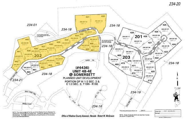
4B-4E @ SOMERSETT LT 437
232-541-15
Washoe
Residentialacreage
Nevada
PD
437
B and X Area of moderate flood hazard, usually the area between the limits of the 100-year and 500-year floods.
0.61 AC
0
N Outlying Washoe County
2026
Reno/Sparks
002408
NEARBY LISTINGS FOR SALE OR LEASE
DEMOGRAPHICS near 8160 Twin Eagles Ct
1 mile
3 mile
5 mile
2025 Total Population
3,191
21,681
52,947
2030 Population
3,297
22,247
54,586
Pop Growth 2025-2030
+ 3.32%
+ 2.61%
+ 3.10%
Average Age
48
45
42
2025 Total Households
1,275
9,033
21,820
HH Growth 2025-2030
+ 3.53%
+ 2.78%
+ 3.22%
Median Household Inc
$160,811
$115,406
$95,426
Avg Household Size
2.50
2.40
2.40
2025 Avg HH Vehicles
2.00
2.00
2.00
Median Home Value
$787,621
$706,996
$662,850
Median Year Built
2010
2003
1998
Nearby Places
Map Layers
Map Styles
 Street
 Aerial
Layers
 Traffic
 Biking
Places
Listings with unknown addresses are not visible on the map
- Restaurants
- Banks
- Shops
- Fitness
- Groceries
PUBLIC TRANSPORTATION
COMMUTER RAIL
Reno (California Zephyr - Amtrak)
Drive
Walk
Distance
Reno (California Zephyr - Amtrak)
17 min
8.9 mi
AIRPORT
Reno/Tahoe International
Drive
Walk
Distance
Reno/Tahoe International
39 min
15.4 mi
Freight Ports
Port of Stockton
Drive
Walk
Distance
Port of Stockton
210 min
178.4 mi
Nearby Properties
Address
Land Use
TOTAL SIZE
Lot Size
Zoning
Address
Land Use
TOTAL SIZE
Lot Size
Zoning
331,462 SF
20.10 AC
PD
Address
Land Use
TOTAL SIZE
Lot Size
Zoning
252,869 SF
10.77 AC
MF14 97% /
Address
Land Use
TOTAL SIZE
Lot Size
Zoning
317,507 SF
19.43 AC
MF14
Address
Land Use
TOTAL SIZE
Lot Size
Zoning
359,209 SF
8.83 AC
HC
Address
Land Use
TOTAL SIZE
Lot Size
Zoning
305,060 SF
23.90 AC
SPD
Address
Land Use
TOTAL SIZE
Lot Size
Zoning
260,382 SF
18.77 AC
PD
Address
Land Use
TOTAL SIZE
Lot Size
Zoning
342,672 SF
18.39 AC
MS
Address
Land Use
TOTAL SIZE
Lot Size
Zoning
92,930 SF
2.68 AC
MF21
Address
Land Use
TOTAL SIZE
Lot Size
Zoning
247,315 SF
20.74 AC
MF14
Address
Land Use
TOTAL SIZE
Lot Size
Zoning
77,545 SF
4.82 AC
PF
Address
Land Use
TOTAL SIZE
Lot Size
Zoning
221,000 SF
13.78 AC
IC
Address
Land Use
TOTAL SIZE
Lot Size
Zoning
200,840 SF
40.35 AC
LLR1
Address
Land Use
TOTAL SIZE
Lot Size
Zoning
206,891 SF
13.81 AC
IC
Address
Land Use
TOTAL SIZE
Lot Size
Zoning
182,000 SF
13.56 AC
IC
Address
Land Use
TOTAL SIZE
Lot Size
Zoning
125,620 SF
12.96 AC
PF
Address
Land Use
TOTAL SIZE
Lot Size
Zoning
62,066 SF
13.42 AC
PF
Address
Land Use
TOTAL SIZE
Lot Size
Zoning
182,656 SF
10.50 AC
IC
Address
Land Use
TOTAL SIZE
Lot Size
Zoning
64,946 SF
6.95 AC
SPD
Address
Land Use
TOTAL SIZE
Lot Size
Zoning
142,558 SF
10.55 AC
MF14
Address
Land Use
TOTAL SIZE
Lot Size
Zoning
45,250 SF
4.35 AC
PD
Address
Land Use
TOTAL SIZE
Lot Size
Zoning
58,157 SF
2.30 AC
PD
Address
Land Use
TOTAL SIZE
Lot Size
Zoning
122,225 SF
5.85 AC
MS
Address
Land Use
TOTAL SIZE
Lot Size
Zoning
57,578 SF
10.07 AC
PF
Address
Land Use
TOTAL SIZE
Lot Size
Zoning
45,121 SF
3.39 AC
NC
Address
Land Use
TOTAL SIZE
Lot Size
Zoning
115,848 SF
9.61 AC
PD
Address
Land Use
TOTAL SIZE
Lot Size
Zoning
14,540 SF
8.90 AC
HC
Address
Land Use
TOTAL SIZE
Lot Size
Zoning
43,394 SF
2.44 AC
PD
Address
Land Use
TOTAL SIZE
Lot Size
Zoning
31,732 SF
2.84 AC
NC
Address
Land Use
TOTAL SIZE
Lot Size
Zoning
56,358 SF
11.25 AC
PF
Address
Land Use
TOTAL SIZE
Lot Size
Zoning
120,296 SF
5.12 AC
PD
The World's #1 Commercial Real Estate Marketplace
Connect with us
© 2026 CoStar Group
The information above has been obtained from sources believed reliable. While we do not doubt its accuracy we have not verified it and make no guarantee, warranty or representation about it. It is your responsibility to independently confirm its accuracy and completeness. Any projections, opinions, assumptions, or estimates used are for example only and do not represent the current or future performance of the property. The value of this transaction to you depends on tax and other factors which should be evaluated by your tax, financial, and legal advisors. You and your advisors should conduct a careful, independent investigation of the property to determine to your satisfaction the suitability of the property for your needs.