Property Record
6033 Camino Real, Jurupa Valley, CA 92509

Property Detail
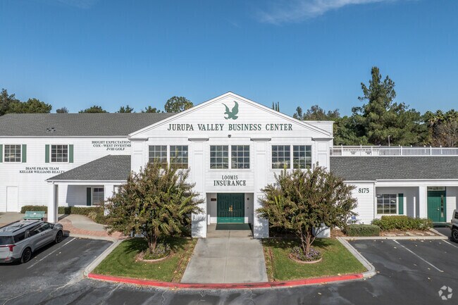
6033 Camino Real
166-330-004
1.05 ACRES GRS IN PAR 4 PM 060/050 PM 12017
Financialbuilding
RIVERSIDE
C1CP
California
B and X Area of moderate flood hazard, usually the area between the limits of the 100-year and 500-year floods.
4
2024
1.05 AC
2025
Riverside
040302
Inland Empire (California)
7,937 SF
Riverside-San Bernardino-Ontario, CA
NEARBY LISTINGS FOR SALE OR LEASE
DEMOGRAPHICS near 6033 Camino Real
1 mile
3 mile
5 mile
2025 Total Population
10,644
89,977
285,363
2030 Population
10,967
91,557
290,377
Pop Growth 2025-2030
+ 3.03%
+ 1.76%
+ 1.76%
Average Age
38
36
36
2025 Total Households
3,009
23,335
78,892
HH Growth 2025-2030
+ 2.66%
+ 1.35%
+ 1.36%
Median Household Inc
$105,948
$93,855
$91,744
Avg Household Size
3.40
3.60
3.40
2025 Avg HH Vehicles
3.00
3.00
2.00
Median Home Value
$626,797
$612,057
$616,559
Median Year Built
1984
1975
1975
Nearby Places
Map Layers
Map Styles
 Street
 Aerial
Layers
 Traffic
 Biking
Places
Listings with unknown addresses are not visible on the map
- Restaurants
- Banks
- Shops
- Fitness
- Groceries
PUBLIC TRANSPORTATION
COMMUTER RAIL
Pedley (Riverside Line - Southern California Regional Rail Authority (Metrolink))
Drive
Walk
Distance
Pedley (Riverside Line - Southern California Regional Rail Authority (Metrolink))
5 min
2.1 mi
Riverside-La Sierra (91 Line - Southern California Regional Rail Authority (Metrolink), Inland Empire-Orange County Line - Southern California Regional Rail Authority (Metrolink))
Drive
Walk
Distance
Riverside-La Sierra (91 Line - Southern California Regional Rail Authority (Metrolink), Inland Empire-Orange County Line - Southern California Regional Rail Authority (Metrolink))
18 min
8.0 mi
AIRPORT
Ontario International
Drive
Walk
Distance
Ontario International
20 min
11.4 mi
Freight Ports
Port of Long Beach
Drive
Walk
Distance
Port of Long Beach
1 min
44.6 mi
SALE & LEASE HISTORY
LISTING DATE
SALE/LEASE

Sep 25, 2016
For Lease
Oct 25, 2017
For Lease
Mar 09, 2022
For Lease
Apr 28, 2022
For Lease
Nearby Properties
Address
Land Use
TOTAL SIZE
Lot Size
Zoning
Address
Land Use
TOTAL SIZE
Lot Size
Zoning
43,152 SF
6.76 AC
R3S2
Address
Land Use
TOTAL SIZE
Lot Size
Zoning
855,621 SF
46.79 AC
I
Address
Land Use
TOTAL SIZE
Lot Size
Zoning
179,589 SF
18.62 AC
Address
Land Use
TOTAL SIZE
Lot Size
Zoning
157,112 SF
10.83 AC
Address
Land Use
TOTAL SIZE
Lot Size
Zoning
8.75 AC
R1065
Address
Land Use
TOTAL SIZE
Lot Size
Zoning
14,068 SF
6.61 AC
R3
Address
Land Use
TOTAL SIZE
Lot Size
Zoning
110,680 SF
11.88 AC
MP
Address
Land Use
TOTAL SIZE
Lot Size
Zoning
63,718 SF
7.25 AC
R3
Address
Land Use
TOTAL SIZE
Lot Size
Zoning
18,480 SF
7.19 AC
Address
Land Use
TOTAL SIZE
Lot Size
Zoning
80,257 SF
5.02 AC
C1CP
Address
Land Use
TOTAL SIZE
Lot Size
Zoning
40,024 SF
4.84 AC
Address
Land Use
TOTAL SIZE
Lot Size
Zoning
149,829 SF
11.60 AC
Address
Land Use
TOTAL SIZE
Lot Size
Zoning
77,640 SF
10.11 AC
R1065
Address
Land Use
TOTAL SIZE
Lot Size
Zoning
97,459 SF
3.89 AC
Address
Land Use
TOTAL SIZE
Lot Size
Zoning
81,250 SF
6.22 AC
Address
Land Use
TOTAL SIZE
Lot Size
Zoning
130,900 SF
15.08 AC
A1R
Address
Land Use
TOTAL SIZE
Lot Size
Zoning
6.38 AC
Address
Land Use
TOTAL SIZE
Lot Size
Zoning
62,619 SF
3.08 AC
C1CP
Address
Land Use
TOTAL SIZE
Lot Size
Zoning
86,590 SF
5.63 AC
AIR
Address
Land Use
TOTAL SIZE
Lot Size
Zoning
144,158 SF
8.90 AC
Address
Land Use
TOTAL SIZE
Lot Size
Zoning
58,035 SF
1.75 AC
Address
Land Use
TOTAL SIZE
Lot Size
Zoning
27,802 SF
5.17 AC
Address
Land Use
TOTAL SIZE
Lot Size
Zoning
6,664 SF
15.89 AC
C1CP
Address
Land Use
TOTAL SIZE
Lot Size
Zoning
88,522 SF
20.89 AC
M1
Address
Land Use
TOTAL SIZE
Lot Size
Zoning
48,434 SF
2.33 AC
C1CP
Address
Land Use
TOTAL SIZE
Lot Size
Zoning
80,017 SF
3.50 AC
R1065
Address
Land Use
TOTAL SIZE
Lot Size
Zoning
77,146 SF
3.50 AC
R1065
Address
Land Use
TOTAL SIZE
Lot Size
Zoning
16.76 AC
MSC
The World's #1 Commercial Real Estate Marketplace
Connect with us
© 2026 CoStar Group
The information above has been obtained from sources believed reliable. While we do not doubt its accuracy we have not verified it and make no guarantee, warranty or representation about it. It is your responsibility to independently confirm its accuracy and completeness. Any projections, opinions, assumptions, or estimates used are for example only and do not represent the current or future performance of the property. The value of this transaction to you depends on tax and other factors which should be evaluated by your tax, financial, and legal advisors. You and your advisors should conduct a careful, independent investigation of the property to determine to your satisfaction the suitability of the property for your needs.