Property Record
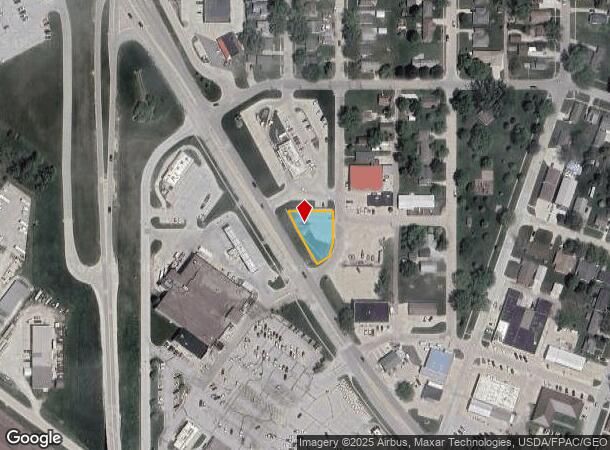
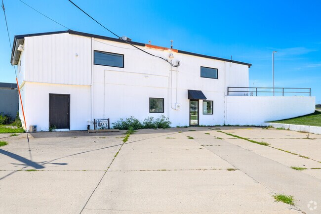
818 W Us Highway 30, Carroll, IA 51401

NEARBY LISTINGS FOR SALE OR LEASE
Property Detail
818 W Us Highway 30
Carroll, IA
Westlawn Addition
06-24-302-003
WESTLAWN ADDITION BLOCK 1 PT OF LOTS 1, 2 & 3 & VAC 9TH ST BET BLKS 5 & 8 LY E OF HWAY 30
Commercialnec
Carroll
X
Iowa
19027C0134C
1-3
2025
0.30 AC
2025
Iowa West Area
960400
Other Market Areas
2,070 SF
DEMOGRAPHICS near 818 W Us Highway 30
1 Mile
3 Mile
5 Mile
2024 Total Population
5,697
10,976
11,441
2029 Population
5,673
10,905
11,350
Pop Growth 2024-2029
(0.42%)
(0.65%)
(0.80%)
Average Age
41
42
42
2024 Total Households
2,458
4,729
4,917
HH Growth 2024-2029
(0.41%)
(0.66%)
(0.79%)
Median Household Inc
$46,890
$56,827
$58,198
Avg Household Size
2.20
2.20
2.20
2024 Avg HH Vehicles
2.00
2.00
2.00
Median Home Value
$145,714
$169,480
$170,933
Median Year Built
1962
1972
1971
Nearby Places
Map Layers
Map Styles
 Street
 Aerial
- Restaurants
- Banks
- Shops
- Fitness
- Groceries
SALE & LEASE HISTORY
LISTING DATE
SALE/LEASE

Mar 30, 2023
For Sale
Nearby Properties
Address
Land Use
TOTAL SIZE
Lot Size
Zoning
Address
Land Use
TOTAL SIZE
Lot Size
Zoning
5,328 SF
32.30 AC
Address
Land Use
TOTAL SIZE
Lot Size
Zoning
22,904 SF
2.90 AC
Address
Land Use
TOTAL SIZE
Lot Size
Zoning
157,615 SF
20.60 AC
Address
Land Use
TOTAL SIZE
Lot Size
Zoning
2,080 SF
51.90 AC
Address
Land Use
TOTAL SIZE
Lot Size
Zoning
37,316 SF
13.90 AC
Address
Land Use
TOTAL SIZE
Lot Size
Zoning
38,845 SF
9.80 AC
Address
Land Use
TOTAL SIZE
Lot Size
Zoning
16,926 SF
1.20 AC
Address
Land Use
TOTAL SIZE
Lot Size
Zoning
58,766 SF
4.40 AC
Address
Land Use
TOTAL SIZE
Lot Size
Zoning
72,588 SF
7 AC
Address
Land Use
TOTAL SIZE
Lot Size
Zoning
13,680 SF
1.20 AC
Address
Land Use
TOTAL SIZE
Lot Size
Zoning
95,109 SF
8.50 AC
Address
Land Use
TOTAL SIZE
Lot Size
Zoning
43,644 SF
4.60 AC
Address
Land Use
TOTAL SIZE
Lot Size
Zoning
43,491 SF
7 AC
Address
Land Use
TOTAL SIZE
Lot Size
Zoning
45,202 SF
5.30 AC
Address
Land Use
TOTAL SIZE
Lot Size
Zoning
11,960 SF
18.60 AC
Address
Land Use
TOTAL SIZE
Lot Size
Zoning
39,744 SF
4.20 AC
Address
Land Use
TOTAL SIZE
Lot Size
Zoning
39,722 SF
4.10 AC
Address
Land Use
TOTAL SIZE
Lot Size
Zoning
3,304 SF
3.40 AC
Address
Land Use
TOTAL SIZE
Lot Size
Zoning
6,810 SF
0.60 AC
Address
Land Use
TOTAL SIZE
Lot Size
Zoning
2,880 SF
3.80 AC
Address
Land Use
TOTAL SIZE
Lot Size
Zoning
40,880 SF
4.70 AC
Address
Land Use
TOTAL SIZE
Lot Size
Zoning
12,090 SF
4.20 AC
Address
Land Use
TOTAL SIZE
Lot Size
Zoning
10,940 SF
1 AC
Address
Land Use
TOTAL SIZE
Lot Size
Zoning
1,904 SF
1.70 AC
Address
Land Use
TOTAL SIZE
Lot Size
Zoning
14,456 SF
1.20 AC
Address
Land Use
TOTAL SIZE
Lot Size
Zoning
26,616 SF
3.50 AC
Address
Land Use
TOTAL SIZE
Lot Size
Zoning
13,280 SF
4.40 AC
Address
Land Use
TOTAL SIZE
Lot Size
Zoning
26,000 SF
13.50 AC
Address
Land Use
TOTAL SIZE
Lot Size
Zoning
28,990 SF
4.70 AC
Address
Land Use
TOTAL SIZE
Lot Size
Zoning
37,050 SF
6.70 AC
The World's #1 Commercial Real Estate Marketplace
Connect with us
© 2025 CoStar Group
The information above has been obtained from sources believed reliable. While we do not doubt its accuracy we have not verified it and make no guarantee, warranty or representation about it. It is your responsibility to independently confirm its accuracy and completeness. Any projections, opinions, assumptions, or estimates used are for example only and do not represent the current or future performance of the property. The value of this transaction to you depends on tax and other factors which should be evaluated by your tax, financial, and legal advisors. You and your advisors should conduct a careful, independent investigation of the property to determine to your satisfaction the suitability of the property for your needs.