Property Record
8184 N Dixie Hwy, Newport, MI 48166
Current Lease Availabilities
NEARBY LISTINGS FOR SALE OR LEASE
-
-
View all Newport listings for lease on LoopNet.com
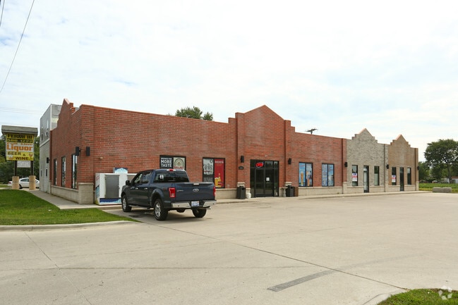
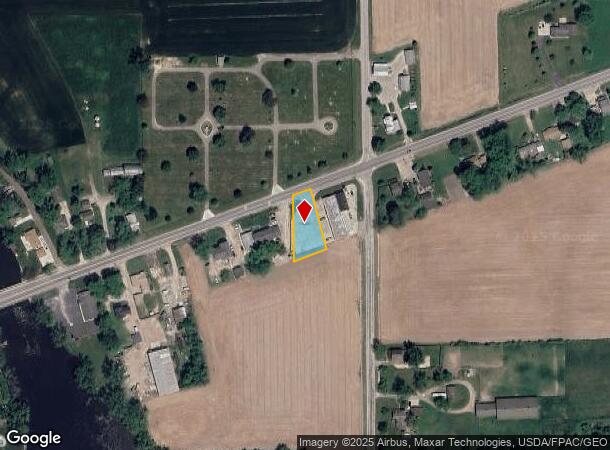
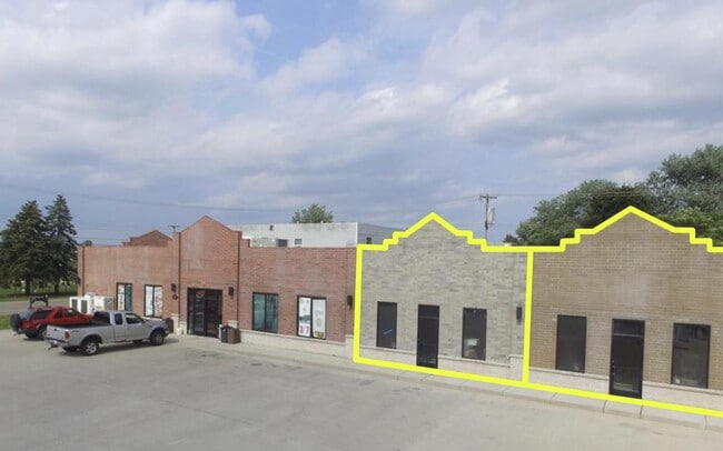
Property Detail
8184 N Dixie Hwy
Monroe, MI
994-828 1044-431 TO 433 1044-767 TO 769 SEC 6 T6S R10E LOT BD N BY M 56 E & S BY EMERICK W BY BEAUBIEN
03-006-015-00
Monroe
Commercialacreage
Michigan
X
bd
26115C0256F
0.33 AC
2024
Monroe County
2025
Detroit
830200
DEMOGRAPHICS near 8184 N Dixie Hwy
1 Mile
3 Mile
5 Mile
2024 Total Population
1,540
7,340
21,845
2029 Population
1,571
7,498
22,254
Pop Growth 2024-2029
+ 2.01%
+ 2.15%
+ 1.87%
Average Age
40
40
40
2024 Total Households
564
2,737
8,500
HH Growth 2024-2029
+ 1.95%
+ 2.08%
+ 1.84%
Median Household Inc
$96,906
$89,991
$68,444
Avg Household Size
2.70
2.70
2.50
2024 Avg HH Vehicles
3.00
2.00
2.00
Median Home Value
$251,871
$232,404
$193,945
Median Year Built
1993
1993
1988
Nearby Places
Map Layers
Map Styles
 Street
 Aerial
- Restaurants
- Banks
- Shops
- Fitness
- Groceries
PUBLIC TRANSPORTATION
AIRPORT
Detroit Metro Wayne County
DRIVE
WALK
Distance
Detroit Metro Wayne County
27 min
20.5 mi
Windsor International
DRIVE
WALK
Distance
Windsor International
58 min
39.8 mi
Freight Ports
Port of Toledo
DRIVE
WALK
Distance
Port of Toledo
46 min
33.5 mi
Nearby Properties
Address
Land Use
TOTAL SIZE
Lot Size
Zoning
Address
Land Use
TOTAL SIZE
Lot Size
Zoning
90.57 AC
PS PUBLIC
Address
Land Use
TOTAL SIZE
Lot Size
Zoning
Address
Land Use
TOTAL SIZE
Lot Size
Zoning
453,206 SF
156.60 AC
AG
Address
Land Use
TOTAL SIZE
Lot Size
Zoning
720,420 SF
71.34 AC
LM-LIGHT M
Address
Land Use
TOTAL SIZE
Lot Size
Zoning
100,407 SF
16.34 AC
Address
Land Use
TOTAL SIZE
Lot Size
Zoning
17.91 AC
A-AGRICULT
Address
Land Use
TOTAL SIZE
Lot Size
Zoning
3,272 SF
121.75 AC
MHP
Address
Land Use
TOTAL SIZE
Lot Size
Zoning
8,788 SF
594 AC
Address
Land Use
TOTAL SIZE
Lot Size
Zoning
Address
Land Use
TOTAL SIZE
Lot Size
Zoning
5,712 SF
0.84 AC
Address
Land Use
TOTAL SIZE
Lot Size
Zoning
8,048 SF
148.21 AC
Address
Land Use
TOTAL SIZE
Lot Size
Zoning
16,239 SF
2.71 AC
Address
Land Use
TOTAL SIZE
Lot Size
Zoning
13,730 SF
2.43 AC
Address
Land Use
TOTAL SIZE
Lot Size
Zoning
2,148 SF
94.44 AC
I1
Address
Land Use
TOTAL SIZE
Lot Size
Zoning
787 AC
PS PUBLIC
Address
Land Use
TOTAL SIZE
Lot Size
Zoning
Address
Land Use
TOTAL SIZE
Lot Size
Zoning
6,109 SF
1.20 AC
Address
Land Use
TOTAL SIZE
Lot Size
Zoning
154.42 AC
AG
Address
Land Use
TOTAL SIZE
Lot Size
Zoning
1,562 SF
83.97 AC
A-AGRICULT
Address
Land Use
TOTAL SIZE
Lot Size
Zoning
3,885 SF
1.26 AC
Address
Land Use
TOTAL SIZE
Lot Size
Zoning
2,135 SF
71.24 AC
A-AGRICULT
Address
Land Use
TOTAL SIZE
Lot Size
Zoning
3,347 SF
13.62 AC
A-AGRICULT
Address
Land Use
TOTAL SIZE
Lot Size
Zoning
2,294 SF
60.36 AC
A-AGRICULT
Address
Land Use
TOTAL SIZE
Lot Size
Zoning
Address
Land Use
TOTAL SIZE
Lot Size
Zoning
2,926 SF
77.80 AC
AG
Address
Land Use
TOTAL SIZE
Lot Size
Zoning
8,256 SF
0.68 AC
Address
Land Use
TOTAL SIZE
Lot Size
Zoning
2,048 SF
106.06 AC
Address
Land Use
TOTAL SIZE
Lot Size
Zoning
136.85 AC
Address
Land Use
TOTAL SIZE
Lot Size
Zoning
1,200 SF
158.12 AC
AG
Address
Land Use
TOTAL SIZE
Lot Size
Zoning
114 AC
AG
The World's #1 Commercial Real Estate Marketplace
Connect with us
© 2025 CoStar Group
The information above has been obtained from sources believed reliable. While we do not doubt its accuracy we have not verified it and make no guarantee, warranty or representation about it. It is your responsibility to independently confirm its accuracy and completeness. Any projections, opinions, assumptions, or estimates used are for example only and do not represent the current or future performance of the property. The value of this transaction to you depends on tax and other factors which should be evaluated by your tax, financial, and legal advisors. You and your advisors should conduct a careful, independent investigation of the property to determine to your satisfaction the suitability of the property for your needs.