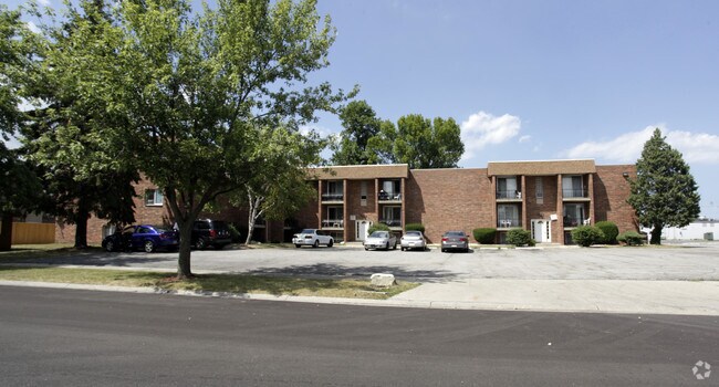
Property Record
819 E 38Th Pl, Griffith, IN 46319

NEARBY LISTINGS FOR SALE OR LEASE
Property Detail
819 E 38Th Pl
Chicago-Naperville-Elgin, IL-IN
Pine Ridge Add
45-07-26-205-006.000-006
PINE RIDGE ADD TO GRIFFITH WEST 76.55 FT OF EAST 80FT LOT 8
Parkinglot
Lake
X
Indiana
18089C0141F
8
2024
0.27 AC
2025
Griffith
041002
Chicago
DEMOGRAPHICS near 819 E 38Th Pl
1 Mile
3 Mile
5 Mile
2024 Total Population
10,404
54,111
176,940
2029 Population
10,382
54,122
178,510
Pop Growth 2024-2029
(0.21%)
+ 0.02%
+ 0.89%
Average Age
38
40
40
2024 Total Households
4,380
22,068
70,875
HH Growth 2024-2029
(0.30%)
(0.06%)
+ 0.86%
Median Household Inc
$58,276
$60,287
$56,116
Avg Household Size
2.40
2.40
2.40
2024 Avg HH Vehicles
2.00
2.00
2.00
Median Home Value
$175,247
$173,099
$173,079
Median Year Built
1967
1963
1963
Nearby Places
Map Layers
Map Styles
 Street
 Aerial
- Restaurants
- Banks
- Shops
- Fitness
- Groceries
PUBLIC TRANSPORTATION
COMMUTER RAIL
Clark Road (Gary) Station (South Shore Line - Northern Indiana Commuter Transportation District (South Shore Line))
DRIVE
WALK
Distance
Clark Road (Gary) Station (South Shore Line - Northern Indiana Commuter Transportation District (South Shore Line))
11 min
6.6 mi
AIRPORT
Chicago Midway International
DRIVE
WALK
Distance
Chicago Midway International
48 min
31.7 mi
Freight Ports
Port Milwaukee
DRIVE
WALK
Distance
Port Milwaukee
148 min
115.8 mi
Nearby Properties
Address
Land Use
TOTAL SIZE
Lot Size
Zoning
Address
Land Use
TOTAL SIZE
Lot Size
Zoning
233,023 SF
37.73 AC
Address
Land Use
TOTAL SIZE
Lot Size
Zoning
233,767 SF
37.03 AC
Address
Land Use
TOTAL SIZE
Lot Size
Zoning
80,444 SF
13.41 AC
R3
Address
Land Use
TOTAL SIZE
Lot Size
Zoning
77,091 SF
2.08 AC
Address
Land Use
TOTAL SIZE
Lot Size
Zoning
217,104 SF
10.45 AC
Address
Land Use
TOTAL SIZE
Lot Size
Zoning
79,169 SF
2.76 AC
Address
Land Use
TOTAL SIZE
Lot Size
Zoning
105,000 SF
2.90 AC
Address
Land Use
TOTAL SIZE
Lot Size
Zoning
34,116 SF
73.40 AC
Address
Land Use
TOTAL SIZE
Lot Size
Zoning
79,059 SF
7.07 AC
R3
Address
Land Use
TOTAL SIZE
Lot Size
Zoning
167,108 SF
10.18 AC
Address
Land Use
TOTAL SIZE
Lot Size
Zoning
69,576 SF
2.55 AC
Address
Land Use
TOTAL SIZE
Lot Size
Zoning
53,096 SF
8.64 AC
R3
Address
Land Use
TOTAL SIZE
Lot Size
Zoning
60,234 SF
9.01 AC
Address
Land Use
TOTAL SIZE
Lot Size
Zoning
33,920 SF
83.34 AC
Address
Land Use
TOTAL SIZE
Lot Size
Zoning
55,656 SF
1.99 AC
R3
Address
Land Use
TOTAL SIZE
Lot Size
Zoning
74,229 SF
10.04 AC
Address
Land Use
TOTAL SIZE
Lot Size
Zoning
61,425 SF
3.29 AC
Address
Land Use
TOTAL SIZE
Lot Size
Zoning
44,960 SF
4.80 AC
Address
Land Use
TOTAL SIZE
Lot Size
Zoning
111,363 SF
9.60 AC
Address
Land Use
TOTAL SIZE
Lot Size
Zoning
47,260 SF
1.61 AC
R3
Address
Land Use
TOTAL SIZE
Lot Size
Zoning
108,072 SF
5.76 AC
Address
Land Use
TOTAL SIZE
Lot Size
Zoning
39,036 SF
2.34 AC
Address
Land Use
TOTAL SIZE
Lot Size
Zoning
247,640 SF
22.88 AC
Address
Land Use
TOTAL SIZE
Lot Size
Zoning
42,886 SF
1.60 AC
R3
Address
Land Use
TOTAL SIZE
Lot Size
Zoning
123,848 SF
10.85 AC
Address
Land Use
TOTAL SIZE
Lot Size
Zoning
38,088 SF
2.60 AC
Address
Land Use
TOTAL SIZE
Lot Size
Zoning
83,120 SF
6 AC
Address
Land Use
TOTAL SIZE
Lot Size
Zoning
76,282 SF
2.55 AC
Address
Land Use
TOTAL SIZE
Lot Size
Zoning
24,964 SF
3.72 AC
Address
Land Use
TOTAL SIZE
Lot Size
Zoning
125,219 SF
11.95 AC
The World's #1 Commercial Real Estate Marketplace
Connect with us
© 2026 CoStar Group
The information above has been obtained from sources believed reliable. While we do not doubt its accuracy we have not verified it and make no guarantee, warranty or representation about it. It is your responsibility to independently confirm its accuracy and completeness. Any projections, opinions, assumptions, or estimates used are for example only and do not represent the current or future performance of the property. The value of this transaction to you depends on tax and other factors which should be evaluated by your tax, financial, and legal advisors. You and your advisors should conduct a careful, independent investigation of the property to determine to your satisfaction the suitability of the property for your needs.