Property Record
8191 S State Route 48, Maineville, OH 45039

Save to a Folder
{{folder.Name}}
{{folder.ListingIds.length}} Properties
{{folder.ListingIds.length}} Property
Create a New Folder
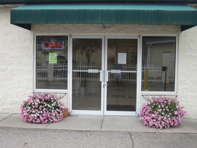
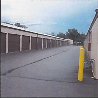
Property Detail
8191 S State Route 48
Cincinnati, OH-KY-IN
MAINEVILLE CORP. LOT 53
16-03-226-014
Warren
Commercialnec
Ohio
B and X Area of moderate flood hazard, usually the area between the limits of the 100-year and 500-year floods.
53
2024
0.39 AC
2025
East
032203
Cincinnati/Dayton
5,432 SF
NEARBY LISTINGS FOR SALE OR LEASE
-
-
View all Maineville listings for sale on LoopNet.com
DEMOGRAPHICS near 8191 S State Route 48
1 mile
3 mile
5 mile
2025 Total Population
6,093
34,172
92,241
2030 Population
6,425
35,953
96,087
Pop Growth 2025-2030
+ 5.45%
+ 5.21%
+ 4.17%
Average Age
40
41
40
2025 Total Households
2,208
12,556
34,917
HH Growth 2025-2030
+ 5.48%
+ 5.22%
+ 4.14%
Median Household Inc
$119,686
$119,631
$114,646
Avg Household Size
2.70
2.70
2.60
2025 Avg HH Vehicles
2.00
2.00
2.00
Median Home Value
$332,578
$358,825
$373,742
Median Year Built
2004
2000
1994
Nearby Places
Map Layers
Map Styles
 Street
 Aerial
Layers
 Traffic
 Biking
Places
Listings with unknown addresses are not visible on the map
- Restaurants
- Banks
- Shops
- Fitness
- Groceries
Nearby Properties
Address
Land Use
TOTAL SIZE
Lot Size
Zoning
Address
Land Use
TOTAL SIZE
Lot Size
Zoning
13,461 SF
47.72 AC
Address
Land Use
TOTAL SIZE
Lot Size
Zoning
23.89 AC
Address
Land Use
TOTAL SIZE
Lot Size
Zoning
21.26 AC
Address
Land Use
TOTAL SIZE
Lot Size
Zoning
21,601 SF
12.40 AC
Address
Land Use
TOTAL SIZE
Lot Size
Zoning
85,048 SF
15.95 AC
Address
Land Use
TOTAL SIZE
Lot Size
Zoning
Address
Land Use
TOTAL SIZE
Lot Size
Zoning
117,046 SF
20.33 AC
Address
Land Use
TOTAL SIZE
Lot Size
Zoning
58,761 SF
15.10 AC
Address
Land Use
TOTAL SIZE
Lot Size
Zoning
35,100 SF
10.92 AC
Address
Land Use
TOTAL SIZE
Lot Size
Zoning
13,742 SF
4.70 AC
Address
Land Use
TOTAL SIZE
Lot Size
Zoning
8,631 SF
4.94 AC
Address
Land Use
TOTAL SIZE
Lot Size
Zoning
65,906 SF
6.14 AC
Address
Land Use
TOTAL SIZE
Lot Size
Zoning
30,640 SF
5.10 AC
Address
Land Use
TOTAL SIZE
Lot Size
Zoning
0.41 AC
Address
Land Use
TOTAL SIZE
Lot Size
Zoning
4.52 AC
Address
Land Use
TOTAL SIZE
Lot Size
Zoning
68,882 SF
5.47 AC
Address
Land Use
TOTAL SIZE
Lot Size
Zoning
0.29 AC
Address
Land Use
TOTAL SIZE
Lot Size
Zoning
11,620 SF
2.03 AC
Address
Land Use
TOTAL SIZE
Lot Size
Zoning
26,232 SF
3.20 AC
Address
Land Use
TOTAL SIZE
Lot Size
Zoning
22,128 SF
4.52 AC
Address
Land Use
TOTAL SIZE
Lot Size
Zoning
0.30 AC
Address
Land Use
TOTAL SIZE
Lot Size
Zoning
81,187 SF
6.72 AC
Address
Land Use
TOTAL SIZE
Lot Size
Zoning
15.77 AC
Address
Land Use
TOTAL SIZE
Lot Size
Zoning
17.46 AC
Address
Land Use
TOTAL SIZE
Lot Size
Zoning
8,840 SF
24 AC
Address
Land Use
TOTAL SIZE
Lot Size
Zoning
14,505 SF
2.19 AC
Address
Land Use
TOTAL SIZE
Lot Size
Zoning
15,854 SF
132.02 AC
Address
Land Use
TOTAL SIZE
Lot Size
Zoning
20,080 SF
3.37 AC
Address
Land Use
TOTAL SIZE
Lot Size
Zoning
Address
Land Use
TOTAL SIZE
Lot Size
Zoning
14,000 SF
1.89 AC
The World's #1 Commercial Real Estate Marketplace
Connect with us
© 2026 CoStar Group
The information above has been obtained from sources believed reliable. While we do not doubt its accuracy we have not verified it and make no guarantee, warranty or representation about it. It is your responsibility to independently confirm its accuracy and completeness. Any projections, opinions, assumptions, or estimates used are for example only and do not represent the current or future performance of the property. The value of this transaction to you depends on tax and other factors which should be evaluated by your tax, financial, and legal advisors. You and your advisors should conduct a careful, independent investigation of the property to determine to your satisfaction the suitability of the property for your needs.