Property Record
8195 Gander Way, Roanoke, VA 24019
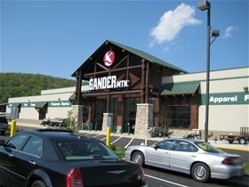

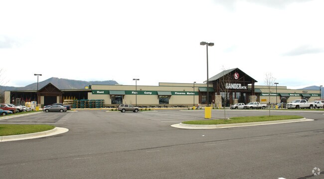

Property Detail
8195 Gander Way
018.18-01-06
PAR A-1 SUBD & COMB FOR KTJ LP & HOLLINS HOSPITALITY LLC HOLLINS
Departmentstore
Roanoke
C2CS
Virginia
B and X Area of moderate flood hazard, usually the area between the limits of the 100-year and 500-year floods.
8.23 AC
2025
Northeast Roanoke
2025
Roanoke
030205
Roanoke, VA
66,386 SF
NEARBY LISTINGS FOR SALE OR LEASE
DEMOGRAPHICS near 8195 Gander Way
1 mile
3 mile
5 mile
2025 Total Population
1,735
19,903
64,970
2030 Population
1,742
20,040
64,904
Pop Growth 2025-2030
+ 0.40%
+ 0.69%
(0.10%)
Average Age
44
43
42
2025 Total Households
691
8,181
26,730
HH Growth 2025-2030
+ 0.43%
+ 0.70%
(0.13%)
Median Household Inc
$110,357
$71,492
$64,060
Avg Household Size
2.40
2.30
2.30
2025 Avg HH Vehicles
2.00
2.00
2.00
Median Home Value
$332,954
$256,641
$239,143
Median Year Built
1985
1973
1971
Nearby Places
Map Layers
Map Styles
 Street
 Aerial
Layers
 Traffic
 Biking
Places
Listings with unknown addresses are not visible on the map
- Restaurants
- Banks
- Shops
- Fitness
- Groceries
PUBLIC TRANSPORTATION
COMMUTER RAIL
Drive
Walk
Distance
15 min
7.6 mi
AIRPORT
Roanoke/Blacksburg Regional (Woodrum Field)
Drive
Walk
Distance
Roanoke/Blacksburg Regional (Woodrum Field)
12 min
4.6 mi
Nearby Properties
Address
Land Use
TOTAL SIZE
Lot Size
Zoning
Address
Land Use
TOTAL SIZE
Lot Size
Zoning
8,930 SF
604.76 AC
AD
Address
Land Use
TOTAL SIZE
Lot Size
Zoning
5,957.14 AC
FC
Address
Land Use
TOTAL SIZE
Lot Size
Zoning
67,903 SF
11.96 AC
I2
Address
Land Use
TOTAL SIZE
Lot Size
Zoning
609,211 SF
41.01 AC
I1C
Address
Land Use
TOTAL SIZE
Lot Size
Zoning
3,893.44 AC
Address
Land Use
TOTAL SIZE
Lot Size
Zoning
40.04 AC
M-2
Address
Land Use
TOTAL SIZE
Lot Size
Zoning
15,312 SF
182.27 AC
AG3
Address
Land Use
TOTAL SIZE
Lot Size
Zoning
207,812 SF
22.62 AC
CLS
Address
Land Use
TOTAL SIZE
Lot Size
Zoning
124,725 SF
6.53 AC
I1
Address
Land Use
TOTAL SIZE
Lot Size
Zoning
48,935 SF
9.15 AC
RMF
Address
Land Use
TOTAL SIZE
Lot Size
Zoning
139,654 SF
4.77 AC
C2S
Address
Land Use
TOTAL SIZE
Lot Size
Zoning
22,950 SF
9.50 AC
R3
Address
Land Use
TOTAL SIZE
Lot Size
Zoning
198,089 SF
46.65 AC
AD
Address
Land Use
TOTAL SIZE
Lot Size
Zoning
135,212 SF
11.29 AC
CLS
Address
Land Use
TOTAL SIZE
Lot Size
Zoning
112,165 SF
9.27 AC
CLS
Address
Land Use
TOTAL SIZE
Lot Size
Zoning
70,091 SF
11.82 AC
R1
Address
Land Use
TOTAL SIZE
Lot Size
Zoning
35,582 SF
16.36 AC
I2S
Address
Land Use
TOTAL SIZE
Lot Size
Zoning
5,433 SF
20.63 AC
AD
Address
Land Use
TOTAL SIZE
Lot Size
Zoning
70,770 SF
6 AC
R3
Address
Land Use
TOTAL SIZE
Lot Size
Zoning
88,570 SF
10.02 AC
CLS
Address
Land Use
TOTAL SIZE
Lot Size
Zoning
24,512 SF
9.10 AC
C2S
Address
Land Use
TOTAL SIZE
Lot Size
Zoning
92,239 SF
11.41 AC
CLS
Address
Land Use
TOTAL SIZE
Lot Size
Zoning
35,796 SF
3.57 AC
C2CS
Address
Land Use
TOTAL SIZE
Lot Size
Zoning
22,950 SF
3.54 AC
Address
Land Use
TOTAL SIZE
Lot Size
Zoning
20,086 SF
9.79 AC
R1S
Address
Land Use
TOTAL SIZE
Lot Size
Zoning
147,992 SF
11.28 AC
I1C
Address
Land Use
TOTAL SIZE
Lot Size
Zoning
68,179 SF
10.18 AC
C2
Address
Land Use
TOTAL SIZE
Lot Size
Zoning
58,366 SF
3.02 AC
C2CS
Address
Land Use
TOTAL SIZE
Lot Size
Zoning
57,181 SF
6 AC
CLS
Address
Land Use
TOTAL SIZE
Lot Size
Zoning
12,252 SF
9.38 AC
R4
The World's #1 Commercial Real Estate Marketplace
Connect with us
© 2026 CoStar Group
The information above has been obtained from sources believed reliable. While we do not doubt its accuracy we have not verified it and make no guarantee, warranty or representation about it. It is your responsibility to independently confirm its accuracy and completeness. Any projections, opinions, assumptions, or estimates used are for example only and do not represent the current or future performance of the property. The value of this transaction to you depends on tax and other factors which should be evaluated by your tax, financial, and legal advisors. You and your advisors should conduct a careful, independent investigation of the property to determine to your satisfaction the suitability of the property for your needs.