Property Record
8199 Neptune Dr, Kalamazoo, MI 49009
This Property Is For Sale
NEARBY LISTINGS FOR SALE OR LEASE
Property Detail
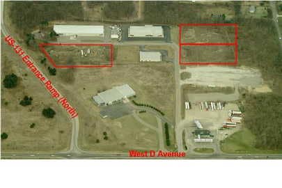
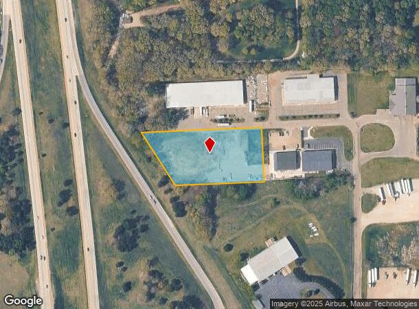
8199 Neptune Dr
01-13-476-030
SEC 13-1-12 COMM SE COR TH S 87DEG26MIN21SEC W ALG S SEC LI 689.92FT TH N 00DEG58MIN39SEC W PAR WI E SEC LI 850.42FT TH S
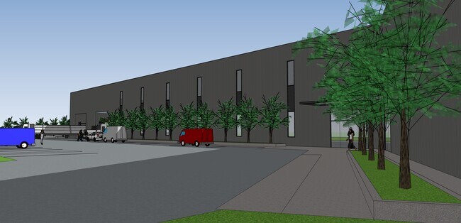
Industrialacreage
Kalamazoo
X
Michigan
26005C0620G
2.35 AC
2025
Western Kalamazoo County
2025
West Michigan
002901
Kalamazoo-Portage, MI
DEMOGRAPHICS near 8199 Neptune Dr
1 Mile
3 Mile
5 Mile
2024 Total Population
741
4,988
21,684
2029 Population
736
4,954
21,594
Pop Growth 2024-2029
(0.67%)
(0.68%)
(0.42%)
Average Age
42
43
41
2024 Total Households
290
1,967
8,611
HH Growth 2024-2029
(0.69%)
(0.71%)
(0.49%)
Median Household Inc
$80,942
$78,804
$74,821
Avg Household Size
2.50
2.50
2.40
2024 Avg HH Vehicles
2.00
2.00
2.00
Median Home Value
$238,947
$233,948
$208,435
Median Year Built
1978
1978
1978
Nearby Places
Map Layers
Map Styles
 Street
 Aerial
- Restaurants
- Banks
- Shops
- Fitness
- Groceries
PUBLIC TRANSPORTATION
COMMUTER RAIL
DRIVE
WALK
Distance
15 min
9.9 mi
AIRPORT
Kalamazoo/Battle Creek International
DRIVE
WALK
Distance
Kalamazoo/Battle Creek International
26 min
16.5 mi
Nearby Properties
Address
Land Use
TOTAL SIZE
Lot Size
Zoning
Address
Land Use
TOTAL SIZE
Lot Size
Zoning
209,000 SF
29.66 AC
Address
Land Use
TOTAL SIZE
Lot Size
Zoning
76,142 SF
43.96 AC
R1
Address
Land Use
TOTAL SIZE
Lot Size
Zoning
12,360 SF
5.92 AC
C-2
Address
Land Use
TOTAL SIZE
Lot Size
Zoning
5,772 SF
25 AC
R-4 MOB
Address
Land Use
TOTAL SIZE
Lot Size
Zoning
20,158 SF
2.99 AC
C-2
Address
Land Use
TOTAL SIZE
Lot Size
Zoning
64,580 SF
15.70 AC
C-2
Address
Land Use
TOTAL SIZE
Lot Size
Zoning
15,814 SF
10.41 AC
CBD
Address
Land Use
TOTAL SIZE
Lot Size
Zoning
24,900 SF
Address
Land Use
TOTAL SIZE
Lot Size
Zoning
201 AC
AG
Address
Land Use
TOTAL SIZE
Lot Size
Zoning
16,000 SF
11.20 AC
C-2
Address
Land Use
TOTAL SIZE
Lot Size
Zoning
92,160 SF
37.48 AC
R1
Address
Land Use
TOTAL SIZE
Lot Size
Zoning
37,284 SF
3.22 AC
I-2
Address
Land Use
TOTAL SIZE
Lot Size
Zoning
5,011 SF
123.63 AC
RD
Address
Land Use
TOTAL SIZE
Lot Size
Zoning
8,769 SF
31.87 AC
C-2
Address
Land Use
TOTAL SIZE
Lot Size
Zoning
5,033 SF
7.73 AC
I-3
Address
Land Use
TOTAL SIZE
Lot Size
Zoning
18,000 SF
5.09 AC
CBD
Address
Land Use
TOTAL SIZE
Lot Size
Zoning
1,299 SF
163.40 AC
AG
Address
Land Use
TOTAL SIZE
Lot Size
Zoning
5.33 AC
C-2
Address
Land Use
TOTAL SIZE
Lot Size
Zoning
3,200 SF
50.85 AC
R1
Address
Land Use
TOTAL SIZE
Lot Size
Zoning
26,220 SF
3.82 AC
C-2
Address
Land Use
TOTAL SIZE
Lot Size
Zoning
2,602 SF
39.68 AC
AG
Address
Land Use
TOTAL SIZE
Lot Size
Zoning
1,977 SF
68.23 AC
Address
Land Use
TOTAL SIZE
Lot Size
Zoning
8,700 SF
16.43 AC
C-2
Address
Land Use
TOTAL SIZE
Lot Size
Zoning
10 AC
I-3
Address
Land Use
TOTAL SIZE
Lot Size
Zoning
23,112 SF
9.84 AC
I-2
Address
Land Use
TOTAL SIZE
Lot Size
Zoning
14,454 SF
2.17 AC
I-2
Address
Land Use
TOTAL SIZE
Lot Size
Zoning
2,042 SF
99.47 AC
AG
Address
Land Use
TOTAL SIZE
Lot Size
Zoning
15,520 SF
24.59 AC
C-2
Address
Land Use
TOTAL SIZE
Lot Size
Zoning
9,350 SF
1.37 AC
C-2
Address
Land Use
TOTAL SIZE
Lot Size
Zoning
9,921 SF
2.14 AC
I-2
The World's #1 Commercial Real Estate Marketplace
Connect with us
© 2026 CoStar Group
The information above has been obtained from sources believed reliable. While we do not doubt its accuracy we have not verified it and make no guarantee, warranty or representation about it. It is your responsibility to independently confirm its accuracy and completeness. Any projections, opinions, assumptions, or estimates used are for example only and do not represent the current or future performance of the property. The value of this transaction to you depends on tax and other factors which should be evaluated by your tax, financial, and legal advisors. You and your advisors should conduct a careful, independent investigation of the property to determine to your satisfaction the suitability of the property for your needs.