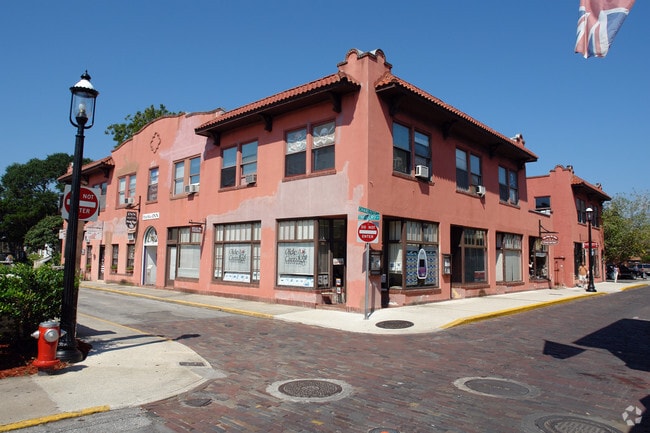
Property Record
82 1/2 Charlotte St, Saint Augustine, FL 32084


NEARBY LISTINGS FOR SALE OR LEASE
Property Detail
82 1/2 Charlotte St
Jacksonville, FL
City Of St Augustine
197010-0000
CITY OF ST AUG LOTS 6 & 7 BLK 9 OR4964/1617
Commercialnec
St. Johns
AE
Florida
12109C0318J
6,7
2023
0.26 AC
2025
St Johns County
020500
Jacksonville (Florida)
14,287 SF
DEMOGRAPHICS near 82 1/2 Charlotte St
1 mile
3 mile
5 mile
2024 Total Population
6,995
37,244
74,793
2029 Population
9,352
49,600
99,683
Pop Growth 2024-2029
+ 33.70%
+ 33.18%
+ 33.28%
Average Age
45
45
46
2024 Total Households
3,023
16,303
32,142
HH Growth 2024-2029
+ 34.77%
+ 33.18%
+ 33.21%
Median Household Inc
$99,452
$67,316
$70,519
Avg Household Size
2.00
2.20
2.20
2024 Avg HH Vehicles
2.00
2.00
2.00
Median Home Value
$453,672
$307,763
$341,650
Median Year Built
1952
1991
1993
Nearby Places
Map Layers
Map Styles
 Street
 Aerial
Transit
 Traffic
 Biking
Places
Listings with unknown addresses are not visible on the map
- Restaurants
- Banks
- Shops
- Fitness
- Groceries
Nearby Properties
Address
Land Use
TOTAL SIZE
Lot Size
Zoning
Address
Land Use
TOTAL SIZE
Lot Size
Zoning
322,553 SF
10.54 AC
Address
Land Use
TOTAL SIZE
Lot Size
Zoning
657,013 SF
77.07 AC
Address
Land Use
TOTAL SIZE
Lot Size
Zoning
44,656 SF
16.56 AC
Address
Land Use
TOTAL SIZE
Lot Size
Zoning
323,748 SF
4.62 AC
Address
Land Use
TOTAL SIZE
Lot Size
Zoning
422,807 SF
80.60 AC
OR
Address
Land Use
TOTAL SIZE
Lot Size
Zoning
532,530 SF
25.80 AC
CG
Address
Land Use
TOTAL SIZE
Lot Size
Zoning
343,365 SF
127.66 AC
Address
Land Use
TOTAL SIZE
Lot Size
Zoning
311,794 SF
39.89 AC
Address
Land Use
TOTAL SIZE
Lot Size
Zoning
312,840 SF
19.29 AC
CG
Address
Land Use
TOTAL SIZE
Lot Size
Zoning
209,356 SF
12.88 AC
RG-O
Address
Land Use
TOTAL SIZE
Lot Size
Zoning
286,292 SF
16.55 AC
Address
Land Use
TOTAL SIZE
Lot Size
Zoning
167,115 SF
1.58 AC
TCMU
Address
Land Use
TOTAL SIZE
Lot Size
Zoning
320,571 SF
15.91 AC
Address
Land Use
TOTAL SIZE
Lot Size
Zoning
Address
Land Use
TOTAL SIZE
Lot Size
Zoning
262,617 SF
37.08 AC
PUD
Address
Land Use
TOTAL SIZE
Lot Size
Zoning
53,451 SF
1.23 AC
CM2
Address
Land Use
TOTAL SIZE
Lot Size
Zoning
100,199 SF
1.56 AC
Address
Land Use
TOTAL SIZE
Lot Size
Zoning
115,134 SF
4.54 AC
Address
Land Use
TOTAL SIZE
Lot Size
Zoning
154,685 SF
82.60 AC
RS3
Address
Land Use
TOTAL SIZE
Lot Size
Zoning
130,186 SF
21.74 AC
CG
Address
Land Use
TOTAL SIZE
Lot Size
Zoning
53,172 SF
2.65 AC
Address
Land Use
TOTAL SIZE
Lot Size
Zoning
107,633 SF
19.47 AC
OR
Address
Land Use
TOTAL SIZE
Lot Size
Zoning
76,020 SF
2.22 AC
CM2
Address
Land Use
TOTAL SIZE
Lot Size
Zoning
117,811 SF
1.17 AC
HP4
Address
Land Use
TOTAL SIZE
Lot Size
Zoning
161,211 SF
21.70 AC
PUD
Address
Land Use
TOTAL SIZE
Lot Size
Zoning
138,677 SF
4.08 AC
Address
Land Use
TOTAL SIZE
Lot Size
Zoning
167,306 SF
17.02 AC
CG
Address
Land Use
TOTAL SIZE
Lot Size
Zoning
60,003 SF
0.79 AC
Address
Land Use
TOTAL SIZE
Lot Size
Zoning
60,889 SF
2.57 AC
CHT
Address
Land Use
TOTAL SIZE
Lot Size
Zoning
56,272 SF
1.36 AC
The World's #1 Commercial Real Estate Marketplace
Connect with us
© 2026 CoStar Group
The information above has been obtained from sources believed reliable. While we do not doubt its accuracy we have not verified it and make no guarantee, warranty or representation about it. It is your responsibility to independently confirm its accuracy and completeness. Any projections, opinions, assumptions, or estimates used are for example only and do not represent the current or future performance of the property. The value of this transaction to you depends on tax and other factors which should be evaluated by your tax, financial, and legal advisors. You and your advisors should conduct a careful, independent investigation of the property to determine to your satisfaction the suitability of the property for your needs.