Property Record
82 E Litchfield Rd S, Litchfield, CT 06759
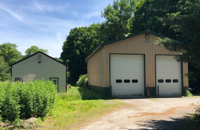

Property Detail
82 E Litchfield Rd S
Torrington, CT
LITCHFIELD
LITC-000266-000003-000002
Connecticut
Industrialgeneral
2
RC
0.78 AC
2025
SE Litchfield County
2025
Hartford
300500
NEARBY LISTINGS FOR SALE OR LEASE
DEMOGRAPHICS near 82 E Litchfield Rd S
1 mile
3 mile
5 mile
2025 Total Population
306
15,233
39,952
2030 Population
312
15,353
40,082
Pop Growth 2025-2030
+ 1.96%
+ 0.79%
+ 0.33%
Average Age
46
43
44
2025 Total Households
127
6,723
17,178
HH Growth 2025-2030
+ 2.36%
+ 0.85%
+ 0.38%
Median Household Inc
$109,722
$73,253
$75,136
Avg Household Size
2.40
2.20
2.20
2025 Avg HH Vehicles
2.00
2.00
2.00
Median Home Value
$403,571
$237,098
$245,051
Median Year Built
1968
1953
1958
Nearby Places
Map Layers
Map Styles
 Street
 Aerial
Transit
 Traffic
 Biking
Places
Listings with unknown addresses are not visible on the map
- Restaurants
- Banks
- Shops
- Fitness
- Groceries
PUBLIC TRANSPORTATION
AIRPORT
Bradley International
Drive
Walk
Distance
Bradley International
62 min
36.7 mi
SALE & LEASE HISTORY
LISTING DATE
SALE/LEASE

Jul 12, 2019
For Sale
Nearby Properties
Address
Land Use
TOTAL SIZE
Lot Size
Zoning
Address
Land Use
TOTAL SIZE
Lot Size
Zoning
119.90 AC
R6
Address
Land Use
TOTAL SIZE
Lot Size
Zoning
85,628 SF
4.25 AC
R6
Address
Land Use
TOTAL SIZE
Lot Size
Zoning
111,459 SF
16.72 AC
R15
Address
Land Use
TOTAL SIZE
Lot Size
Zoning
15.03 AC
DD
Address
Land Use
TOTAL SIZE
Lot Size
Zoning
42,676 SF
3.19 AC
R6
Address
Land Use
TOTAL SIZE
Lot Size
Zoning
58.50 AC
RR
Address
Land Use
TOTAL SIZE
Lot Size
Zoning
39,111 SF
0.63 AC
DD-R
Address
Land Use
TOTAL SIZE
Lot Size
Zoning
124,360 SF
4.30 AC
DD
Address
Land Use
TOTAL SIZE
Lot Size
Zoning
68,192 SF
1.76 AC
DD
Address
Land Use
TOTAL SIZE
Lot Size
Zoning
131,925 SF
12.51 AC
DD
Address
Land Use
TOTAL SIZE
Lot Size
Zoning
24,768 SF
1.67 AC
DD
Address
Land Use
TOTAL SIZE
Lot Size
Zoning
3.90 AC
B1
Address
Land Use
TOTAL SIZE
Lot Size
Zoning
7,200 SF
0.27 AC
DD
Address
Land Use
TOTAL SIZE
Lot Size
Zoning
1 AC
DD
Address
Land Use
TOTAL SIZE
Lot Size
Zoning
4.70 AC
I
Address
Land Use
TOTAL SIZE
Lot Size
Zoning
57,875 SF
21.83 AC
CRA-2
Address
Land Use
TOTAL SIZE
Lot Size
Zoning
21,654 SF
0.53 AC
DD
Address
Land Use
TOTAL SIZE
Lot Size
Zoning
20,873 SF
0.54 AC
DD
Address
Land Use
TOTAL SIZE
Lot Size
Zoning
22,852 SF
10.99 AC
RR, GR
Address
Land Use
TOTAL SIZE
Lot Size
Zoning
14,405 SF
1.50 AC
DD
Address
Land Use
TOTAL SIZE
Lot Size
Zoning
36.63 AC
RR
Address
Land Use
TOTAL SIZE
Lot Size
Zoning
42,771 SF
1.40 AC
DD
Address
Land Use
TOTAL SIZE
Lot Size
Zoning
24,385 SF
2.28 AC
R6
Address
Land Use
TOTAL SIZE
Lot Size
Zoning
154,553 SF
4.36 AC
DD
Address
Land Use
TOTAL SIZE
Lot Size
Zoning
1.35 AC
R6
Address
Land Use
TOTAL SIZE
Lot Size
Zoning
7,333 SF
180.95 AC
CRA-2
Address
Land Use
TOTAL SIZE
Lot Size
Zoning
1.30 AC
DD
Address
Land Use
TOTAL SIZE
Lot Size
Zoning
87,475 SF
5.63 AC
I
Address
Land Use
TOTAL SIZE
Lot Size
Zoning
11,611 SF
0.46 AC
DD
Address
Land Use
TOTAL SIZE
Lot Size
Zoning
1.60 AC
DD
The World's #1 Commercial Real Estate Marketplace
Connect with us
© 2026 CoStar Group
The information above has been obtained from sources believed reliable. While we do not doubt its accuracy we have not verified it and make no guarantee, warranty or representation about it. It is your responsibility to independently confirm its accuracy and completeness. Any projections, opinions, assumptions, or estimates used are for example only and do not represent the current or future performance of the property. The value of this transaction to you depends on tax and other factors which should be evaluated by your tax, financial, and legal advisors. You and your advisors should conduct a careful, independent investigation of the property to determine to your satisfaction the suitability of the property for your needs.