Property Record
82 N Eagleville Rd, Storrs Mansfield, CT 06268

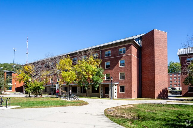
Property Detail
82 N Eagleville Rd
MANS-000009-000023-000150UC
Capitol
Publicschool
Connecticut
I
uc150
0
1 AC
2025
Mansfield/Tolland/Willington
510200
Hartford
19,872 SF
Hartford-West Hartford-East Hartford, CT
NEARBY LISTINGS FOR SALE OR LEASE
DEMOGRAPHICS near 82 N Eagleville Rd
1 mile
3 mile
5 mile
2025 Total Population
13,201
22,847
37,524
2030 Population
13,417
23,402
38,474
Pop Growth 2025-2030
+ 1.64%
+ 2.43%
+ 2.53%
Average Age
24
30
35
2025 Total Households
1,293
5,082
11,116
HH Growth 2025-2030
+ 3.63%
+ 3.76%
+ 3.21%
Median Household Inc
$34,021
$52,827
$85,073
Avg Household Size
2.20
2.20
2.30
2025 Avg HH Vehicles
2.00
2.00
2.00
Median Home Value
$332,462
$352,059
$333,616
Median Year Built
1980
1978
1974
Nearby Places
Map Layers
Map Styles
 Street
 Aerial
Layers
 Traffic
 Biking
Places
Listings with unknown addresses are not visible on the map
- Restaurants
- Banks
- Shops
- Fitness
- Groceries
PUBLIC TRANSPORTATION
AIRPORT
Bradley International
Drive
Walk
Distance
Bradley International
59 min
34.6 mi
Freight Ports
Port of Davisville, RI
Drive
Walk
Distance
Port of Davisville, RI
93 min
65.7 mi
Nearby Properties
Address
Land Use
TOTAL SIZE
Lot Size
Zoning
Address
Land Use
TOTAL SIZE
Lot Size
Zoning
253,885 SF
I
Address
Land Use
TOTAL SIZE
Lot Size
Zoning
121,528 SF
Address
Land Use
TOTAL SIZE
Lot Size
Zoning
257,360 SF
1 AC
I
Address
Land Use
TOTAL SIZE
Lot Size
Zoning
171,605 SF
5.30 AC
PB4
Address
Land Use
TOTAL SIZE
Lot Size
Zoning
120,135 SF
Address
Land Use
TOTAL SIZE
Lot Size
Zoning
153,234 SF
1 AC
I
Address
Land Use
TOTAL SIZE
Lot Size
Zoning
213,280 SF
1 AC
I
Address
Land Use
TOTAL SIZE
Lot Size
Zoning
203,904 SF
1 AC
I
Address
Land Use
TOTAL SIZE
Lot Size
Zoning
111,455 SF
1 AC
I
Address
Land Use
TOTAL SIZE
Lot Size
Zoning
255,750 SF
1 AC
I
Address
Land Use
TOTAL SIZE
Lot Size
Zoning
227,479 SF
2 AC
I
Address
Land Use
TOTAL SIZE
Lot Size
Zoning
35,212 SF
3.20 AC
I
Address
Land Use
TOTAL SIZE
Lot Size
Zoning
Address
Land Use
TOTAL SIZE
Lot Size
Zoning
155,276 SF
1.37 AC
SCDD
Address
Land Use
TOTAL SIZE
Lot Size
Zoning
Address
Land Use
TOTAL SIZE
Lot Size
Zoning
83,869 SF
I
Address
Land Use
TOTAL SIZE
Lot Size
Zoning
Address
Land Use
TOTAL SIZE
Lot Size
Zoning
Address
Land Use
TOTAL SIZE
Lot Size
Zoning
23.33 AC
PB3
Address
Land Use
TOTAL SIZE
Lot Size
Zoning
66,136 SF
1 AC
I
Address
Land Use
TOTAL SIZE
Lot Size
Zoning
115,104 SF
1 AC
I
Address
Land Use
TOTAL SIZE
Lot Size
Zoning
21.54 AC
I
Address
Land Use
TOTAL SIZE
Lot Size
Zoning
77,333 SF
1 AC
I
Address
Land Use
TOTAL SIZE
Lot Size
Zoning
88,000 SF
1 AC
Address
Land Use
TOTAL SIZE
Lot Size
Zoning
83,297 SF
SCDD
Address
Land Use
TOTAL SIZE
Lot Size
Zoning
75,328 SF
1 AC
I
Address
Land Use
TOTAL SIZE
Lot Size
Zoning
9.48 AC
DMR
Address
Land Use
TOTAL SIZE
Lot Size
Zoning
71,221 SF
1.72 AC
SCDD
Address
Land Use
TOTAL SIZE
Lot Size
Zoning
70,696 SF
1 AC
I
Address
Land Use
TOTAL SIZE
Lot Size
Zoning
24,067 SF
1 AC
I
The World's #1 Commercial Real Estate Marketplace
Connect with us
© 2026 CoStar Group
The information above has been obtained from sources believed reliable. While we do not doubt its accuracy we have not verified it and make no guarantee, warranty or representation about it. It is your responsibility to independently confirm its accuracy and completeness. Any projections, opinions, assumptions, or estimates used are for example only and do not represent the current or future performance of the property. The value of this transaction to you depends on tax and other factors which should be evaluated by your tax, financial, and legal advisors. You and your advisors should conduct a careful, independent investigation of the property to determine to your satisfaction the suitability of the property for your needs.