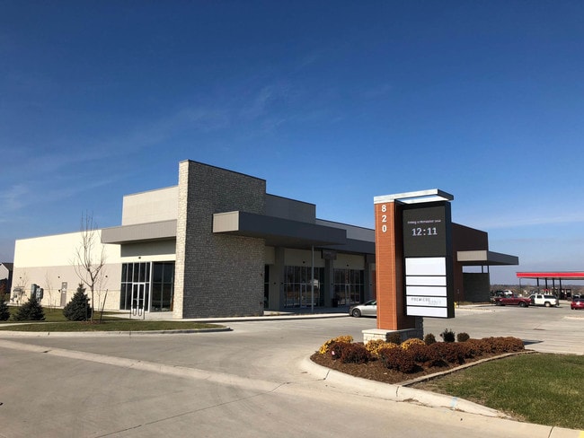
Property Record
820 Ne Alices Rd, Waukee, IA 50263

NEARBY LISTINGS FOR SALE OR LEASE
Property Detail
820 Ne Alices Rd
Des Moines-West Des Moines, IA
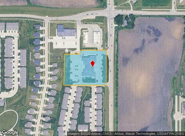
Landing At Shadow Creek Plat 4
12-27-227-016
LANDING AT SHADOW CREEK PLAT 4 LOT 34
Regionalshoppingcenterormallwithanchorstore
Dallas
X
Iowa
19153C0165F
34
2023
3.04 AC
2024
Western Suburbs
050807
Des Moines
15,836 SF
DEMOGRAPHICS near 820 Ne Alices Rd
1 Mile
3 Mile
5 Mile
2024 Total Population
10,743
57,306
90,067
2029 Population
13,151
69,107
106,404
Pop Growth 2024-2029
+ 22.41%
+ 20.59%
+ 18.14%
Average Age
35
36
37
2024 Total Households
3,763
20,966
34,688
HH Growth 2024-2029
+ 23.28%
+ 21.34%
+ 18.74%
Median Household Inc
$120,985
$111,922
$103,696
Avg Household Size
2.90
2.70
2.60
2024 Avg HH Vehicles
2.00
2.00
2.00
Median Home Value
$368,301
$321,089
$311,089
Median Year Built
2010
2009
2007
Nearby Places
Map Layers
Map Styles
 Street
 Aerial
- Restaurants
- Banks
- Shops
- Fitness
- Groceries
PUBLIC TRANSPORTATION
AIRPORT
Des Moines International
DRIVE
WALK
Distance
Des Moines International
28 min
16.4 mi
Freight Ports
Port Milwaukee
DRIVE
WALK
Distance
Port Milwaukee
428 min
383.8 mi
SALE & LEASE HISTORY
LISTING DATE
SALE/LEASE

Jun 14, 2017
For Lease
Dec 03, 2018
For Lease
Nearby Properties
Address
Land Use
TOTAL SIZE
Lot Size
Zoning
Address
Land Use
TOTAL SIZE
Lot Size
Zoning
48,937 SF
76.01 AC
Address
Land Use
TOTAL SIZE
Lot Size
Zoning
72,372 SF
74.45 AC
Address
Land Use
TOTAL SIZE
Lot Size
Zoning
457,056 SF
26.01 AC
Address
Land Use
TOTAL SIZE
Lot Size
Zoning
37,325 SF
Address
Land Use
TOTAL SIZE
Lot Size
Zoning
2,864 SF
21.03 AC
Address
Land Use
TOTAL SIZE
Lot Size
Zoning
101,097 SF
30 AC
Address
Land Use
TOTAL SIZE
Lot Size
Zoning
3,358 SF
21.13 AC
Address
Land Use
TOTAL SIZE
Lot Size
Zoning
196,904 SF
26.10 AC
PUD
Address
Land Use
TOTAL SIZE
Lot Size
Zoning
5.75 AC
Address
Land Use
TOTAL SIZE
Lot Size
Zoning
39,505 SF
4.94 AC
Address
Land Use
TOTAL SIZE
Lot Size
Zoning
17.73 AC
Address
Land Use
TOTAL SIZE
Lot Size
Zoning
19.84 AC
Address
Land Use
TOTAL SIZE
Lot Size
Zoning
17.76 AC
Address
Land Use
TOTAL SIZE
Lot Size
Zoning
87,362 SF
16.87 AC
Address
Land Use
TOTAL SIZE
Lot Size
Zoning
175,860 SF
40.72 AC
Address
Land Use
TOTAL SIZE
Lot Size
Zoning
121,824 SF
14.72 AC
C-3
Address
Land Use
TOTAL SIZE
Lot Size
Zoning
66.16 AC
Address
Land Use
TOTAL SIZE
Lot Size
Zoning
88,670 SF
15.44 AC
Address
Land Use
TOTAL SIZE
Lot Size
Zoning
89,765 SF
11.89 AC
Address
Land Use
TOTAL SIZE
Lot Size
Zoning
80,271 SF
12.38 AC
Address
Land Use
TOTAL SIZE
Lot Size
Zoning
30,943 SF
2.98 AC
Address
Land Use
TOTAL SIZE
Lot Size
Zoning
12.44 AC
Address
Land Use
TOTAL SIZE
Lot Size
Zoning
5.14 AC
Address
Land Use
TOTAL SIZE
Lot Size
Zoning
71,483 SF
8.26 AC
Address
Land Use
TOTAL SIZE
Lot Size
Zoning
66,997 SF
8.95 AC
Address
Land Use
TOTAL SIZE
Lot Size
Zoning
21,009 SF
12.65 AC
Address
Land Use
TOTAL SIZE
Lot Size
Zoning
17.50 AC
Address
Land Use
TOTAL SIZE
Lot Size
Zoning
42,575 SF
6.81 AC
Address
Land Use
TOTAL SIZE
Lot Size
Zoning
28,016 SF
7.76 AC
Address
Land Use
TOTAL SIZE
Lot Size
Zoning
43,207 SF
2.93 AC
The World's #1 Commercial Real Estate Marketplace
Connect with us
© 2025 CoStar Group
The information above has been obtained from sources believed reliable. While we do not doubt its accuracy we have not verified it and make no guarantee, warranty or representation about it. It is your responsibility to independently confirm its accuracy and completeness. Any projections, opinions, assumptions, or estimates used are for example only and do not represent the current or future performance of the property. The value of this transaction to you depends on tax and other factors which should be evaluated by your tax, financial, and legal advisors. You and your advisors should conduct a careful, independent investigation of the property to determine to your satisfaction the suitability of the property for your needs.