Property Record
820 W 95Th St, Los Angeles, CA 90044

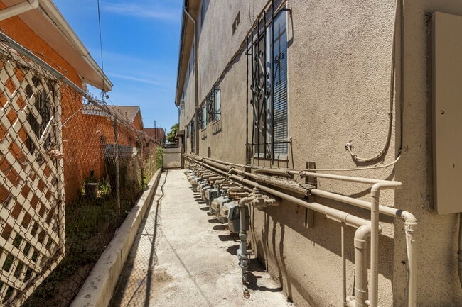
This Property Is For Sale
NEARBY LISTINGS FOR SALE OR LEASE
Property Detail
820 W 95Th St
Los Angeles-Long Beach-Glendale, CA
Sunny Side
6039-017-061
SUNNY SIDE LOT 204
Multifamilydwelling
Los Angeles
X
California
06037C1785G
204
2024
0.19 AC
2025
South Central LA
240401
Los Angeles
6,471 SF
DEMOGRAPHICS near 820 W 95Th St
1 Mile
3 Mile
5 Mile
2024 Total Population
53,929
372,979
1,050,453
2029 Population
51,889
358,498
1,010,615
Pop Growth 2024-2029
(3.78%)
(3.88%)
(3.79%)
Average Age
36
37
37
2024 Total Households
15,354
103,324
299,359
HH Growth 2024-2029
(4.21%)
(4.30%)
(4.13%)
Median Household Inc
$52,109
$62,278
$65,630
Avg Household Size
3.30
3.40
3.30
2024 Avg HH Vehicles
2.00
2.00
2.00
Median Home Value
$682,004
$696,080
$717,991
Median Year Built
1954
1952
1955
Nearby Places
Map Layers
Map Styles
 Street
 Aerial
- Restaurants
- Banks
- Shops
- Fitness
- Groceries
PUBLIC TRANSPORTATION
AIRPORT
Los Angeles International
DRIVE
WALK
Distance
Los Angeles International
16 min
7.4 mi
Long Beach (Daugherty Field)
DRIVE
WALK
Distance
Long Beach (Daugherty Field)
25 min
15.6 mi
Bob Hope
DRIVE
WALK
Distance
Bob Hope
36 min
25.4 mi
Freight Ports
Port of Long Beach
DRIVE
WALK
Distance
Port of Long Beach
29 min
17.6 mi
Nearby Properties
Address
Land Use
TOTAL SIZE
Lot Size
Zoning
Address
Land Use
TOTAL SIZE
Lot Size
Zoning
2,531,696 SF
79.60 AC
INCR*
Address
Land Use
TOTAL SIZE
Lot Size
Zoning
Address
Land Use
TOTAL SIZE
Lot Size
Zoning
Address
Land Use
TOTAL SIZE
Lot Size
Zoning
724,715 SF
5.76 AC
INCR*
Address
Land Use
TOTAL SIZE
Lot Size
Zoning
248,531 SF
13.30 AC
LCM11/2-B1
Address
Land Use
TOTAL SIZE
Lot Size
Zoning
227,596 SF
14.38 AC
HAM1YY
Address
Land Use
TOTAL SIZE
Lot Size
Zoning
181,213 SF
3.96 AC
INCR*
Address
Land Use
TOTAL SIZE
Lot Size
Zoning
544,967 SF
10.74 AC
HAM2YY
Address
Land Use
TOTAL SIZE
Lot Size
Zoning
57,488 SF
4.30 AC
LAPF
Address
Land Use
TOTAL SIZE
Lot Size
Zoning
111,254 SF
5.63 AC
INCR
Address
Land Use
TOTAL SIZE
Lot Size
Zoning
169,426 SF
3.50 AC
LCM11/2-B1
Address
Land Use
TOTAL SIZE
Lot Size
Zoning
127,484 SF
7.33 AC
LAM2
Address
Land Use
TOTAL SIZE
Lot Size
Zoning
81,735 SF
4.10 AC
LAR4
Address
Land Use
TOTAL SIZE
Lot Size
Zoning
104,291 SF
7.35 AC
LAR3
Address
Land Use
TOTAL SIZE
Lot Size
Zoning
130,337 SF
9.31 AC
HAM2
Address
Land Use
TOTAL SIZE
Lot Size
Zoning
267,463 SF
1.97 AC
INCR
Address
Land Use
TOTAL SIZE
Lot Size
Zoning
93,597 SF
0.32 AC
LCC2
Address
Land Use
TOTAL SIZE
Lot Size
Zoning
402,118 SF
9.39 AC
LAC2
Address
Land Use
TOTAL SIZE
Lot Size
Zoning
460,912 SF
3.96 AC
INCR
Address
Land Use
TOTAL SIZE
Lot Size
Zoning
111,213 SF
12.04 AC
LAR4
Address
Land Use
TOTAL SIZE
Lot Size
Zoning
103,339 SF
Address
Land Use
TOTAL SIZE
Lot Size
Zoning
153,520 SF
15.72 AC
INM1L*
Address
Land Use
TOTAL SIZE
Lot Size
Zoning
188,030 SF
3.09 AC
LAR5
Address
Land Use
TOTAL SIZE
Lot Size
Zoning
101,562 SF
7.53 AC
LAR3
Address
Land Use
TOTAL SIZE
Lot Size
Zoning
313,853 SF
8.96 AC
INCZ*
Address
Land Use
TOTAL SIZE
Lot Size
Zoning
102,260 SF
16.84 AC
LAR4
Address
Land Use
TOTAL SIZE
Lot Size
Zoning
80,606 SF
1.40 AC
INC2*
The World's #1 Commercial Real Estate Marketplace
Connect with us
© 2025 CoStar Group
The information above has been obtained from sources believed reliable. While we do not doubt its accuracy we have not verified it and make no guarantee, warranty or representation about it. It is your responsibility to independently confirm its accuracy and completeness. Any projections, opinions, assumptions, or estimates used are for example only and do not represent the current or future performance of the property. The value of this transaction to you depends on tax and other factors which should be evaluated by your tax, financial, and legal advisors. You and your advisors should conduct a careful, independent investigation of the property to determine to your satisfaction the suitability of the property for your needs.