Property Record
820 W Hind Dr, Honolulu, HI 96821
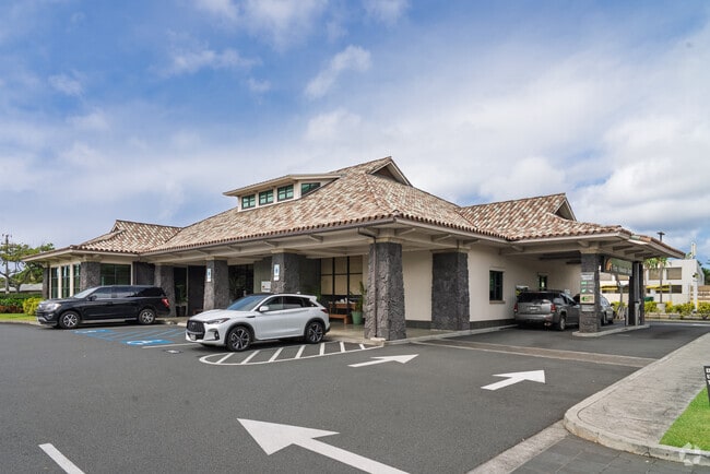


Property Detail
820 W Hind Dr
1-3-6-008-052-0000
LOT 1595 MAP 230 LCAPP 656 45,385 SF SUBJ/E K MAP 30 & 230 SUBJ/E FOR UTILITY PURP
Commercialnec
HONOLULU
U/31/30
Hawaii
AE The base floodplain where base flood elevations are provided. AE Zones are now used on new format FIRMs instead of A1-A30 Zones.
1595
2025
1.04 AC
2026
East Oahu
000302
Hawaii
9,825 SF
Urban Honolulu, HI
NEARBY LISTINGS FOR SALE OR LEASE
DEMOGRAPHICS near 820 W Hind Dr
1 mile
3 mile
5 mile
2025 Total Population
7,565
47,553
161,412
2030 Population
7,422
47,034
162,047
Pop Growth 2025-2030
(1.89%)
(1.09%)
+ 0.39%
Average Age
48
47
45
2025 Total Households
2,587
16,401
62,424
HH Growth 2025-2030
(2.71%)
(1.84%)
+ 0.39%
Median Household Inc
$190,481
$153,853
$108,761
Avg Household Size
2.80
2.70
2.40
2025 Avg HH Vehicles
2.00
2.00
2.00
Median Home Value
$1,139,683
$1,112,970
$1,050,521
Median Year Built
1965
1965
1970
Nearby Places
Map Layers
Map Styles
 Street
 Aerial
Layers
 Traffic
 Biking
Places
Listings with unknown addresses are not visible on the map
- Restaurants
- Banks
- Shops
- Fitness
- Groceries
PUBLIC TRANSPORTATION
AIRPORT
Daniel K Inouye International
Drive
Walk
Distance
Daniel K Inouye International
25 min
13.0 mi
Freight Ports
Honolulu Harbor, Oahu
Drive
Walk
Distance
Honolulu Harbor, Oahu
27 min
12.9 mi
Nearby Properties
Address
Land Use
TOTAL SIZE
Lot Size
Zoning
Address
Land Use
TOTAL SIZE
Lot Size
Zoning
206,214 SF
6.49 AC
U/21/20
Address
Land Use
TOTAL SIZE
Lot Size
Zoning
671,201 SF
20.25 AC
U/32/30
Address
Land Use
TOTAL SIZE
Lot Size
Zoning
146,113 SF
8.45 AC
U/32/30
Address
Land Use
TOTAL SIZE
Lot Size
Zoning
64,703 SF
4.70 AC
U/31/30
Address
Land Use
TOTAL SIZE
Lot Size
Zoning
39,551 SF
U/31/30
Address
Land Use
TOTAL SIZE
Lot Size
Zoning
2.84 AC
U/32/70
Address
Land Use
TOTAL SIZE
Lot Size
Zoning
65,337 SF
5.41 AC
U/31/30
Address
Land Use
TOTAL SIZE
Lot Size
Zoning
84,153 SF
0.61 AC
U/32/30
Address
Land Use
TOTAL SIZE
Lot Size
Zoning
3,771 SF
5.68 AC
U/32/30
Address
Land Use
TOTAL SIZE
Lot Size
Zoning
23,910 SF
144.72 AC
U/62/90
Address
Land Use
TOTAL SIZE
Lot Size
Zoning
41,546 SF
0.91 AC
U/32/30
Address
Land Use
TOTAL SIZE
Lot Size
Zoning
58,646 SF
2.27 AC
U/32/30
Address
Land Use
TOTAL SIZE
Lot Size
Zoning
33,461 SF
1.63 AC
U/32/30
Address
Land Use
TOTAL SIZE
Lot Size
Zoning
89,202 SF
1.07 AC
U/32/30
Address
Land Use
TOTAL SIZE
Lot Size
Zoning
4.05 AC
U/32/30
Address
Land Use
TOTAL SIZE
Lot Size
Zoning
14,850 SF
1.38 AC
U/32/30
Address
Land Use
TOTAL SIZE
Lot Size
Zoning
0.83 AC
U/32/30
Address
Land Use
TOTAL SIZE
Lot Size
Zoning
17,614 SF
0.64 AC
U/32/30
Address
Land Use
TOTAL SIZE
Lot Size
Zoning
12,000 SF
2.01 AC
U/03/70
Address
Land Use
TOTAL SIZE
Lot Size
Zoning
51,328 SF
1.15 AC
U/32/30
Address
Land Use
TOTAL SIZE
Lot Size
Zoning
3.20 AC
U/32/30
Address
Land Use
TOTAL SIZE
Lot Size
Zoning
91,000 SF
1.29 AC
U/32/30
Address
Land Use
TOTAL SIZE
Lot Size
Zoning
43,438 SF
1.07 AC
U/32/30
Address
Land Use
TOTAL SIZE
Lot Size
Zoning
34,516 SF
1.53 AC
U/32/30
Address
Land Use
TOTAL SIZE
Lot Size
Zoning
1.18 AC
U/32/70
Address
Land Use
TOTAL SIZE
Lot Size
Zoning
19,666 SF
0.97 AC
U/32/30
Address
Land Use
TOTAL SIZE
Lot Size
Zoning
30,752 SF
0.90 AC
U/32/30
Address
Land Use
TOTAL SIZE
Lot Size
Zoning
5,838 SF
0.79 AC
U/05/00
Address
Land Use
TOTAL SIZE
Lot Size
Zoning
47,741 SF
0.69 AC
U/32/30
Address
Land Use
TOTAL SIZE
Lot Size
Zoning
13,985 SF
0.93 AC
U/32/70
The World's #1 Commercial Real Estate Marketplace
Connect with us
© 2026 CoStar Group
The information above has been obtained from sources believed reliable. While we do not doubt its accuracy we have not verified it and make no guarantee, warranty or representation about it. It is your responsibility to independently confirm its accuracy and completeness. Any projections, opinions, assumptions, or estimates used are for example only and do not represent the current or future performance of the property. The value of this transaction to you depends on tax and other factors which should be evaluated by your tax, financial, and legal advisors. You and your advisors should conduct a careful, independent investigation of the property to determine to your satisfaction the suitability of the property for your needs.