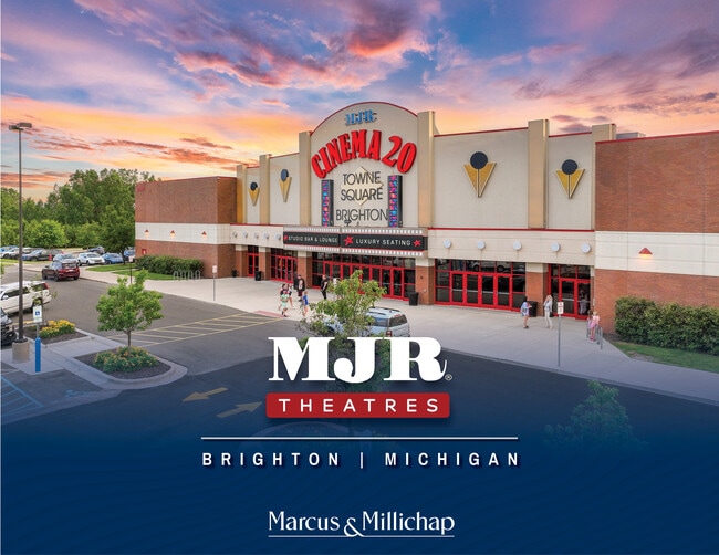
Property Record
8200 Murphy Dr, Brighton, MI 48116


Property Detail
8200 Murphy Dr
18-24-400-032
SEC 24 T2N R5E COM SE COR OF SEC TH S88*17'12"W 681.08 FT ALG C/L OF CHALLIS RD TH N01*09'13"W 1473.44 FT FOR A POB TH
Commercialnec
Livingston
OR
Michigan
B and X Area of moderate flood hazard, usually the area between the limits of the 100-year and 500-year floods.
13.72 AC
2025
Livingston County
2025
Detroit
741100
Detroit-Warren-Dearborn, MI
80,573 SF
NEARBY LISTINGS FOR SALE OR LEASE
DEMOGRAPHICS near 8200 Murphy Dr
1 mile
3 mile
5 mile
2025 Total Population
1,621
27,259
52,919
2030 Population
1,636
27,515
53,435
Pop Growth 2025-2030
+ 0.93%
+ 0.94%
+ 0.98%
Average Age
47
45
45
2025 Total Households
712
11,426
21,167
HH Growth 2025-2030
+ 1.12%
+ 1.07%
+ 1.10%
Median Household Inc
$84,423
$104,959
$111,407
Avg Household Size
2.20
2.40
2.50
2025 Avg HH Vehicles
2.00
2.00
2.00
Median Home Value
$328,440
$377,113
$388,495
Median Year Built
1990
1988
1987
Nearby Places
Map Layers
Map Styles
 Street
 Aerial
Layers
 Traffic
 Biking
Places
Listings with unknown addresses are not visible on the map
- Restaurants
- Banks
- Shops
- Fitness
- Groceries
PUBLIC TRANSPORTATION
AIRPORT
Bishop International
Drive
Walk
Distance
Bishop International
53 min
37.6 mi
Freight Ports
Port of Toledo
Drive
Walk
Distance
Port of Toledo
100 min
80.8 mi
SALE & LEASE HISTORY
LISTING DATE
SALE/LEASE

Jul 11, 2024
For Sale
Nearby Properties
Address
Land Use
TOTAL SIZE
Lot Size
Zoning
Address
Land Use
TOTAL SIZE
Lot Size
Zoning
222,504 SF
25.60 AC
C1
Address
Land Use
TOTAL SIZE
Lot Size
Zoning
4.30 AC
R5
Address
Land Use
TOTAL SIZE
Lot Size
Zoning
304,566 SF
27.31 AC
C1
Address
Land Use
TOTAL SIZE
Lot Size
Zoning
172,817 SF
7.87 AC
OS
Address
Land Use
TOTAL SIZE
Lot Size
Zoning
97,544 SF
12.13 AC
R4
Address
Land Use
TOTAL SIZE
Lot Size
Zoning
90,399 SF
13.90 AC
B-1
Address
Land Use
TOTAL SIZE
Lot Size
Zoning
142,190 SF
23.24 AC
R4
Address
Land Use
TOTAL SIZE
Lot Size
Zoning
114,371 SF
9.88 AC
R4
Address
Land Use
TOTAL SIZE
Lot Size
Zoning
173,509 SF
18.06 AC
R-M
Address
Land Use
TOTAL SIZE
Lot Size
Zoning
240,114 SF
18.91 AC
R-M
Address
Land Use
TOTAL SIZE
Lot Size
Zoning
85,147 SF
12.67 AC
C1
Address
Land Use
TOTAL SIZE
Lot Size
Zoning
134,148 SF
11.43 AC
IA
Address
Land Use
TOTAL SIZE
Lot Size
Zoning
53,494 SF
10 AC
MUPUD
Address
Land Use
TOTAL SIZE
Lot Size
Zoning
124,157 SF
13.27 AC
OR
Address
Land Use
TOTAL SIZE
Lot Size
Zoning
100,728 SF
14.30 AC
B-2
Address
Land Use
TOTAL SIZE
Lot Size
Zoning
110,602 SF
18.63 AC
R-M
Address
Land Use
TOTAL SIZE
Lot Size
Zoning
113,038 SF
9.73 AC
OR
Address
Land Use
TOTAL SIZE
Lot Size
Zoning
5,947 SF
104.68 AC
MHP
Address
Land Use
TOTAL SIZE
Lot Size
Zoning
19.60 AC
OR
Address
Land Use
TOTAL SIZE
Lot Size
Zoning
100,326 SF
8.61 AC
R4
Address
Land Use
TOTAL SIZE
Lot Size
Zoning
57,169 SF
3.70 AC
OS
Address
Land Use
TOTAL SIZE
Lot Size
Zoning
6 AC
R4
Address
Land Use
TOTAL SIZE
Lot Size
Zoning
41,261 SF
1.72 AC
OS
Address
Land Use
TOTAL SIZE
Lot Size
Zoning
5 AC
R4
Address
Land Use
TOTAL SIZE
Lot Size
Zoning
27,605 SF
3.82 AC
R-M
Address
Land Use
TOTAL SIZE
Lot Size
Zoning
51,408 SF
5.40 AC
OR
Address
Land Use
TOTAL SIZE
Lot Size
Zoning
25,337 SF
6.53 AC
OR
Address
Land Use
TOTAL SIZE
Lot Size
Zoning
76,892 SF
5.42 AC
R4
Address
Land Use
TOTAL SIZE
Lot Size
Zoning
109,385 SF
17.19 AC
I-1
The World's #1 Commercial Real Estate Marketplace
Connect with us
© 2026 CoStar Group
The information above has been obtained from sources believed reliable. While we do not doubt its accuracy we have not verified it and make no guarantee, warranty or representation about it. It is your responsibility to independently confirm its accuracy and completeness. Any projections, opinions, assumptions, or estimates used are for example only and do not represent the current or future performance of the property. The value of this transaction to you depends on tax and other factors which should be evaluated by your tax, financial, and legal advisors. You and your advisors should conduct a careful, independent investigation of the property to determine to your satisfaction the suitability of the property for your needs.