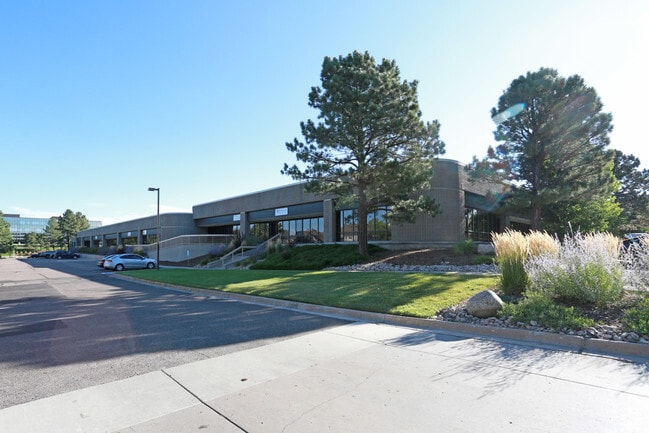
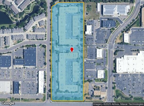
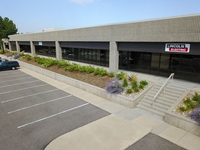
Property Record
8250 S Akron St, Centennial, CO 80112
Current Lease Availabilities
NEARBY LISTINGS FOR SALE OR LEASE
Property Detail
8250 S Akron St
Denver-Aurora-Lakewood, CO
Highland Park 2Nd Amend
2075-34-3-12-006
SUBDIVISIONCD 032751 SUBDIVISIONNAME HIGHLAND PARK 2ND AMEND BLOCK 004 LOT 003 LOT 3 BLK 4 HIGHLAND PARK SECOND AMENDMENT
Warehouse
Arapahoe
X
Colorado
08005C0459L
003,3
2023
11.91 AC
2024
Highlands Ranch
006709
Denver
165,262 SF
DEMOGRAPHICS near 8250 S Akron St
1 Mile
3 Mile
5 Mile
2024 Total Population
8,157
84,356
223,418
2029 Population
8,349
90,139
238,006
Pop Growth 2024-2029
+ 2.35%
+ 6.86%
+ 6.53%
Average Age
40
40
40
2024 Total Households
3,821
35,696
89,977
HH Growth 2024-2029
+ 2.51%
+ 7.34%
+ 6.44%
Median Household Inc
$108,840
$113,767
$117,051
Avg Household Size
2.10
2.30
2.40
2024 Avg HH Vehicles
2.00
2.00
2.00
Median Home Value
$569,336
$682,621
$667,021
Median Year Built
2001
1993
1995
Nearby Places
- Restaurants
- Banks
- Shops
- Fitness
- Groceries
PUBLIC TRANSPORTATION
TRANSIT/SUBWAY
County Line (E Line - Denver Regional Transportation District Light Rail (TheRide), F Line - Denver Regional Transportation District Light Rail (TheRide), G Line - Denver Regional Transportation District Light Rail (TheRide))
DRIVE
WALK
Distance
County Line (E Line - Denver Regional Transportation District Light Rail (TheRide), F Line - Denver Regional Transportation District Light Rail (TheRide), G Line - Denver Regional Transportation District Light Rail (TheRide))
3 min
18 min
1.0 mi
AIRPORT
Denver International
DRIVE
WALK
Distance
Denver International
39 min
30.9 mi
Freight Ports
Tulsa Port Of Catoosa
DRIVE
WALK
Distance
Tulsa Port Of Catoosa
734 min
714.9 mi
Nearby Properties
Address
Land Use
TOTAL SIZE
Lot Size
Zoning
Address
Land Use
TOTAL SIZE
Lot Size
Zoning
709,725 SF
29.14 AC
Address
Land Use
TOTAL SIZE
Lot Size
Zoning
709,725 SF
15.21 AC
Address
Land Use
TOTAL SIZE
Lot Size
Zoning
805,440 SF
28.65 AC
Address
Land Use
TOTAL SIZE
Lot Size
Zoning
344,259 SF
5.18 AC
Address
Land Use
TOTAL SIZE
Lot Size
Zoning
92,346 SF
4.22 AC
Address
Land Use
TOTAL SIZE
Lot Size
Zoning
260,667 SF
19.72 AC
Address
Land Use
TOTAL SIZE
Lot Size
Zoning
313,812 SF
5.24 AC
GMC
Address
Land Use
TOTAL SIZE
Lot Size
Zoning
1,629,937 SF
32.01 AC
Address
Land Use
TOTAL SIZE
Lot Size
Zoning
1,666,986 SF
11.12 AC
Address
Land Use
TOTAL SIZE
Lot Size
Zoning
637,459 SF
4.94 AC
AMU
Address
Land Use
TOTAL SIZE
Lot Size
Zoning
959,756 SF
5.52 AC
PUD
Address
Land Use
TOTAL SIZE
Lot Size
Zoning
207,637 SF
28.17 AC
PDU
Address
Land Use
TOTAL SIZE
Lot Size
Zoning
661,139 SF
Address
Land Use
TOTAL SIZE
Lot Size
Zoning
252,760 SF
3.63 AC
Address
Land Use
TOTAL SIZE
Lot Size
Zoning
222,000 SF
16.26 AC
AMU
Address
Land Use
TOTAL SIZE
Lot Size
Zoning
29,070 SF
308.89 AC
Address
Land Use
TOTAL SIZE
Lot Size
Zoning
395,438 SF
6.49 AC
AMU
Address
Land Use
TOTAL SIZE
Lot Size
Zoning
332,114 SF
3.24 AC
GTC
Address
Land Use
TOTAL SIZE
Lot Size
Zoning
186,993 SF
16.22 AC
Address
Land Use
TOTAL SIZE
Lot Size
Zoning
162,758 SF
11.21 AC
Address
Land Use
TOTAL SIZE
Lot Size
Zoning
305,198 SF
34.41 AC
PUD
Address
Land Use
TOTAL SIZE
Lot Size
Zoning
246,768 SF
23.37 AC
PUD
Address
Land Use
TOTAL SIZE
Lot Size
Zoning
279,884 SF
14.72 AC
Address
Land Use
TOTAL SIZE
Lot Size
Zoning
473,600 SF
5.57 AC
Address
Land Use
TOTAL SIZE
Lot Size
Zoning
246,768 SF
12.37 AC
PUD
Address
Land Use
TOTAL SIZE
Lot Size
Zoning
546,774 SF
8.81 AC
PUD
Address
Land Use
TOTAL SIZE
Lot Size
Zoning
139,291 SF
8.63 AC
AMU
Address
Land Use
TOTAL SIZE
Lot Size
Zoning
621,565 SF
32.64 AC
PDU
Address
Land Use
TOTAL SIZE
Lot Size
Zoning
428,811 SF
8.73 AC
PUD
Address
Land Use
TOTAL SIZE
Lot Size
Zoning
650,416 SF
33.37 AC
LI
The World's #1 Commercial Real Estate Marketplace
Connect with us
© 2025 CoStar Group
The information above has been obtained from sources believed reliable. While we do not doubt its accuracy we have not verified it and make no guarantee, warranty or representation about it. It is your responsibility to independently confirm its accuracy and completeness. Any projections, opinions, assumptions, or estimates used are for example only and do not represent the current or future performance of the property. The value of this transaction to you depends on tax and other factors which should be evaluated by your tax, financial, and legal advisors. You and your advisors should conduct a careful, independent investigation of the property to determine to your satisfaction the suitability of the property for your needs.