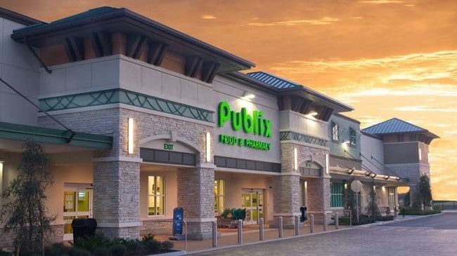
Property Record
8200 Tattant Blvd, Windermere, FL 34786

Property Detail
8200 Tattant Blvd
25-2327-0000-00-034
COMM AT THE SE CORNER OF THE SW 1/4 SEC 25-23-27 TH S89-25-3 6W 609.82 FT TH N00-34-24W 340.95 FT TO THE POB TH S89-25-36 W 426.61 FT TH N15-57-22E 41.81 FT TH N13-26-48W 36.8 FT TH
Publicschool
Orange
P-D
Florida
B and X Area of moderate flood hazard, usually the area between the limits of the 100-year and 500-year floods.
34
0
25.45 AC
2026
SW Orange Outlying
017112
Orlando
175,271 SF
Orlando-Kissimmee-Sanford, FL
NEARBY LISTINGS FOR SALE OR LEASE
-
-
View all Windermere listings for lease on LoopNet.com
DEMOGRAPHICS near 8200 Tattant Blvd
1 mile
3 mile
5 mile
2025 Total Population
15,054
46,278
113,117
2030 Population
16,420
50,680
124,538
Pop Growth 2025-2030
+ 9.07%
+ 9.51%
+ 10.10%
Average Age
36
37
39
2025 Total Households
5,142
15,658
38,932
HH Growth 2025-2030
+ 9.43%
+ 9.89%
+ 10.51%
Median Household Inc
$111,452
$121,187
$128,338
Avg Household Size
2.90
2.90
2.90
2025 Avg HH Vehicles
2.00
2.00
2.00
Median Home Value
$579,678
$660,177
$679,604
Median Year Built
2010
2010
2008
Nearby Places
Map Layers
Map Styles
 Street
 Aerial
Layers
 Traffic
 Biking
Places
Listings with unknown addresses are not visible on the map
- Restaurants
- Banks
- Shops
- Fitness
- Groceries
PUBLIC TRANSPORTATION
AIRPORT
Orlando International
Drive
Walk
Distance
Orlando International
38 min
24.3 mi
Orlando Sanford International
Drive
Walk
Distance
Orlando Sanford International
66 min
47.5 mi
SALE & LEASE HISTORY
LISTING DATE
SALE/LEASE

Sep 26, 2016
For Lease
Nearby Properties
Address
Land Use
TOTAL SIZE
Lot Size
Zoning
Address
Land Use
TOTAL SIZE
Lot Size
Zoning
2,075,986 SF
143.39 AC
E
Address
Land Use
TOTAL SIZE
Lot Size
Zoning
350,704 SF
4.65 AC
H/R
Address
Land Use
TOTAL SIZE
Lot Size
Zoning
545,861 SF
2.83 AC
H/R
Address
Land Use
TOTAL SIZE
Lot Size
Zoning
1,012,115 SF
50.12 AC
H/R
Address
Land Use
TOTAL SIZE
Lot Size
Zoning
375,315 SF
64.92 AC
R-CE
Address
Land Use
TOTAL SIZE
Lot Size
Zoning
246,220 SF
25 AC
C
Address
Land Use
TOTAL SIZE
Lot Size
Zoning
883,748 SF
119.44 AC
SUP-FAC
Address
Land Use
TOTAL SIZE
Lot Size
Zoning
491,851 SF
13.95 AC
P-D
Address
Land Use
TOTAL SIZE
Lot Size
Zoning
433,494 SF
15.85 AC
P-D
Address
Land Use
TOTAL SIZE
Lot Size
Zoning
446,359 SF
17.15 AC
P-D
Address
Land Use
TOTAL SIZE
Lot Size
Zoning
495,168 SF
21.91 AC
P-D
Address
Land Use
TOTAL SIZE
Lot Size
Zoning
474,869 SF
17.37 AC
P-D
Address
Land Use
TOTAL SIZE
Lot Size
Zoning
286,257 SF
46.42 AC
R-CE
Address
Land Use
TOTAL SIZE
Lot Size
Zoning
285,091 SF
8.48 AC
P-D
Address
Land Use
TOTAL SIZE
Lot Size
Zoning
109,728 SF
18.28 AC
PF
Address
Land Use
TOTAL SIZE
Lot Size
Zoning
64,349 SF
10.62 AC
P-D
Address
Land Use
TOTAL SIZE
Lot Size
Zoning
94,185 SF
13.50 AC
P-D
Address
Land Use
TOTAL SIZE
Lot Size
Zoning
88,524 SF
14.81 AC
P-D
Address
Land Use
TOTAL SIZE
Lot Size
Zoning
67,695 SF
9.57 AC
P-D
Address
Land Use
TOTAL SIZE
Lot Size
Zoning
75,489 SF
9.36 AC
P-D
Address
Land Use
TOTAL SIZE
Lot Size
Zoning
89,730 SF
2.95 AC
P-D
Address
Land Use
TOTAL SIZE
Lot Size
Zoning
94,324 SF
13.51 AC
P-D
Address
Land Use
TOTAL SIZE
Lot Size
Zoning
104,640 SF
4.02 AC
P-D
Address
Land Use
TOTAL SIZE
Lot Size
Zoning
290,707 SF
46.73 AC
R-3
Address
Land Use
TOTAL SIZE
Lot Size
Zoning
109,960 SF
3.30 AC
P-D
Address
Land Use
TOTAL SIZE
Lot Size
Zoning
97,625 SF
2.98 AC
P-D
Address
Land Use
TOTAL SIZE
Lot Size
Zoning
109,248 SF
3.80 AC
P-D
Address
Land Use
TOTAL SIZE
Lot Size
Zoning
85,465 SF
10.98 AC
P-D
Address
Land Use
TOTAL SIZE
Lot Size
Zoning
100,008 SF
4.67 AC
P-D
The World's #1 Commercial Real Estate Marketplace
Connect with us
© 2026 CoStar Group
The information above has been obtained from sources believed reliable. While we do not doubt its accuracy we have not verified it and make no guarantee, warranty or representation about it. It is your responsibility to independently confirm its accuracy and completeness. Any projections, opinions, assumptions, or estimates used are for example only and do not represent the current or future performance of the property. The value of this transaction to you depends on tax and other factors which should be evaluated by your tax, financial, and legal advisors. You and your advisors should conduct a careful, independent investigation of the property to determine to your satisfaction the suitability of the property for your needs.