Property Record
8201 Madison Ave, Indianapolis, IN 46227

NEARBY LISTINGS FOR SALE OR LEASE
Property Detail
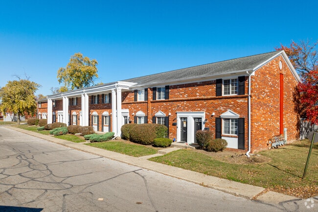
8201 Madison Ave
49-15-20-128-024.000-500
PT SE1/4 NE1/4 S19 T14 R4 BEG 7FT W OF SE COR L245IN WINCHESTER VILLAGE 4TH SEC E 67FT SELY 45FTW 67FT NWLY 45FT TO BEG .69AC
Apartment
Marion
X
Indiana
18081C0038E
245
2023
24.62 AC
2024
South Perry
381203
Indianapolis
2,911 SF
Indianapolis-Carmel-Anderson, IN
DEMOGRAPHICS near 8201 Madison Ave
1 Mile
3 Mile
5 Mile
2024 Total Population
16,968
82,869
215,597
2029 Population
16,670
83,412
218,317
Pop Growth 2024-2029
(1.76%)
+ 0.66%
+ 1.26%
Average Age
36
39
38
2024 Total Households
6,793
33,522
82,995
HH Growth 2024-2029
(1.77%)
+ 0.81%
+ 1.32%
Median Household Inc
$45,076
$65,895
$70,471
Avg Household Size
2.40
2.40
2.50
2024 Avg HH Vehicles
1.00
2.00
2.00
Median Home Value
$165,398
$199,125
$204,481
Median Year Built
1972
1979
1986
Nearby Places
Map Layers
Map Styles
 Street
 Aerial
- Restaurants
- Banks
- Shops
- Fitness
- Groceries
PUBLIC TRANSPORTATION
COMMUTER RAIL
DRIVE
WALK
Distance
16 min
8.5 mi
AIRPORT
Indianapolis International
DRIVE
WALK
Distance
Indianapolis International
33 min
18.9 mi
Nearby Properties
Address
Land Use
TOTAL SIZE
Lot Size
Zoning
Address
Land Use
TOTAL SIZE
Lot Size
Zoning
295,161 SF
70.54 AC
Address
Land Use
TOTAL SIZE
Lot Size
Zoning
31,217 SF
105.06 AC
ZO01
Address
Land Use
TOTAL SIZE
Lot Size
Zoning
5,846 SF
43.64 AC
ZO01
Address
Land Use
TOTAL SIZE
Lot Size
Zoning
56,520 SF
35.65 AC
Address
Land Use
TOTAL SIZE
Lot Size
Zoning
3,586 SF
30.28 AC
ZO01
Address
Land Use
TOTAL SIZE
Lot Size
Zoning
5,576 SF
14.15 AC
ZO01
Address
Land Use
TOTAL SIZE
Lot Size
Zoning
3,286 SF
26.39 AC
Address
Land Use
TOTAL SIZE
Lot Size
Zoning
81,996 SF
8.56 AC
Address
Land Use
TOTAL SIZE
Lot Size
Zoning
181,458 SF
6 AC
Address
Land Use
TOTAL SIZE
Lot Size
Zoning
6,786 SF
45.81 AC
Address
Land Use
TOTAL SIZE
Lot Size
Zoning
3,782 SF
44.43 AC
ZO01
Address
Land Use
TOTAL SIZE
Lot Size
Zoning
21,784 SF
30.75 AC
ZO01
Address
Land Use
TOTAL SIZE
Lot Size
Zoning
5,401 SF
21.94 AC
ZO01
Address
Land Use
TOTAL SIZE
Lot Size
Zoning
23,040 SF
9.28 AC
ZO01
Address
Land Use
TOTAL SIZE
Lot Size
Zoning
4,478 SF
12.05 AC
Address
Land Use
TOTAL SIZE
Lot Size
Zoning
226,129 SF
18.69 AC
ZO01
Address
Land Use
TOTAL SIZE
Lot Size
Zoning
110,598 SF
22.82 AC
ZO01
Address
Land Use
TOTAL SIZE
Lot Size
Zoning
1,102 SF
9.98 AC
Address
Land Use
TOTAL SIZE
Lot Size
Zoning
11,546 SF
14.18 AC
Address
Land Use
TOTAL SIZE
Lot Size
Zoning
99,178 SF
18.04 AC
Address
Land Use
TOTAL SIZE
Lot Size
Zoning
155,088 SF
20.85 AC
ZO01
Address
Land Use
TOTAL SIZE
Lot Size
Zoning
3,935 SF
36.09 AC
ZO01
Address
Land Use
TOTAL SIZE
Lot Size
Zoning
3,793 SF
23.47 AC
ZO01
Address
Land Use
TOTAL SIZE
Lot Size
Zoning
176,228 SF
1.57 AC
Address
Land Use
TOTAL SIZE
Lot Size
Zoning
2,320 SF
7.92 AC
ZO01
Address
Land Use
TOTAL SIZE
Lot Size
Zoning
4,476 SF
12.18 AC
Address
Land Use
TOTAL SIZE
Lot Size
Zoning
1,925 SF
29.98 AC
Address
Land Use
TOTAL SIZE
Lot Size
Zoning
3,296 SF
21 AC
Address
Land Use
TOTAL SIZE
Lot Size
Zoning
3,202 SF
18.62 AC
ZO01
The World's #1 Commercial Real Estate Marketplace
Connect with us
© 2025 CoStar Group
The information above has been obtained from sources believed reliable. While we do not doubt its accuracy we have not verified it and make no guarantee, warranty or representation about it. It is your responsibility to independently confirm its accuracy and completeness. Any projections, opinions, assumptions, or estimates used are for example only and do not represent the current or future performance of the property. The value of this transaction to you depends on tax and other factors which should be evaluated by your tax, financial, and legal advisors. You and your advisors should conduct a careful, independent investigation of the property to determine to your satisfaction the suitability of the property for your needs.